

2019-06 Foix - Circle to Col de Péguère
Una ruta en bici que comienza en Foix, Languedoc-Roussillon-Midi-Pyrénées, France.
Visión General
Sobre esta ruta
In 2019, we did self-supported touring for a little less than 2 months from mid-September through early November.
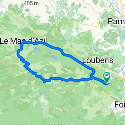
Day 6 - Foix - Circle to Col de Péguère
We've done most of this ride a number of times. D17 from Foix to the Col de Péguère at 1375M (passing the Col des Marrous at 990M and the Col de Jouels at 1247M). This is a wonderful ride with very little in the way of traffic once you pass St-Pierre-de-Rivière. The climb is for the most part relatively gentle with no steep sections above 8%. The view at the top is great, though along the way, the forest prevents much of a view.
D15 was new to us. It was an outstanding well-paved almost zero-traffic one-lane road (the section from D17 down about ten or twelve kilometers) that would be a real challenge climbing. On this ride, we were descending, but look forward to someday climbing up it.
Shortly after reaching D117, we got onto the Voie Verte, which was easy riding with, of course, zero cars. This Voie Verte is not paved, but most of it is pretty good hard pack. Our 700x35 tires have no problem with this. While most of the Voie Verte is in pretty good condition, some of it closer to Foix degenerates into something that's better than a goat path, but not by that much. Racing bikes with narrow tires should be careful on this section...or avoid it by taking D117 which parallels the path for the most part.
This was a great ride that we highly recommend.
- -:--
- Duración
- 76,9 km
- Distancia
- 1138 m
- Ascenso
- 1137 m
- Descenso
- ---
- Velocidad Media
- ---
- Altitud máxima

Fotos de la ruta


Calidad de la ruta
Tipos de vía y superficies a lo largo de la ruta
Tipos de vía
Carretera concurrida
36,3 km
(47 %)
Carretera
23,5 km
(31 %)
Superficies
Pavimentado
46,3 km
(60 %)
Sin pavimentar
11,8 km
(15 %)
Asfalto
46,2 km
(60 %)
Grava suelta
8,8 km
(11 %)
Continuar con Bikemap
Usa, edita o descarga esta ruta en bici
¿Te gustaría recorrer 2019-06 Foix - Circle to Col de Péguère o personalizarla para tu propio viaje? Esto es lo que puedes hacer con esta ruta de Bikemap:
Funciones gratuitas
- Guarda esta ruta como favorita o en una colección
- Copia y planifica tu propia versión de esta ruta
- Sincroniza tu ruta con Garmin o Wahoo
Funciones Premium
Prueba gratuita de 3 días o pago único. Más información sobre Bikemap Premium.
- Navega esta ruta en iOS y Android
- Exporta un archivo GPX / KML de esta ruta
- Crea tu impresión personalizada (pruébala gratis)
- Descarga esta ruta para la navegación sin conexión
Descubre más funciones Premium.
Consigue Bikemap PremiumDe nuestra comunidad
Foix: Otras rutas populares que empiezan aquí
 c2c 2-1
- Distancia
- 150,6 km
- Ascenso
- 2567 m
- Descenso
- 2548 m
- Ubicación
- Foix, Languedoc-Roussillon-Midi-Pyrénées, France
 2019-08 Foix to Colomiers (Toulouse)
- Distancia
- 85,8 km
- Ascenso
- 31 m
- Descenso
- 241 m
- Ubicación
- Foix, Languedoc-Roussillon-Midi-Pyrénées, France
 2019-06 Foix - Circle to Col de Péguère
- Distancia
- 76,9 km
- Ascenso
- 1138 m
- Descenso
- 1137 m
- Ubicación
- Foix, Languedoc-Roussillon-Midi-Pyrénées, France
 40k around the Séronais
- Distancia
- 40,7 km
- Ascenso
- 759 m
- Descenso
- 785 m
- Ubicación
- Foix, Languedoc-Roussillon-Midi-Pyrénées, France
 C2C 2-2 136km
- Distancia
- 135,6 km
- Ascenso
- 2195 m
- Descenso
- 2176 m
- Ubicación
- Foix, Languedoc-Roussillon-Midi-Pyrénées, France
 Le Tour De France: Stage 17
- Distancia
- 150,7 km
- Ascenso
- 3098 m
- Descenso
- 2843 m
- Ubicación
- Foix, Languedoc-Roussillon-Midi-Pyrénées, France
 Vernajoul Durban sur Arize
- Distancia
- 42,3 km
- Ascenso
- 1148 m
- Descenso
- 1146 m
- Ubicación
- Foix, Languedoc-Roussillon-Midi-Pyrénées, France
 50k Flat To Mas d'Azil
- Distancia
- 51,9 km
- Ascenso
- 570 m
- Descenso
- 578 m
- Ubicación
- Foix, Languedoc-Roussillon-Midi-Pyrénées, France
Ábrela en la app