

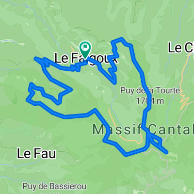
2019-26 Riom-ès-Montagnes to Aurillac
Una ruta en bici que comienza en Riom-ès-Montagnes, Auvernia-Ródano-Alpes, Francia.
Visión General
Sobre esta ruta
En 2019, hicimos un tour auto-sostenido por un poco menos de 2 meses desde mediados de septiembre hasta principios de noviembre.
Día 26 - De Riom-ès-Montagnes a Aurillac
El recorrido por la D3 fue hermoso a pesar de que es una carretera relativamente importante. El tráfico era escaso y disfrutamos de las subidas y bajadas. El ascenso al Col d'Entremont (1210 m) fue relativamente benigno desde esta dirección, con una pendiente bastante suave.
Al llegar a la D139, que conecta con la D3 varios kilómetros antes de Murat, giramos y encontramos una hermosa carretera que conectaba hacia el sur con Laveissière y una carretera (D439) que corre paralela a la N122.
En Fraisse-Haut, que está un poco al oeste de Laveissière en la D439, encontramos un camino lateral sin número que corría paralelo a la N122 durante varios kilómetros. Tomando este camino estrecho de un solo carril con chaussée déformée (pero afortunadamente pavimentado), tuvimos una subida hermosa pero muy, muy desafiante que nos llevó por encima de un puente ferroviario y finalmente de regreso a la N122, cerca del Túnel del Lioran. Creo que fue la primera vez en este viaje que realmente utilicé mi marcha más baja en mi bicicleta de turismo. No intentamos pasar por el túnel (probablemente está prohibido para ciclistas) y en su lugar ascendimos más por la D67 hasta el Col de Cère a 1294 m, pasando por varias zonas de esquí durante el ascenso. Habíamos planeado usar otras carreteras laterales más pequeñas después del Col de Cère para evitar estar en la N122 durante gran parte del recorrido restante hasta Aurillac, pero esta subida que comenzaba en Fraisse-Haut fue tan dura que pensamos que tendríamos que quedarnos en la N122 para asegurarnos de llegar a Aurillac antes del anochecer. (Debido al cambio de hora de anoche porque terminó el horario de verano, creo que ambos pensamos que nos quedaba una hora menos de luz diurna. No había cambiado la hora en nuestras computadoras de bicicleta.) En cualquier caso, con algunas excepciones, la mayor parte del recorrido restante a Aurillac fue cuesta abajo, siendo los primeros kilómetros después de reincorporarnos a la N122 desde la D67 un descenso increíble. En general, la N122 no estuvo mal, ya que el paisaje es estupendo y no había mucho tráfico hasta estar a unos diez kilómetros o así de Aurillac. También tenía ocasionalmente un arcén. Llegamos a Aurillac aproximadamente dos horas antes del atardecer, así que ningún problema con el tiempo.
- -:--
- Duración
- 84,9 km
- Distancia
- 1008 m
- Ascenso
- 1223 m
- Descenso
- ---
- Velocidad Media
- ---
- Altitud máxima

Fotos de la ruta


Calidad de la ruta
Tipos de vía y superficies a lo largo de la ruta
Tipos de vía
Carretera tranquila
8,5 km
(10 %)
Carretera
6,8 km
(8 %)
Superficies
Pavimentado
52,6 km
(62 %)
Asfalto
52,6 km
(62 %)
Sin definir
32,3 km
(38 %)
Continuar con Bikemap
Usa, edita o descarga esta ruta en bici
¿Te gustaría recorrer 2019-26 Riom-ès-Montagnes to Aurillac o personalizarla para tu propio viaje? Esto es lo que puedes hacer con esta ruta de Bikemap:
Funciones gratuitas
- Guarda esta ruta como favorita o en una colección
- Copia y planifica tu propia versión de esta ruta
- Divídelo en etapas para crear una excursión de varios días
- Sincroniza tu ruta con Garmin o Wahoo
Funciones Premium
Prueba gratuita de 3 días o pago único. Más información sobre Bikemap Premium.
- Navega esta ruta en iOS y Android
- Exporta un archivo GPX / KML de esta ruta
- Crea tu impresión personalizada (pruébala gratis)
- Descarga esta ruta para la navegación sin conexión
Descubre más funciones Premium.
Consigue Bikemap PremiumDe nuestra comunidad
Riom-ès-Montagnes: Otras rutas populares que empiezan aquí
 Cantal 2022 N° 2 bis 103km 2110 D+
- Distancia
- 103 km
- Ascenso
- 2461 m
- Descenso
- 2469 m
- Ubicación
- Riom-ès-Montagnes, Auvernia-Ródano-Alpes, Francia
 Plateau de Trizac -1568-Utagawa
- Distancia
- 40 km
- Ascenso
- 946 m
- Descenso
- 948 m
- Ubicación
- Riom-ès-Montagnes, Auvernia-Ródano-Alpes, Francia
 4.etapa Riom-es-Montagnes - Saint-Cirgues-De-Jordanne
- Distancia
- 84,3 km
- Ascenso
- 1474 m
- Descenso
- 1454 m
- Ubicación
- Riom-ès-Montagnes, Auvernia-Ródano-Alpes, Francia
 Cantal 2022 circuit N°1 - 43km samedi aprem
- Distancia
- 43,2 km
- Ascenso
- 951 m
- Descenso
- 954 m
- Ubicación
- Riom-ès-Montagnes, Auvernia-Ródano-Alpes, Francia
 12. Etappe: Condat über Pas de Peyrol
- Distancia
- 52,6 km
- Ascenso
- 1064 m
- Descenso
- 1154 m
- Ubicación
- Riom-ès-Montagnes, Auvernia-Ródano-Alpes, Francia
 Le Falgoux-Le Lioran
- Distancia
- 28 km
- Ascenso
- 1164 m
- Descenso
- 820 m
- Ubicación
- Riom-ès-Montagnes, Auvernia-Ródano-Alpes, Francia
 Cantal 2022 N°1 bis 61km
- Distancia
- 60,9 km
- Ascenso
- 1396 m
- Descenso
- 1397 m
- Ubicación
- Riom-ès-Montagnes, Auvernia-Ródano-Alpes, Francia
 Le Puy Mary (1783m) et la vallée du Falgoux par les crêtes
- Distancia
- 43,9 km
- Ascenso
- 1933 m
- Descenso
- 1934 m
- Ubicación
- Riom-ès-Montagnes, Auvernia-Ródano-Alpes, Francia
Ábrela en la app