

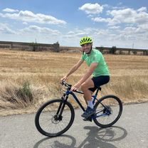
Through the vast Dobrogea
Una ruta en bici que comienza en 23 August, Constanța, Rumanía.
Visión General
Sobre esta ruta
Un sector mal pavimentado (8-10 km) en la primera parte (de Pecineaga a Amzacea), luego desde aquí mucho viento de frente en una ruta exigente y agotadora con muchas subidas y bajadas (hay valles/hondonadas) durante unos 50 km hasta Cerchezu (el 85% del ascenso total se realiza en esta parte) - afortunadamente, el viento de frente cesa cuando giras el recorrido hacia el sur.
Entre los km 60 y 70 hay 3-4 tramos donde se baja por una carretera recta y con asfalto perfecto donde se puede alcanzar fácilmente la máxima velocidad (llegué a 59,8 km/h con una bicicleta trekking sin forzar).
En la parte sur de la ruta tienes un recorrido más constante (así lo sentí, aunque en el mapa no parece necesariamente así; tal vez el viento de frente fue un factor muy importante en este aspecto). En el segundo segmento de la parte sur tuve otro momento picante, una tormenta potente se formó en el Mar del Norte que bajó desde el norte y luego se dirigió al oeste, la encontré en Cotu Vaii (lluvia intensa con trozos de hielo y muchos relámpagos, lo cual fue un poco aterrador porque fueron unos 15 km con poca cobertura a lo largo del camino (pocos árboles y postes eléctricos) - me detuve media hora y luego la lluvia intensa continuó todo el camino de regreso.
Tour duro, pero muy bonito.
- -:--
- Duración
- 128,3 km
- Distancia
- 458 m
- Ascenso
- 458 m
- Descenso
- ---
- Velocidad Media
- ---
- Altitud máxima
Calidad de la ruta
Tipos de vía y superficies a lo largo de la ruta
Tipos de vía
Carretera tranquila
24,4 km
(19 %)
Carretera
19,2 km
(15 %)
Superficies
Pavimentado
106,5 km
(83 %)
Sin pavimentar
5,1 km
(4 %)
Asfalto
106,5 km
(83 %)
Grava
5,1 km
(4 %)
Sin definir
16,7 km
(13 %)
Continuar con Bikemap
Usa, edita o descarga esta ruta en bici
¿Te gustaría recorrer Through the vast Dobrogea o personalizarla para tu propio viaje? Esto es lo que puedes hacer con esta ruta de Bikemap:
Funciones gratuitas
- Guarda esta ruta como favorita o en una colección
- Copia y planifica tu propia versión de esta ruta
- Divídelo en etapas para crear una excursión de varios días
- Sincroniza tu ruta con Garmin o Wahoo
Funciones Premium
Prueba gratuita de 3 días o pago único. Más información sobre Bikemap Premium.
- Navega esta ruta en iOS y Android
- Exporta un archivo GPX / KML de esta ruta
- Crea tu impresión personalizada (pruébala gratis)
- Descarga esta ruta para la navegación sin conexión
Descubre más funciones Premium.
Consigue Bikemap PremiumDe nuestra comunidad
23 August: Otras rutas populares que empiezan aquí
 Strada Trandafirilor, Mangalia to Strada Trandafirilor, Mangalia
- Distancia
- 52,5 km
- Ascenso
- 318 m
- Descenso
- 318 m
- Ubicación
- 23 August, Constanța, Rumanía
 Strada Trandafirilor, Mangalia to Strada Trandafirilor, Mangalia
- Distancia
- 55,3 km
- Ascenso
- 326 m
- Descenso
- 326 m
- Ubicación
- 23 August, Constanța, Rumanía
 Olimp - 23 August - Costinesti - Tuzla - Eforie Sud - Eforie Nord
- Distancia
- 29,2 km
- Ascenso
- 132 m
- Descenso
- 133 m
- Ubicación
- 23 August, Constanța, Rumanía
 hotel Amfiteatru Olimp-Mangalia și retur
- Distancia
- 26,6 km
- Ascenso
- 100 m
- Descenso
- 101 m
- Ubicación
- 23 August, Constanța, Rumanía
 tura de vacanta 2019 Olimp
- Distancia
- 127 km
- Ascenso
- 288 m
- Descenso
- 288 m
- Ubicación
- 23 August, Constanța, Rumanía
 Strada Gării 1, Neptun to Strada Ion Creangă Nr 2, Vama Veche
- Distancia
- 18,1 km
- Ascenso
- 128 m
- Descenso
- 136 m
- Ubicación
- 23 August, Constanța, Rumanía
 olimp mangalia
- Distancia
- 24,8 km
- Ascenso
- 94 m
- Descenso
- 93 m
- Ubicación
- 23 August, Constanța, Rumanía
 Sea Aude Ride
- Distancia
- 36,4 km
- Ascenso
- 137 m
- Descenso
- 137 m
- Ubicación
- 23 August, Constanța, Rumanía
Ábrela en la app