Shortcut to/and the extreme downhill path
Una ruta en bici que comienza en Blagoevgrad, Blagoevgrad, Bulgaria.
Visión General
Sobre esta ruta
Básicamente, subes por el vecindario, alrededor del lado izquierdo del zoológico, hacia el jardín de rosas y luego subes la colina pasando las antenas y subiendo por la carretera.
Cuando llegues a los primeros árboles, un lugar donde los ciclistas saltan sobre la carretera, puedes ver a tu izquierda una piedra pintada de color rojo. A lo largo del camino verás tales piedras que te indican el camino. Sin embargo, la primera vez, te sugiero que tomes el camino a pie o muy despacio.
Después de la primera curva, el camino baja abruptamente. Los chicos construyeron algunos saltos salvajes, giros laterales y todo lo que conlleva la conducción en bajada.
Dado que mis habilidades no son muy buenas, estuve frenando todo el tiempo, y aun así, me resultó bastante difícil permanecer en el suelo. Al final, deberías saltar mucho a los lados del camino para mantenerte firme. También hay algunos saltos bastante altos y aterradores.
Mira las fotos en el mapa para hacerte una idea.
¡Usa buen equipo y protección y grita!
- -:--
- Duración
- 1,1 km
- Distancia
- 85 m
- Ascenso
- 75 m
- Descenso
- ---
- Velocidad Media
- ---
- Altitud máxima
Destacados de la ruta
Puntos de interés a lo largo de la ruta

Foto después de 0,5 km

Foto después de 0,8 km

Foto después de 0,8 km

Foto después de 0,8 km
Start of the DH path

Foto después de 0,8 km
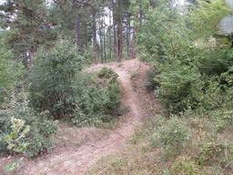
Foto después de 0,9 km

Foto después de 0,9 km
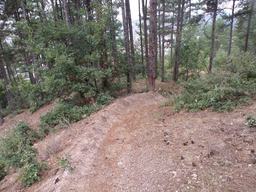
Foto después de 0,9 km
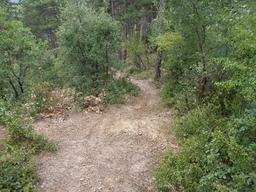
Foto después de 0,9 km
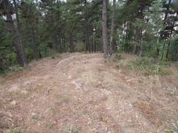
Foto después de 0,9 km
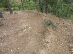
Foto después de 1 km

Foto después de 1 km
Crazy part here
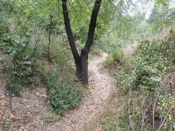
Foto después de 1 km
Very steep

Foto después de 1,1 km
Nice
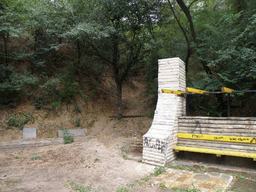
Foto después de 1,1 km
The end
Continuar con Bikemap
Usa, edita o descarga esta ruta en bici
¿Te gustaría recorrer Shortcut to/and the extreme downhill path o personalizarla para tu propio viaje? Esto es lo que puedes hacer con esta ruta de Bikemap:
Funciones gratuitas
- Guarda esta ruta como favorita o en una colección
- Copia y planifica tu propia versión de esta ruta
- Sincroniza tu ruta con Garmin o Wahoo
Funciones Premium
Prueba gratuita de 3 días o pago único. Más información sobre Bikemap Premium.
- Navega esta ruta en iOS y Android
- Exporta un archivo GPX / KML de esta ruta
- Crea tu impresión personalizada (pruébala gratis)
- Descarga esta ruta para la navegación sin conexión
Descubre más funciones Premium.
Consigue Bikemap PremiumDe nuestra comunidad
Blagoevgrad: Otras rutas populares que empiezan aquí
 Steep route to the almond forest
- Distancia
- 0,7 km
- Ascenso
- 50 m
- Descenso
- 29 m
- Ubicación
- Blagoevgrad, Blagoevgrad, Bulgaria
 Notre parcours en Macédoine
- Distancia
- 392,5 km
- Ascenso
- 3215 m
- Descenso
- 2575 m
- Ubicación
- Blagoevgrad, Blagoevgrad, Bulgaria
 Blagoevgrad-Demirevo-Bistrica-Blagoevgrad CLONED FROM ROUTE 819503
- Distancia
- 34 km
- Ascenso
- 854 m
- Descenso
- 858 m
- Ubicación
- Blagoevgrad, Blagoevgrad, Bulgaria
 Blagoevgrad - Pehchevo
- Distancia
- 62,3 km
- Ascenso
- 1386 m
- Descenso
- 731 m
- Ubicación
- Blagoevgrad, Blagoevgrad, Bulgaria
 Nice route to the near villas and back to Blago
- Distancia
- 9,4 km
- Ascenso
- 243 m
- Descenso
- 213 m
- Ubicación
- Blagoevgrad, Blagoevgrad, Bulgaria
 Near the river (right side) to the lake
- Distancia
- 2 km
- Ascenso
- 70 m
- Descenso
- 26 m
- Ubicación
- Blagoevgrad, Blagoevgrad, Bulgaria
 Dead end path with view on Bachinovo
- Distancia
- 1,1 km
- Ascenso
- 100 m
- Descenso
- 57 m
- Ubicación
- Blagoevgrad, Blagoevgrad, Bulgaria
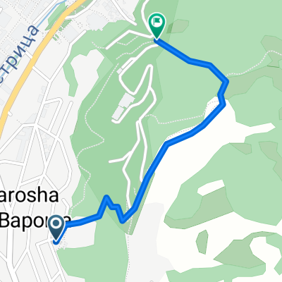 Shortcut to/and the extreme downhill path
- Distancia
- 1,1 km
- Ascenso
- 85 m
- Descenso
- 75 m
- Ubicación
- Blagoevgrad, Blagoevgrad, Bulgaria
Ábrela en la app

