

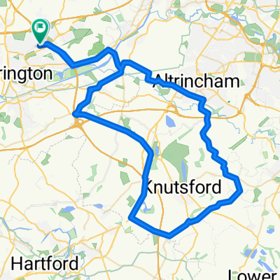
stretton - warburton loop
Una ruta en bici que comienza en Croft, Inglaterra, Reino Unido.
Visión General
Sobre esta ruta
- baja por Fearnhead Lane hacia Padgate Lane y luego sigue hacia Kingsway.
- cruza el puente de Kingsway y sigue la carretera.. en el segundo semáforo, gira a la izquierda y luego inmediatamente a la derecha a lo largo del canal (subida).
- gira a la izquierda en la cima del puente y sigue la carretera hacia abajo girando a la derecha al final.
- en el semáforo gira a la derecha y luego a la izquierda en el siguiente (bajo un puente) tomando la primera izquierda (Bridge Lane)
- gira a la derecha en Broom Ave que se convierte en Lyons Road.
- al final de la carretera, gira a la izquierda en London Road.
- finalmente, gira a la derecha en Hatton Lane.
- cuando la carretera se divide, gira a la izquierda y pasa por debajo de la M6... girando a la derecha en Pilmoss Lane.
- gira a la izquierda en Newton Lane y luego a la derecha en Higher Lane.
- gira a la izquierda en Marsh Lane (cruza Tarporley Road en Heath Lane)
- toma Ash House Lane a la izquierda que se convierte en Coghill Lane - sigue esto y gira a la derecha en Hough Lane.
- cuando Hough Lane se desvía a la derecha - DETENTE en la carretera y regresa a Gogshall Lane girando a la derecha en Marbury Road.
- gira a la derecha en Budworth Lane - cruza la A559 en High Street y únete a Westgate Lane. mantente a la izquierda en Budworth Road.
- gira a la izquierda en CANN Lane y pasa por debajo de la M6... ahora estás en Whitley Lane.
- gira a la izquierda en Rowey Bank Lane y luego a la derecha en Halliwells Brow.
- cuando llegues a la A50, gira a la izquierda y luego a la derecha en W Lane (High Leigh). sigue esto debajo de la M56 y en High Leigh Road.
- en la A56 (Higher Lane) cruza a Bullford Lane.
- cruza el canal a Mill Lane.
- en la A6144 gira a la derecha hacia Heatley y a la izquierda en la B5159 (Townfield Lane).
- sigue esto a través de la carretera de peaje... y a la izquierda hacia Manchester Road..... después a casa...
- -:--
- Duración
- 54,6 km
- Distancia
- 144 m
- Ascenso
- 142 m
- Descenso
- ---
- Velocidad Media
- ---
- Altitud máxima

Continuar con Bikemap
Usa, edita o descarga esta ruta en bici
¿Te gustaría recorrer stretton - warburton loop o personalizarla para tu propio viaje? Esto es lo que puedes hacer con esta ruta de Bikemap:
Funciones gratuitas
- Guarda esta ruta como favorita o en una colección
- Copia y planifica tu propia versión de esta ruta
- Sincroniza tu ruta con Garmin o Wahoo
Funciones Premium
Prueba gratuita de 3 días o pago único. Más información sobre Bikemap Premium.
- Navega esta ruta en iOS y Android
- Exporta un archivo GPX / KML de esta ruta
- Crea tu impresión personalizada (pruébala gratis)
- Descarga esta ruta para la navegación sin conexión
Descubre más funciones Premium.
Consigue Bikemap PremiumDe nuestra comunidad
Croft: Otras rutas populares que empiezan aquí
 appleton, stretton, daresbury 29.5mile
- Distancia
- 47,5 km
- Ascenso
- 143 m
- Descenso
- 143 m
- Ubicación
- Croft, Inglaterra, Reino Unido
 74 Sandicroft Close, Warrington to 14 Broadstone Close, Warrington
- Distancia
- 13,4 km
- Ascenso
- 9 m
- Descenso
- 8 m
- Ubicación
- Croft, Inglaterra, Reino Unido
 knutsfors peeover route
- Distancia
- 69,8 km
- Ascenso
- 146 m
- Descenso
- 149 m
- Ubicación
- Croft, Inglaterra, Reino Unido
 mini lymm route
- Distancia
- 26,4 km
- Ascenso
- 59 m
- Descenso
- 61 m
- Ubicación
- Croft, Inglaterra, Reino Unido
 14–15 Delenty Drive, Warrington to 14–15 Delenty Drive, Warrington
- Distancia
- 23,6 km
- Ascenso
- 88 m
- Descenso
- 88 m
- Ubicación
- Croft, Inglaterra, Reino Unido
 tatton circular
- Distancia
- 55,5 km
- Ascenso
- 135 m
- Descenso
- 135 m
- Ubicación
- Croft, Inglaterra, Reino Unido
 stretton - warburton loop
- Distancia
- 54,6 km
- Ascenso
- 144 m
- Descenso
- 142 m
- Ubicación
- Croft, Inglaterra, Reino Unido
 leigh 18 miler
- Distancia
- 29,4 km
- Ascenso
- 65 m
- Descenso
- 66 m
- Ubicación
- Croft, Inglaterra, Reino Unido
Ábrela en la app