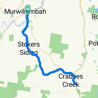
Around Mount Warning
Una ruta en bici que comienza en Murwillumbah, Nueva Gales del Sur, Australia.
Visión General
Sobre esta ruta
Comenzamos en Uki y viajamos hacia el este y luego hacia el norte por la Kyogle Road siguiendo el río Tweed. Alrededor de los 10 km giramos a la izquierda en la Tyalgum Road que sigue el río Oxley. Hacemos una parada en Tyalgum para un té de la mañana. Luego, nos dirigimos hacia el sur por la Brays Creek Road. A los 33 km giramos a la izquierda en la Byrrill Creek Road. Ascendemos firmemente a través de la matorral en una carretera sin pavimentar. En el punto de 38 km comenzamos a descender con vistas del Byrrill Creek a nuestra derecha y del Monte Warning a nuestra izquierda. A los 49.8 km giramos a la izquierda en la Kyogle Road que seguimos hasta Uki. Almuerzo en Uki en el parque o en la cafetería o pub.
- -:--
- Duración
- 56,2 km
- Distancia
- 808 m
- Ascenso
- 806 m
- Descenso
- ---
- Velocidad Media
- ---
- Altitud máxima
Continuar con Bikemap
Usa, edita o descarga esta ruta en bici
¿Te gustaría recorrer Around Mount Warning o personalizarla para tu propio viaje? Esto es lo que puedes hacer con esta ruta de Bikemap:
Funciones gratuitas
- Guarda esta ruta como favorita o en una colección
- Copia y planifica tu propia versión de esta ruta
- Sincroniza tu ruta con Garmin o Wahoo
Funciones Premium
Prueba gratuita de 3 días o pago único. Más información sobre Bikemap Premium.
- Navega esta ruta en iOS y Android
- Exporta un archivo GPX / KML de esta ruta
- Crea tu impresión personalizada (pruébala gratis)
- Descarga esta ruta para la navegación sin conexión
Descubre más funciones Premium.
Consigue Bikemap PremiumDe nuestra comunidad
Murwillumbah: Otras rutas populares que empiezan aquí
 S3 Murwillumban - Advancetown Lake - Nerang
- Distancia
- 66,1 km
- Ascenso
- 700 m
- Descenso
- 680 m
- Ubicación
- Murwillumbah, Nueva Gales del Sur, Australia
 Nullum St, Murwillumbah to 1 Broadway La, Burringbar
- Distancia
- 20,5 km
- Ascenso
- 374 m
- Descenso
- 366 m
- Ubicación
- Murwillumbah, Nueva Gales del Sur, Australia
 Recovered Route
- Distancia
- 48,5 km
- Ascenso
- 375 m
- Descenso
- 375 m
- Ubicación
- Murwillumbah, Nueva Gales del Sur, Australia
 Murwillumbah Rail Trail Loop 1
- Distancia
- 78,5 km
- Ascenso
- 1063 m
- Descenso
- 1058 m
- Ubicación
- Murwillumbah, Nueva Gales del Sur, Australia
 Murwillimbah to Kyogle
- Distancia
- 78,7 km
- Ascenso
- 1614 m
- Descenso
- 1555 m
- Ubicación
- Murwillumbah, Nueva Gales del Sur, Australia
 Numb bah Rd To B Rd
- Distancia
- 12,4 km
- Ascenso
- 91 m
- Descenso
- 94 m
- Ubicación
- Murwillumbah, Nueva Gales del Sur, Australia
 maybe
maybe- Distancia
- 56,6 km
- Ascenso
- 446 m
- Descenso
- 446 m
- Ubicación
- Murwillumbah, Nueva Gales del Sur, Australia
 Murwillumbah Rail Loop 2
- Distancia
- 82,1 km
- Ascenso
- 1002 m
- Descenso
- 1005 m
- Ubicación
- Murwillumbah, Nueva Gales del Sur, Australia
Ábrela en la app


