

Route des Grand Alps in France
Una ruta en bici que comienza en Niza, Provenza-Alpes-Costa Azul, Francia.
Visión General
Sobre esta ruta
The Alps can be biked dozens of ways, new passes each time. This summer I felt bold. Once again I flew to Nice, but this time I intended to bike as close as possible to the Italian border, along the Route des Grandes Alpes. Weather was warm, blue skies, and I biked with all my belongings in just the front bag, so I was fast and nimble. This trip is a dream if you’re lucky with the weather.
I did Tour de France legends like Col de la Cayolle, Col de Vars, Col d’Izoard, Col du Galibier, Col du Télégraphe, Col de l’Iseran and finally Little St Bernard Pass into Italy. From there it would appear to be smooth sailing to the Aosta valley, but the final pass, Colle San Carlo in Italy was perhaps the toughest ever in my life. 10 km at a constant 10% with short stretches at 15%! I was forever slaloming up, to reduce the steepness of the road, and almost gave up.
The last stretch was grueling in a completely different way. It was hard head wind, and really hot, so I had to fight myself down (!) the valley to the city of Aosta. When I arrived my thighs were covered in wet blisters. There’s photographic evidence of the grimy mess, but trust me, you don’t want to see it.
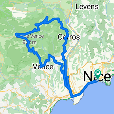
Please note: The route out of Nice is hand-drawn, I wouldn't trust it in real life.
- -:--
- Duración
- 510 km
- Distancia
- 21.336 m
- Ascenso
- 20.792 m
- Descenso
- ---
- Velocidad Media
- ---
- Altitud máxima

Continuar con Bikemap
Usa, edita o descarga esta ruta en bici
¿Te gustaría recorrer Route des Grand Alps in France o personalizarla para tu propio viaje? Esto es lo que puedes hacer con esta ruta de Bikemap:
Funciones gratuitas
- Guarda esta ruta como favorita o en una colección
- Copia y planifica tu propia versión de esta ruta
- Divídelo en etapas para crear una excursión de varios días
- Sincroniza tu ruta con Garmin o Wahoo
Funciones Premium
Prueba gratuita de 3 días o pago único. Más información sobre Bikemap Premium.
- Navega esta ruta en iOS y Android
- Exporta un archivo GPX / KML de esta ruta
- Crea tu impresión personalizada (pruébala gratis)
- Descarga esta ruta para la navegación sin conexión
Descubre más funciones Premium.
Consigue Bikemap PremiumDe nuestra comunidad
Niza: Otras rutas populares que empiezan aquí
 Nice 70.3
- Distancia
- 93,5 km
- Ascenso
- 1101 m
- Descenso
- 1099 m
- Ubicación
- Niza, Provenza-Alpes-Costa Azul, Francia
 Nice Ventimiglia Sospel Nice - Escape from Tourrorism !
- Distancia
- 120,2 km
- Ascenso
- 1562 m
- Descenso
- 1561 m
- Ubicación
- Niza, Provenza-Alpes-Costa Azul, Francia
 Bummer-Tour , 215km straight 50km climbing + Roller-coaster
- Distancia
- 215,7 km
- Ascenso
- 3494 m
- Descenso
- 3494 m
- Ubicación
- Niza, Provenza-Alpes-Costa Azul, Francia
 EZF Nizza
- Distancia
- 25,8 km
- Ascenso
- 1125 m
- Descenso
- 1116 m
- Ubicación
- Niza, Provenza-Alpes-Costa Azul, Francia
 Hügelige Runde bei Nizza
- Distancia
- 97,7 km
- Ascenso
- 2223 m
- Descenso
- 2220 m
- Ubicación
- Niza, Provenza-Alpes-Costa Azul, Francia
 Col de la Madone 74km
- Distancia
- 72,6 km
- Ascenso
- 1515 m
- Descenso
- 1516 m
- Ubicación
- Niza, Provenza-Alpes-Costa Azul, Francia
 Nice-Castillon-Turini-Nice
- Distancia
- 141,7 km
- Ascenso
- 2793 m
- Descenso
- 2787 m
- Ubicación
- Niza, Provenza-Alpes-Costa Azul, Francia
 Florence1
- Distancia
- 474,5 km
- Ascenso
- 1129 m
- Descenso
- 1086 m
- Ubicación
- Niza, Provenza-Alpes-Costa Azul, Francia
Ábrela en la app