2013_North Cap

2013_North Cap

Une collection de 13 itinéraires à vélo, créée par Oschep Heinz.

Vue d'ensemble

Ă€ propos de cette collection

The North Cap Tour - has been a fantastic experience. Throughout the three weeks we have seen a lot of the “higher north”, enjoyed marvellous nature and interesting sightseeing places. Planning a cycling tour up to North Cap has some difficulties. North of the Arctic Circle there is just a limited number of streets. You would expect that in this remote areas might be less traffic, but that is not always so. To avoid the most annoying traffic you should not use “E” roads, sadly this is not possible on few occasions.

13
Itinéraires
-:--
Durée
1 562,3 km
Distance
---
Vit. moyenne
6 238 m
Montée
5 968 m
Descente
Oschep Heinz
Oschep Heinz

créé il y a il y a 8 ans

2013_North Cap

Itinéraires dans cette collection

Les 13 itinéraires de cette collection peuvent être ouverts sur la carte ou dans l’application Bikemap pour plus de détails. Tu peux les ajuster dans le planificateur d’itinéraire, ou les télécharger au format GPX ou KML. Utilise-les comme modèle pour planifier tes propres sorties, ou laisse Bikemap te guider directement.

Lulea - Kalix
Vélo de villeRevêtu
Oschep Heinz
1

Lulea - Kalix

Itinéraire à vélo à Luleå, Comté de Norbotten, Suède

<span lang="EN" style="line-height: 115%; font-family: "Verdana","sans-serif"; font-size: 8.5pt; mso-fareast-font-family: Calibri; mso-fareast-theme-font: minor-latin; mso-bidi-font-family: "Times New Roman"; mso-bidi-theme-font: minor-bidi; mso-ansi-language: EN; mso-fareast-language: EN-US; mso-bidi-language: AR-SA;"><font color="#000000">First day up to North Cap. We picked up our cycles from Bussgods in Lulea and set off for Kalix. A good trip on mostly quiet roads. Just a pity that on two occasions we have had to drive a few km along the E10. All together 102 km enjoyable cycling.</font></span> Done 2013 - 06 - 28
101,7 km
Distance
167 m
Montée
168 m
Descente
Kalix - Ylitornio
Vélo de villeRevêtuNon revêtu
Oschep Heinz
0

Kalix - Ylitornio

Itinéraire à vélo à Rolfs, Comté de Norbotten, Suède

<span lang="EN" style="line-height: 115%; font-family: "Verdana","sans-serif"; font-size: 8.5pt; mso-fareast-font-family: Calibri; mso-fareast-theme-font: minor-latin; mso-bidi-font-family: "Times New Roman"; mso-bidi-theme-font: minor-bidi; mso-ansi-language: EN; mso-fareast-language: EN-US; mso-bidi-language: AR-SA;"><font color="#000000">The second day brought us good weather. The aim of the day was to cross the Swedish border and reach Ylitornio in Finland. Definitely one of the best cycling days of the tour. We cycled on roads with less traffic in marvelous nature. Crossing the border to Finland, we have been attacked by mosquitoes on the first stop, that is not to say that in north Sweden it is different. Mosquitoes were our companions for the next few days</font></span>. Done 2013 06 29
95 km
Distance
421 m
Montée
378 m
Descente
Ylitornio - Rovaniemi
Vélo de villeRevêtu
Oschep Heinz
0

Ylitornio - Rovaniemi

Itinéraire à vélo à Ylitornio, Laponie, Finlande

<span lang="EN" style="line-height: 115%; font-family: "Verdana","sans-serif"; font-size: 8.5pt; mso-fareast-font-family: Calibri; mso-fareast-theme-font: minor-latin; mso-bidi-font-family: "Times New Roman"; mso-bidi-theme-font: minor-bidi; mso-ansi-language: EN; mso-fareast-language: EN-US; mso-bidi-language: AR-SA;"><font color="#000000">During the first part of the 121 km from Ylitornio to Rovaniemi we “enjoyed” heavy rain. The rain stopped about midday and a bit later we had a very good pizza in Muuro.Finally we used an excellent cycle lane from Muuro up to Rovaniemi. All in all, a very good cycling day</font></span>. Done 2012 06 30
120,2 km
Distance
315 m
Montée
264 m
Descente
Rovaniemi - Raudanjoki
Vélo de villeRevêtuNon revêtu
Oschep Heinz
0

Rovaniemi - Raudanjoki

Itinéraire à vélo à Rovaniemi, Laponie, Finlande

The day of rest in Rovaniemi was earmarked for visiting the Santa Claus Village and the Arctic Museum. Passing Santa Claus Village once more on day five we had to drive for a few km on the E75. Soon we used the quiet roads -to and along- the lake Perunkajarvi. After hours of good cycling we got back to E75 for the final km to reach the destination for that day. In the evening I enjoyed Finnish wood Sauna and a 12 degree warm lake. Done 2013 - 07 02
99,4 km
Distance
409 m
Montée
310 m
Descente
Raudanjoki - Kittila
Vélo de villeRevêtuNon revêtu
Oschep Heinz
0

Raudanjoki - Kittila

Itinéraire à vélo à

<span lang="EN" style="line-height: 115%; font-family: "Verdana","sans-serif"; font-size: 8.5pt; mso-fareast-font-family: Calibri; mso-fareast-theme-font: minor-latin; mso-bidi-font-family: "Times New Roman"; mso-bidi-theme-font: minor-bidi; mso-ansi-language: EN; mso-fareast-language: EN-US; mso-bidi-language: AR-SA;"><font color="#000000">A bit earlier as usual and in good mood we started for the longest daily trip of the holiday. 170 km and a navigation challenge through finish forest made this day really demanding. However, beautiful nature and good cycling weather rewarded us. We even found a small store & coffee shop where we had a good rest. The language barrier prevented me from a chat, I am not able to speak Finnish. The final part of the trip to Kittila was on main road with less traffic and tailwind.</font></span> Done 2013 - 07 - 03
170,5 km
Distance
280 m
Montée
308 m
Descente
Kittila - Enontekio
Vélo de villeRevêtuNon revêtuGravier
Oschep Heinz
0

Kittila - Enontekio

Itinéraire à vélo à Kittilä, Laponie, Finlande

The environment is changing it starts to get hilly. Now the possibilities to chose alternative lanes and avoid main roads are very limited and later there is no choice at all. Touring from Kittila to Enontekio was all right and easy to navigate. Levi seems to be a passable ski area, however during summertime very quiet. We found only one Hotel in Levi for a quick coffee. Done 2013 - 07 04
142,6 km
Distance
269 m
Montée
141 m
Descente
Enontekio - Kautokeino
Vélo de villeRevêtu
Oschep Heinz
0

Enontekio - Kautokeino

Itinéraire à vélo à Enontekiö, Laponie, Finlande

A short tour, about 85 km, brought us from Finland to Norway. Again the environment is changing and several mountain ranges can be seen in the distance. Vegetation is getting smaller. From the point of orientation there is nothing to do, just follow road 93. From Enontekio to Kautokeino we still have had a passable cycle environment with limited traffic. Done 2013 - 07 - 05
84,4 km
Distance
286 m
Montée
259 m
Descente
Kautokeion - Karasjok
Vélo de villeRevêtu
Oschep Heinz
0

Kautokeion - Karasjok

Itinéraire à vélo à Kautokeino, Finnmark, Norvège

Along the road 93 and 92 to Karasjok we met the first cyclist who were coming back from North Cap complaining about headwind. Since a few days we were very lucky with the wind, most of the time we have had moderate tailwind. The environment is beautiful and basically it is nice to cycle. But you have to bear in mind that your are on the main-road therefore limited to move in line. Still lucky with the weather we found a quiet Restaurant along the 92, they served good home made burger. Done 2013 - 07 - 05
127,6 km
Distance
328 m
Montée
510 m
Descente
Karasjok - Olderfjord
Vélo de villeRevêtu
Oschep Heinz
0

Karasjok - Olderfjord

Itinéraire à vélo à Kárášjohka, Finnmark, Norvège

Just two daily trips away from Honningsvag, last Village before North Cap, the goal for today is Olderfjord. We left the mountainous region and were cycling along beautiful nature up the coast of Tanjafjorden of the Barent Sea. Just sad, the traffic situation is going worse. Especially on the E6 coming from Finland there is more traffic as some would expect in this remote area. Otherwise it was good cycling. Rain has caught 2013 - 07 06 & Route Olderfjord to North Capus on the end of the day. Done 2013 - 07 - 06  
139,4 km
Distance
504 m
Montée
641 m
Descente
Olderfjord - Honnigvag
Vélo de villeRevêtu
Oschep Heinz
0

Olderfjord - Honnigvag

Itinéraire à vélo à

The Trip to Honnigsvag started with the heavy wind but clear sky. Within the day the condition got worse and we have had to deal with tailwind and crosswind with peaks up to 15 m/sec. In some exposed fjords we were forced to push the cycle for certain distances. The three tunnels up to Honnigsvag sheltered us from the heavy wind, it takes some nerves to get used to this particular environment. The 96 km have been more demanding as I have had expected. Done 2013 07 07
103,5 km
Distance
1 121 m
Montée
1 199 m
Descente
Harstad - Riksgränsen
Vélo de villeRevêtu
Oschep Heinz
0

Harstad - Riksgränsen

Itinéraire à vélo à Harstad, Troms, Norvège

From Harstad to Tjeldsundbrua along road 83 was a bit annoying, lot of traffic and no alternative. The next part was excellent cycling along the Norway fjords. The terrain from reaching E6 and later following E10 to Riksgransen is seen by me with mixed feelings, on the one hand there is marvellous nature, on the other hand you have the disadvantage moving on main roads coping with moderate traffic. Done 2013 - 07 -11
155,1 km
Distance
1 372 m
Montée
876 m
Descente
Riksgränsen  - Kiruna
Vélo de villeRevêtu
Oschep Heinz
1

Riksgränsen - Kiruna

Itinéraire à vélo à

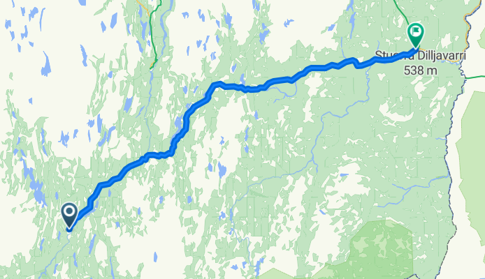
  This part was a bit annoying, a lot of traffic and no alternative. The original idea was to go through Kebenekaise Nationalpark, however, this is not possible, not even for Mountain bikes. So we went along the E 10.    
136,2 km
Distance
512 m
Montée
475 m
Descente