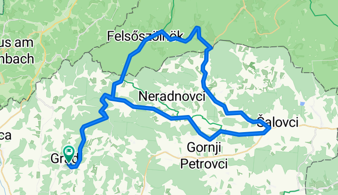
Goričko Nature Park
Un tour à vélo de 3 étapes, au départ de Grad, Grad, Slovénie.
Vue d'ensemble
À propos de ce tour
Itinéraires du Parc Naturel de Goričko
- 3
- Itinéraires
- -:--
- Durée
- 193,8 km
- Distance
- ---
- Vit. moyenne
- 1 333 m
- Montée
- 1 331 m
- Descente
Javni zavod Krajinski park Goričko
créé il y a 8 ans
Goričko Nature Park
Étapes de ce tour
Les 3 étapes de ce tour peuvent être ouvertes sur la carte ou dans l’application Bikemap pour plus de détails. Tu peux les ajuster dans le planificateur d’itinéraire ou les télécharger au format GPX ou KML. Utilise-les comme modèle pour planifier ton propre tour, ou laisse Bikemap te guider directement.
Kolesarska povezava Trideželnega parka Goričko-Raab-Őrseg
Itinéraire à vélo à Grad, Grad, Slovénie
Piste cyclable / Circuit à vélo Goričko-Raab-Őrseg 3 pays / États / paysages = 1 PARC Goričko-Raab-Őrseg
- 52,9 km
- Distance
- 361 m
- Montée
- 361 m
- Descente
Tour de RŐG 2017, Green Exercise, 90 km
Itinéraire à vélo à Grad, Grad, Slovénie
Tour de RŐG is a bicycle event of the Trilateral Nature Park Goričko-Raab-Őrség. It will be held on Saturday, September 2nd 2017 with a start and finish at the castle Grad in Goričko Nature Park. There will be marked 2 routes trough Slovenia and Hungary. 90 km route start is at 10:00. Applications …
- 90,9 km
- Distance
- 533 m
- Montée
- 533 m
- Descente
Tour de RŐG 2017, Green Exercise, 50 km
Itinéraire à vélo à Grad, Grad, Slovénie
La Tour de RŐG est un événement cycliste du Parc Naturel Trilatéral Goričko-Raab-Őrség. Elle aura lieu le samedi 2 septembre 2017 avec départ et arrivée au château de Grad dans le parc naturel de Goričko. Deux parcours balisés traverseront la Slovénie et la Hongrie. Le départ du parcours de 90 km e…
- 50 km
- Distance
- 439 m
- Montée
- 437 m
- Descente


