Die schönsten Rennradrouten der Schweiz

Die schönsten Rennradrouten der Schweiz

Une collection de 10 itinéraires à vélo, créée par MySwitzerland.com.

Vue d'ensemble

À propos de cette collection

Die schönsten Rennradrouten der Schweiz

10
Itinéraires
-:--
Durée
1 102 km
Distance
---
Vit. moyenne
19 897 m
Montée
19 897 m
Descente
MySwitzerland.com
MySwitzerland.com

créé il y a il y a 7 ans

Die schönsten Rennradrouten der Schweiz

Itinéraires dans cette collection

Les 10 itinéraires de cette collection peuvent être ouverts sur la carte ou dans l’application Bikemap pour plus de détails. Tu peux les ajuster dans le planificateur d’itinéraire, ou les télécharger au format GPX ou KML. Utilise-les comme modèle pour planifier tes propres sorties, ou laisse Bikemap te guider directement.
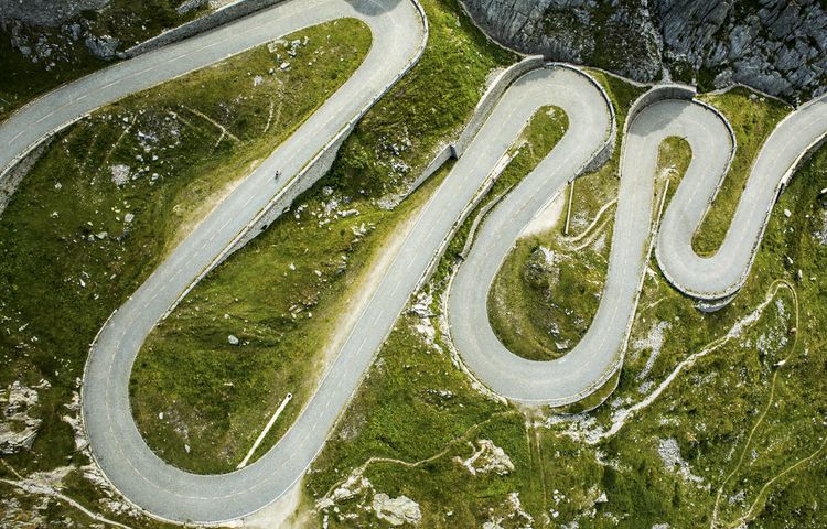
Gotthard Challenge
Vélo de routeRevêtu
MySwitzerland.com
65

Gotthard Challenge

Itinéraire à vélo à Andermatt, Canton of Uri, Switzerland

With three legendary passes that regularly feature in the Tour de Suisse, this loop ranks among the great alpine classics. Although just 106km in length, it should not be underestimated: with almost 40km of climbing, it presents a major challenge.   Starting in Andermatt in Canton Uri, the first pass is the Furka: 11km of climbing to reach the summit at alt. 2436m. You then enter Canton Valais for the long descent to Gletsch followed by Ulrichen in the Upper Rhone valley, known locally as the Goms. Time to think of taking food and drink on board, since you are about to make the ascent to the Nufenen pass (alt. 2478m) after 13km of climbing punctuated by long straights over 10% in gradient. Featuring Switzerland’s second-highest metalled pass road (only the Umbrail is higher), the Nufenen is a challenge in itself.  The summit marks the gateway to another of Switzerland’s cantons: Ticino. There now follows a marvellous, extended descent towards Italian-speaking Airolo, where the day’s third and final ascent starts to the Gotthard at alt. 2091m. The world’s fourth-longest road tunnel swallows most of the north-south traffic; what is left takes the main pass road. Cyclists climb the ancient road, call the Tremola. Uniquely for the Alps, its 24 upper hairpin bends feature cobblestones. Enough to make you forget the 3000m-plus of difference in altitude you have been climbing today.  Once at the top, Andermatt is no more than a few kilometres further on (and down!). Time for a well-earned rest in this quintessential village in the heart of the Swiss Alps.
105,9 km
Distance
3 023 m
Montée
3 021 m
Descente
A Loop With A View
Vélo de routeRevêtu
MySwitzerland.com
39

A Loop With A View

Itinéraire à vélo à Villars-sur-Ollon, Canton of Vaud, Switzerland

This escapade starting in Villars-Gryon is made up largely of back roads with moderate traffic. It features a breathtaking vantage point with views of Lake Geneva and the Alps.   This route is open between 1 June and 31 October. Visit www.hongrin.ch for details of whether the military zone of Petit Hongrin (km 30 to 50) is open to traffic during the working week (it is always open at weekends). At weekends and on public holidays, you also have to consider the ascent/descent times displayed at the Agites tunnel (km 50)  On leaving Villars, the pass road to the Croix pass (alt. 1774m) features a number of steep inclines prior to a level section – perfect for catching your breath before the final three kilometres to the summit.  The descent to Les Diablerets offers glorious views; why not stop off in the village for refreshments? During the descent to Le Sépey, turn right towards Les Voëttes; this narrow, at times steep road takes you to the Mosses pass (alt. 1445m) and avoids the traffic of the main road.  On reaching the pass, keep heading for La Lécherette and take a left towards the Hongrin. This is another quasi-deserted road that meanders through wild scenery for more than 20km. At Les Agites, pause to admire the view of Lake Geneva. On a clear day, the views extend as far as the Jura mountains!  A rapid descent brings you to Yvorne and the Chablais vineyards before a level ten kilometres or so on back roads towards Bex: a welcome respite before the final ascent comprising a number of steep inclines. The ascent to Villars takes a little-known route via Les Plans-sur-Bex. You’ll encounter very few cars on this road, which continues on to Gryon. Then it’s another few kilometres before you are back in Villars.
91,6 km
Distance
1 951 m
Montée
1 951 m
Descente
Alpe di Neggia
Vélo de routeRevêtu
MySwitzerland.com
34

Alpe di Neggia

Itinéraire à vélo à Muralto, Canton Ticino, Switzerland

It takes a climb of almost 1200m to reach Alpe di Neggia, a hidden gem in Canton Ticino, Switzerland’s Italian-speaking canton. The view from the summit is worth the effort!   The loop starts in Locarno. The first few kilometres follow a cycle path that hugs Lake Maggiore then crosses the Magadino plain.  You rejoin the lake at the village of Magadino, where the palm trees impart a Mediterranean ambience that contrasts with the surrounding mountains. After ten or so kilometres you enter Italy at Dirinella.  Now it is another ten kilometres before the ascent to Alpe di Neggia starts. Quite steep and narrow, the road climbs rapidly via numerous hairpins. The views of the lake are simply superb.  With the exception of a level stretch at Garabiolo, the road climbs constantly for 11 km while entering the Vedasca valley. Ups and downs then feature for 6 kilometres to Indemini, the point at which you cross back into Switzerland.  The ultimate leg of the ascent is arduous, fluctuating between 8 and 10% over 4.5 kilometres to finally reach Alpe di Neggia at alt. 1395m. In all, you will have climbed 1177m over 21.5km, figures worthy of a major alpine pass.  The views from the pass – which lies between the Monte Gambarogno and the Monte Tamaro – of the peaks overlooking the Verzasca valley above Locarno are glorious. A restaurant is on hand for relaxation and refreshment.  The downhill back to Vira is steep: averaging 9.5%, it boasts 33 hairpins. Please take care! You return to Locarno along the same cycle path as before.
81,5 km
Distance
1 252 m
Montée
1 257 m
Descente
Les Classiques des Alpes Vaudoises
Vélo de routeRevêtu
MySwitzerland.com
54

Les Classiques des Alpes Vaudoises

Itinéraire à vélo à Aigle, Canton of Vaud, Switzerland

This loop starts in Aigle and goes in search of the classic passes of the Vaud Alps. The little town of Aigle in Switzerland’s Chablais region is home to the UCI, the International Cycling Union. The first few kilometres in the Rhone valley are an opportunity to warm up before the ascent to the Croix pass (alt. 1778m). Featuring a difference in altitude in excess of 1300m over a distance of 23km, this pass is one of the longest and most arduous Switzerland has to offer.  During the climb, you pass through the village of Villars-sur-Ollon, which hosted a leg of the Tour de Romandie won in 2016 by British cyclist Chris Froome.  Following a descent of 8km, you reach the village of Les Diablerets and start the ascent to the Pillon pass (alt. 1546m). The summit marks the linguistic border with Swiss-German-speaking Switzerland, and you soon find yourself in the famous resort of Gstaad. A few kilometres further on and you re-enter French-speaking Switzerland.  At Château d’Oex, you head left for the Mosses pass, which featured in the 2016 Tour de France. The ascent is interspersed with level sections and passes through the village of l’Etivaz, famous for its eponymous cheese. The pass at alt. 1445m precedes the long final descent back to Aigle.  This loop can equally well be started in Villars, Les Diablerets, Gstaad or Château d’Oex.
107,9 km
Distance
2 277 m
Montée
2 277 m
Descente
Säntis Classic
Vélo de routeRevêtu
MySwitzerland.com
37

Säntis Classic

Itinéraire à vélo à Weinfelden, Thurgau, Switzerland

This loop follows the route of the Säntis Classic, an annual challenge that attracts almost 2000 cyclists.   Leaving Weinfelden in Canton Thurgau, the road rises gently in the countryside before descending to Wil. This is where you enter Canton St. Gallen.  The route undulates as it enters the hilly Toggenburg region. At Ebnat-Kappel, you continue to follow the Thur river upstream along the valley’s flank, taking a charming little road that meanders amid the farms away from the traffic.  The main ascent starts at Neu Sankt Johann and consists of a number of ramps (gradient: 7-8%) through the meadows interspersed with level sections. The pass itself is reached at alt. 1278m and offers views of the Säntis (alt. 2502m), the main peak in the regions which can be accessed via aerial cableway. In fine weather, this peak offers views not only of Switzerland, but also of Germany, Austria, Liechtenstein and France!  A rapid descent leads to Urnäsch, after which a series of back roads bring you to Herisau, the capital of Canton Appenzell Ausserrhoden. The 40km return leg to Weinfelden is largely downhill.
123,8 km
Distance
1 204 m
Montée
1 204 m
Descente
Graubünden challenge
Vélo de routeRevêtu
MySwitzerland.com
47

Graubünden challenge

Itinéraire à vélo à Davos, Grisons, Switzerland

From Davos, Europe’s highest town, the loop covers a distance of 117km and 2780m of climbing. The Albula, the ascent to which starts 30km further on, is arguably Switzerland’s prettiest pass.   National Cycling Route 6 is dotted with unspoilt villages featuring houses with richly decorated facades. After Bergün, the loop passes beneath some spectacular bridges on the Albula line of the Rhaetian Railway (the entire line is a UNESCO World Heritage Site) before reaching the summit at alt. 2315m after 23km of climbing. The pass regularly features on the Tour de Suisse: in 2013 Frenchman Thibaut Pinot reached the summit first to take the King of the Mountain jersey, but it was the Portuguese Rui Costa who won stage seven in La Punt at the end of the descent.  Having crossed part of the Engadine 27km further on, you reach Susch and the foot of the Flüela. Another Tour de Suisse favourite, this 12km-long pass road summits at alt. 2383m between the Flüela-Weisshorn (alt. 3085 m) to the north and Schwarzhorn (alt. 3147 m) to the south. A spectacular descent brings you back to Davos.
116,5 km
Distance
2 478 m
Montée
2 478 m
Descente
Tour du Lac de Neuchatel
Vélo de routeRevêtu
MySwitzerland.com
131

Tour du Lac de Neuchatel

Itinéraire à vélo à Neuchâtel, Canton of Neuchâtel, Switzerland

Discover Lake Neuchâtel on this tour featuring 107km of cycling on segregated cycle paths with no ups or downs worth mentioning.   The capital of its eponymous canton, Neuchâtel is a university town easily reached by train from anywhere in Switzerland. You leave the town to pedal through the vineyards on the northern side of the lake. Passing a succession of wine-growing villages, you reach Grandson and its magnificent castle, witness to a famous battle in 1476 between Charles the Bold and the Swiss.  The next town on the loop is Yverdon-les-Bains, a site with Celtic origins located at the end of the lake, and you continue on your way alongside the Grande Cariçaie wetland. This marshy resource with its many reed beds extends 40 km along the southern shore of the lake and provides a habitat for more than 100 species of bird.  Estavayer-le-Lac is a good place to pause a while. This particularly well preserved medieval town harbours a 13th century castle, as well as agreeable beaches.  Before returning to Neuchâtel, you make a brief visit to Canton Bern and the Swiss-German-speaking part of the country.  This loop includes short sections on unmetalled surfaces conceived for road cycling which avoid main road traffic.
106,8 km
Distance
320 m
Montée
317 m
Descente
Baselbiet
Vélo de routeRevêtu
MySwitzerland.com
82

Baselbiet

Itinéraire à vélo à Binningen, Basel-Landschaft, Switzerland

This getaway full of surprises and beginning in Basel follows empty back roads in Canton Basel-Landschaft (known familiarly as the Baselbiet).   Setting off from the Swiss Federal Railways station in Basel, you use the city’s excellent network of cycle paths to escape the conurbation in double-quick time. The countryside starts in Aesch, where you encounter the Birs river before starting the climb to Breitenbach (km 25).  Six kilometres further on, you turn right towards the Nunningerberg (alt. 885m), a delightful 4 km climb averaging 7% which meanders through the woods and offers superb views of the Jura arc. The bustle of the city is by now a distant memory.  The descent amid equally wild scenery is immediately followed by the ascent of the Passwang: 3.3km at 8.5% to reach an altitude of 943m. At the top, a short tunnel brings you to the other side; the descent starts with a series of spectacular hairpins heading towards Balstahl.  You then start climbing gently again to Langenbruck, where the actual ascent of the Belchen pass (alt. 991m) begins. The pass itself offers breathtaking views of the surrounding countryside.  Following a sinuous descent to Eptingen, you head for Liestal and join Basel city’s wonderful network of cycle paths at Sissach. The 103km loop returns you to the railway station.
103,4 km
Distance
1 270 m
Montée
1 270 m
Descente
Three classic passes
Vélo de routeRevêtu
MySwitzerland.com
45

Three classic passes

Itinéraire à vélo à Meiringen, Canton of Bern, Switzerland

This loop featuring three major mountain passes starts in Meiringen, the village made famous by the Reichenbach Falls, where Sir Arthur Conan Doyle’s fictional hero Sherlock Holmes dies – or does he?   The first pass is the Grimsel (alt. 2165m), an irregular ascent 26km in length that leads from the Hasli valley to a rock-strewn landscape nestled between lakes and waterfalls. Following a short, hairpinned descent you arrive in Gletsch, where a left-hand turn launches you up and towards the Furka (alt. 2431m). This 10km ascent offers great views of the glaciers hereabouts, one of which is the Rhone glacier. The descent from the Furka to Andermatt is highly enjoyable. Look out for the sign commemorating the famous car chase in the 1964 James Bond: Goldfinger.    Wassen is where you turn left to embark on the formidable Susten pass (alt. 2264m), which climbs 1308m over a distance of 17km up the Meien valley. This leg marks the final ascent of the Alpenbrevet, one of Switzerland’s best-known road cycling challenges. Once at the summit, it is downhill all the way to Innertkirchen: the road’s numerous bends and excellent surface make this one of the Alps’ best descents.
130,8 km
Distance
3 511 m
Montée
3 511 m
Descente
Heart of Switzerland
Vélo de routeRevêtu
MySwitzerland.com
23

Heart of Switzerland

Itinéraire à vélo à Altdorf, Canton of Uri, Switzerland

Featuring almost 50 kilometres of climbing, this loop calls for fitness and a love of adventure.   The road starts climbing the moment you leave Altdorf – moderately as far as Bürglen, birthplace of William Tell. That is where the ascent proper to the Klausen pass starts, one of the classic passes of the Tour de Suisse.  You soon find yourself entering the Schächen valley, which boasts a spectacular waterfall on the far flank.  The road just before Unterschächen features a slight descent for 1.5km – welcome respite before the final 12 kilometres of climbing, where the gradient is never less than 7%. The summit at alt. 1948m is finally reached after 24km of climbing.  The descent amid the cliffs is spectacular. The route flattens out for a few kilometres through the Urnerboden, a high-level valley dotted with farms where time seems to have stopped still.  A few more hairpins and you arrive in Linthal then Glarus. The next challenge is the Pragel pass up a narrow, tranquil road. The first part of the climb is steep, reaching Lake Klöntal ringed by awe-inspiring cliffs after 5km. This level section helps you gather your strength in readiness for the last 10 kilometres of pass road, culminating at alt. 1548m. It is closed to traffic at weekends.  The downhill to Schwyz is steep – thankfully the loop is not in the other direction! The return leg to Altdorf follows the craggy shoreline of Lake Lucerne.
133,7 km
Distance
2 611 m
Montée
2 611 m
Descente