Bike Across Canada Route Network

Bike Across Canada Route Network

Une collection de 118 itinéraires à vélo, créée par Trans Canada Bike Route.

Vue d'ensemble

Ă€ propos de cette collection

You can download the full GPX file of the network here https://www.facebook.com/groups/bikeacrosscanada/permalink/1909719059097371/

118
Itinéraires
-:--
Durée
10 577,4 km
Distance
---
Vit. moyenne
34 230 m
Montée
34 942 m
Descente
Trans Canada Bike Route

créé il y a il y a 7 ans

Bike Across Canada Route Network

Itinéraires dans cette collection

Les 118 itinéraires de cette collection peuvent être ouverts sur la carte ou dans l’application Bikemap pour plus de détails. Tu peux les ajuster dans le planificateur d’itinéraire, ou les télécharger au format GPX ou KML. Utilise-les comme modèle pour planifier tes propres sorties, ou laisse Bikemap te guider directement.

1of12 BC - 13a Cranbrook, BC to Fernie, BC (Raging Elk Hostel) 103km
Vélo de routeVTTVélo de villeRevêtu
Trans Canada Bike Route
1

1of12 BC - 13a Cranbrook, BC to Fernie, BC (Raging Elk Hostel) 103km

Itinéraire à vélo à Cranbrook, British Columbia, Canada

1of12 BC - 13a Cranbrook, BC to Fernie, BC (Raging Elk Hostel) 103km 1of12 BC - British Columbia Bike Across Canada Route Network & GPS tracks https://drive.google.com/open?id=1yniizksmYYqJy32SYCbf5LMZyZk&usp=sharing
102,6 km
Distance
379 m
Montée
297 m
Descente
1of12 BC - 12a Creston, BC to Cranbrook, BC (Mount Baker RV Park & Tenting) 108km
Vélo de routeVTTVélo de villeRevêtu
Trans Canada Bike Route
0

1of12 BC - 12a Creston, BC to Cranbrook, BC (Mount Baker RV Park & Tenting) 108km

Itinéraire à vélo à Creston, British Columbia, Canada

1of12 BC - 12a Creston, BC to Cranbrook, BC (Mount Baker RV Park & Tenting) 108km 1of12 BC - British Columbia Bike Across Canada Route Network & GPS tracks https://drive.google.com/open?id=1yniizksmYYqJy32SYCbf5LMZyZk&usp=sharing
108,5 km
Distance
606 m
Montée
272 m
Descente
1of12 BC - 03e Hope, BC to Boston Bar, BC (Canyon Alpine RV Park and Campground) 73km
Vélo de routeVTTVélo de villeRevêtu
Trans Canada Bike Route
0

1of12 BC - 03e Hope, BC to Boston Bar, BC (Canyon Alpine RV Park and Campground) 73km

Itinéraire à vélo à

1of12 BC - 03e Hope, BC to Boston Bar, BC (Canyon Alpine RV Park and Campground) 73km  ---  Copyright Creative Commons - Attribution (please do share this work, just source back to where it came from)
77,1 km
Distance
690 m
Montée
564 m
Descente
1of12 BC - 04e Boston Bar, BC to Spences Bridge, BC (Acacia Grove RV Park & Cabins) 77km
Vélo de routeVTTVélo de ville
Trans Canada Bike Route
0

1of12 BC - 04e Boston Bar, BC to Spences Bridge, BC (Acacia Grove RV Park & Cabins) 77km

Itinéraire à vélo à

1of12 BC - 04e Boston Bar, BC to Spences Bridge, BC (Acacia Grove RV Park & Cabins) 77km ---  Copyright Creative Commons - Attribution (please do share this work, just source back to where it came from)
77 km
Distance
796 m
Montée
760 m
Descente
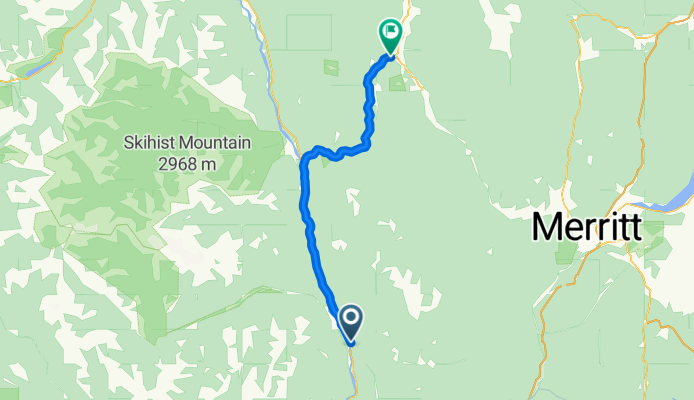
1of12 BC - 05e Spences Bridge, BC to Cache Creek, BC (Brookside Campsite) 49km
Vélo de routeVTTVélo de ville
Trans Canada Bike Route
0

1of12 BC - 05e Spences Bridge, BC to Cache Creek, BC (Brookside Campsite) 49km

Itinéraire à vélo à

1of12 BC - 05e Spences Bridge, BC to Cache Creek, BC (Brookside Campsite) 49km ---  Copyright Creative Commons - Attribution (please do share this work, just source back to where it came from)
48,8 km
Distance
495 m
Montée
228 m
Descente
1of12 BC - 06e Cache Creek, BC to Kamloops, BC (Silver Sage Trailer Park) 87km
Vélo de routeVTTVélo de villeRevêtu
Trans Canada Bike Route
0

1of12 BC - 06e Cache Creek, BC to Kamloops, BC (Silver Sage Trailer Park) 87km

Itinéraire à vélo à Cache Creek, British Columbia, Canada

1of12 BC - 06e Cache Creek, BC to Kamloops, BC (Silver Sage Trailer Park) 87km ---  Copyright Creative Commons - Attribution (please do share this work, just source back to where it came from)
86,9 km
Distance
836 m
Montée
990 m
Descente
1of12 BC - 07e Kamloops, BC to Salmon Arm, BC (Pierre's Point Campground) 102km
Vélo de routeVTTVélo de villeRevêtu
Trans Canada Bike Route
2

1of12 BC - 07e Kamloops, BC to Salmon Arm, BC (Pierre's Point Campground) 102km

Itinéraire à vélo à Kamloops, British Columbia, Canada

1of12 BC - 07e Kamloops, BC to Salmon Arm, BC (Pierre's Point Campground) 102km ---  Copyright Creative Commons - Attribution (please do share this work, just source back to where it came from)
102,2 km
Distance
442 m
Montée
429 m
Descente
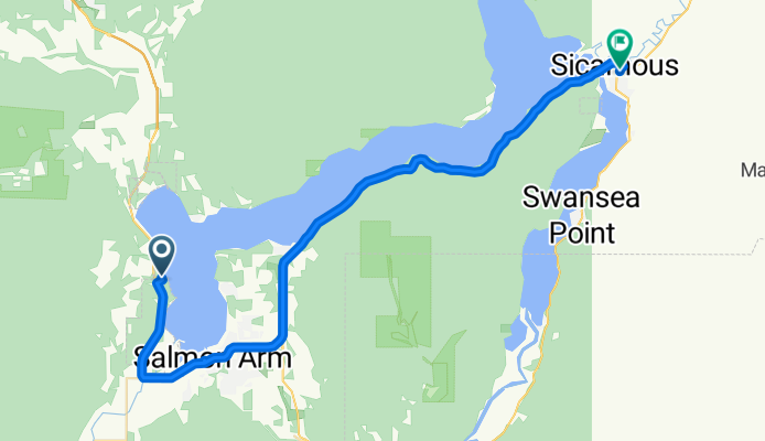
1of12 BC - 08e Salmon Arm, BC to Sicamous, BC (Paradise Motel) 41km
Vélo de routeVTTVélo de ville
Trans Canada Bike Route
1

1of12 BC - 08e Salmon Arm, BC to Sicamous, BC (Paradise Motel) 41km

Itinéraire à vélo à Salmon Arm, British Columbia, Canada

1of12 BC - 08e Salmon Arm, BC to Sicamous, BC (Paradise Motel) 41km ---  Copyright Creative Commons - Attribution (please do share this work, just source back to where it came from)
40,6 km
Distance
384 m
Montée
390 m
Descente
6of12 SouthCentralON - 05a South Baymouth, ON to Owen Sound, ON (Kelso Beach Campground) + ferry 154km
Vélo de routeVTTVélo de villeRevêtu
Trans Canada Bike Route
1

6of12 SouthCentralON - 05a South Baymouth, ON to Owen Sound, ON (Kelso Beach Campground) + ferry 154km

Itinéraire à vélo à

6of12 SouthCentralON - 05a South Baymouth, ON to Owen Sound, ON (Kelso Beach Campground) + ferry 154km ---  Copyright Creative Commons - Attribution (please do share this work, just source back to where it came from)
154,7 km
Distance
194 m
Montée
196 m
Descente
6of12 SouthCentralON - 06a Owen Sound, ON to Orangeville, ON (Orangeville Motel) 110km
Vélo de routeVTTVélo de villeRevêtu
Trans Canada Bike Route
2

6of12 SouthCentralON - 06a Owen Sound, ON to Orangeville, ON (Orangeville Motel) 110km

Itinéraire à vélo à Owen Sound, Ontario, Canada

6of12 SouthCentralON - 06a Owen Sound, ON to Orangeville, ON (Orangeville Motel) 110km ---  Copyright Creative Commons - Attribution (please do share this work, just source back to where it came from)
110,4 km
Distance
453 m
Montée
213 m
Descente
6of12 SouthCentralON - 07a Orangeville, ON to Brampton, ON (Indian Line Campground) 55km
Vélo de routeVTTVélo de villeRevêtu
Trans Canada Bike Route
1

6of12 SouthCentralON - 07a Orangeville, ON to Brampton, ON (Indian Line Campground) 55km

Itinéraire à vélo à Orangeville, Ontario, Canada

6of12 SouthCentralON - 07a Orangeville, ON to Brampton, ON (Indian Line Campground) 55km ---  Copyright Creative Commons - Attribution (please do share this work, just source back to where it came from)
54,9 km
Distance
90 m
Montée
343 m
Descente
6of12 SouthCentralON - 8a Brampton, ON to Scarborough, ON (Glen Rouge Campground) 73km
Vélo de routeVTTVélo de villeRevêtu
Trans Canada Bike Route
1

6of12 SouthCentralON - 8a Brampton, ON to Scarborough, ON (Glen Rouge Campground) 73km

Itinéraire à vélo à Etobicoke, Ontario, Canada

6of12 SouthCentralON - 8a Brampton, ON to Scarborough, ON (Glen Rouge Campground) 73km ---  Copyright Creative Commons - Attribution (please do share this work, just source back to where it came from)
73,3 km
Distance
200 m
Montée
280 m
Descente