
Dolce Via
Dolce Via - Ardèche Greenway
Une collection de 5 itinéraires à vélo.
Vue d'ensemble
À propos de cette collection
A chill rail-trail through the Eyrieux valley in Ardèche, France. This collection covers the Dolce Via and its main spurs, mostly on a former railway, so the gradients stay easy and the views keep coming.
Surfaces are mixed: lots of compacted gravel and other unpaved bits with stretches of asphalt. It rides best on a gravel or hybrid bike; touring tires with some volume are fine. Most of the time you’re on dedicated cycleway and quiet lanes, with only short links on busier roads.
Expect river views, old viaducts and tunnels, shady sections, and swim spots when it’s hot. Handy stops include villages like Le Cheylard and Les Ollières-sur-Eyrieux for food and water. It’s easy to split into day stages, and you can hook into the ViaRhôna at La Voulte-sur-Rhône to reach the Rhône valley.
Rideable in either direction and great for families and casual riders. Bring lights for tunnels and be ready for occasional loose gravel.
- 5
- Itinéraires
- -:--
- Durée
- 81,1 km
- Distance
- ---
- Vit. moyenne
- 3 085 m
- Montée
- 2 650 m
- Descente
Dolce Via - Ardèche Greenway
Itinéraires dans cette collection
Les 5 itinéraires de cette collection peuvent être ouverts sur la carte ou dans l’application Bikemap pour plus de détails. Tu peux les ajuster dans le planificateur d’itinéraire, ou les télécharger au format GPX ou KML. Utilise-les comme modèle pour planifier tes propres sorties, ou laisse Bikemap te guider directement.

Dolce Via: Désaignes - Lamastre
Itinéraire à vélo à Désaignes, Auvergne-Rhône-Alpes, France
- 6,4 km
- Distance
- 212 m
- Montée
- 87 m
- Descente
Dolce Via: Saint-Martin-de-Valamas to Le Cheylard
Itinéraire à vélo à Saint-Martin-de-Valamas, Auvergne-Rhône-Alpes, France
- 8,3 km
- Distance
- 260 m
- Montée
- 156 m
- Descente
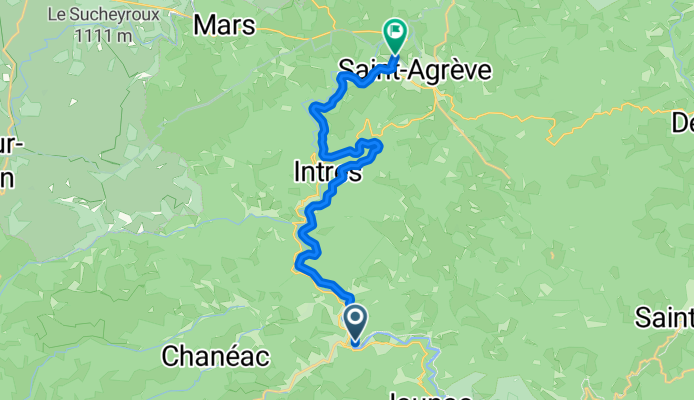
Dolce Via: Saint-Agrève to Saint-Martin-de-Valamas
Itinéraire à vélo à Saint-Agrève, Auvergne-Rhône-Alpes, France
- 17 km
- Distance
- 1 232 m
- Montée
- 706 m
- Descente

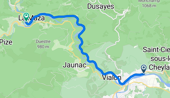
Dolce Via: Le Cheylard - Saint-Sauveur-de-Montagut
Itinéraire à vélo à Le Cheylard, Auvergne-Rhône-Alpes, France
- 21,6 km
- Distance
- 633 m
- Montée
- 838 m
- Descente
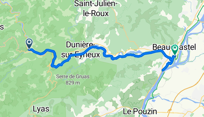
Dolce Via: Saint-Sauveur-de-Montagut to Beauchastel
Itinéraire à vélo à Saint-Sauveur-de-Montagut, Auvergne-Rhône-Alpes, France
- 27,8 km
- Distance
- 746 m
- Montée
- 863 m
- Descente