
Mont St Michel - Cherbourg
Un tour à vélo de 12 étapes, au départ de Pontorson, Normandie, France.
Vue d'ensemble
À propos de ce tour
A Brompton tour following the EuroVelo 4 from Mont-Saint-Michel (Pontorson) to Cherbourg. Accommodation a mixture of camping and hotels.
- 12
- Itinéraires
- 20 h 1 min
- Durée
- 288,7 km
- Distance
- 14,4 km/h
- Vit. moyenne
- 2 211 m
- Montée
- 2 228 m
- Descente

créé il y a 7 mois
Mont St Michel - Cherbourg
Étapes de ce tour
Les 12 étapes de ce tour peuvent être ouvertes sur la carte ou dans l’application Bikemap pour plus de détails. Tu peux les ajuster dans le planificateur d’itinéraire ou les télécharger au format GPX ou KML. Utilise-les comme modèle pour planifier ton propre tour, ou laisse Bikemap te guider directement.


Pontorson - Ducey-les-Chéris
Itinéraire à vélo à Pontorson, Normandie, France
- 28,5 km
- Distance
- 60 m
- Montée
- 72 m
- Descente


Ducey-Les Chéris - Saint-Hilaire-du-Harcouët
Itinéraire à vélo à Ducey, Normandie, France
- 18,9 km
- Distance
- 147 m
- Montée
- 89 m
- Descente


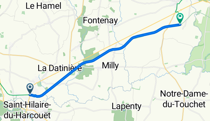
Saint-Hilaire-du-Harcouët - Mortain-Bocage
Itinéraire à vélo à Saint-Hilaire-du-Harcouët, Normandie, France
- 11 km
- Distance
- 102 m
- Montée
- 49 m
- Descente


Mortain-Bocage - Vire
Itinéraire à vélo à Romagny, Normandie, France
- 42,9 km
- Distance
- 400 m
- Montée
- 406 m
- Descente


Vire Normandie - Pont-Farcy
Itinéraire à vélo à Vire, Normandie, France
- 33 km
- Distance
- 420 m
- Montée
- 486 m
- Descente


Pont-Farcy - Saint-Lô
Itinéraire à vélo à Tessy-sur-Vire, Normandie, France
- 32 km
- Distance
- 173 m
- Montée
- 209 m
- Descente


Saint-Lô - Saint-Jean-de-Daye
Itinéraire à vélo à Agneaux, Normandie, France
- 22,7 km
- Distance
- 272 m
- Montée
- 245 m
- Descente


Saint-Jean-de-Daye - Carentan-les-Marais
Itinéraire à vélo à La Meauffe, Normandie, France
- 18,9 km
- Distance
- 41 m
- Montée
- 78 m
- Descente


Carentan-les-Marais - La Haye
Itinéraire à vélo à Carentan, Normandie, France
- 22,7 km
- Distance
- 84 m
- Montée
- 57 m
- Descente


La Haye - Saint-Sauveur-le-Vicomte
Itinéraire à vélo à La Haye-du-Puits, Normandie, France
- 13,4 km
- Distance
- 58 m
- Montée
- 68 m
- Descente


Saint-Sauveur-le-Vicomte - Bricquebec-en-Cotentin
Itinéraire à vélo à Saint-Sauveur-le-Vicomte, Normandie, France
- 13,5 km
- Distance
- 135 m
- Montée
- 120 m
- Descente


Bricquebec-en-Cotentin - Cherbourg-en-Cotentin
Itinéraire à vélo à Bricquebec, Normandie, France
- 31 km
- Distance
- 320 m
- Montée
- 350 m
- Descente