
Hatogaya-honchō à vélo
Découvre une carte de 41 itinéraires et pistes cyclables près de Hatogaya-honchō, créés par notre communauté.
Portrait de région
Fais connaissance avec Hatogaya-honchō
Trouve l’itinéraire à vélo qui te convient à Hatogaya-honchō, où nous avons 41 pistes cyclables à explorer.
1 119 km
Distance enregistrée
41
Itinéraires cyclables
53 062
Population
Communauté
Utilisateurs les plus actifs à Hatogaya-honchō


De notre communauté
Les meilleurs itinéraires à vélo dans et autour de Hatogaya-honchō


Shibakawa Cycling Road
Itinéraire à vélo à Hatogaya-honchō, préfecture de Saitama, Japon
- 15,5 km
- Distance
- 96 m
- Montée
- 88 m
- Descente

Healthy Road へルーシロード
Itinéraire à vélo à Hatogaya-honchō, préfecture de Saitama, Japon
This is a very interesting route that has a lot of scenic spots, you can’t help but stop to take a quick picture of Mt.Fuji in the distance or the gates of the various temples.
The route is very flat, it’s very popular too so expect some foot traffic, there are a few bumpy sections especially around the 3K mark and along the 5K to 6K mark but their are alternative roads that go along perpendicular to the route, you just sacrifice the view a little.
I ended this route at the train track crossing but you can go further just expect a lot of narrow paths and stops at crossroads, I cycled beyond the crossing only once on a rainy evening so it was pretty clear of traffic but I can see it being busy on a sunny day and you may have to travel at a snails pace or you may upset some walkers along the narrow sections, it’s just something to keep in mind or note about.
- 13,6 km
- Distance
- 36 m
- Montée
- 32 m
- Descente

Higashi Urawa River Cycle 東浦和近くの川
Itinéraire à vélo à Hatogaya-honchō, préfecture de Saitama, Japon
Mostly flat with quiet roads, between cycling under beautiful trees with the river next to you there are areas of open farmlands with a great view of Saitama Shintoshin skyscrapers in the far distance. It is a very scenic and calm route.
- 14,6 km
- Distance
- 63 m
- Montée
- 67 m
- Descente

13 芝川で「農」を体感するルート
Itinéraire à vélo à Hatogaya-honchō, préfecture de Saitama, Japon
- 12,5 km
- Distance
- 23 m
- Montée
- 25 m
- Descente
Découvrez plus d'itinéraires
 763−2, 川口市 to 1丁目 20, 秩父市
- Distance
- 94 km
- Montée
- 3 113 m
- Descente
- 2 878 m
- Emplacement
- Hatogaya-honchō, préfecture de Saitama, Japon
 18-17, Toneri 1-Chōme, Adachi to 9-7, Nakakasai 6-Chōme, Edogawa
- Distance
- 22,7 km
- Montée
- 106 m
- Descente
- 110 m
- Emplacement
- Hatogaya-honchō, préfecture de Saitama, Japon
 芝川サイクリングロード〜見沼代用水東縁〜見沼自然公園〜〃西縁
- Distance
- 31,6 km
- Montée
- 78 m
- Descente
- 66 m
- Emplacement
- Hatogaya-honchō, préfecture de Saitama, Japon
 BRM322-1
- Distance
- 153,1 km
- Montée
- 990 m
- Descente
- 366 m
- Emplacement
- Hatogaya-honchō, préfecture de Saitama, Japon
 一般県道足立さいたま自転車道線(芝川自転車道)
- Distance
- 11,5 km
- Montée
- 23 m
- Descente
- 20 m
- Emplacement
- Hatogaya-honchō, préfecture de Saitama, Japon
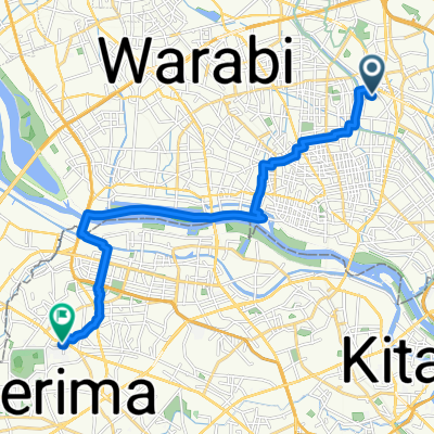
 30, Kawaguchi to 5-chōme 12, Kawaguchi
- Distance
- 3 km
- Montée
- 22 m
- Descente
- 23 m
- Emplacement
- Hatogaya-honchō, préfecture de Saitama, Japon
 里, 川口市へ赤塚新町3丁目, 板橋区
- Distance
- 16,4 km
- Montée
- 91 m
- Descente
- 60 m
- Emplacement
- Hatogaya-honchō, préfecture de Saitama, Japon
 2丁目 23, 川口市 to 2丁目 23, さいたま市
- Distance
- 4,1 km
- Montée
- 3 m
- Descente
- 0 m
- Emplacement
- Hatogaya-honchō, préfecture de Saitama, Japon