
Officer à vélo
Découvre une carte de 134 itinéraires et pistes cyclables près de Officer, créés par notre communauté.
Portrait de région
Fais connaissance avec Officer
Trouve l’itinéraire à vélo qui te convient à Officer, où nous avons 134 pistes cyclables à explorer. La plupart des gens enfourchent leur vélo pour rouler ici aux mois de février et mars.
2 136 km
Distance enregistrée
134
Itinéraires cyclables
1 761
Population
Communauté
Utilisateurs les plus actifs à Officer


De notre communauté
Les meilleurs itinéraires à vélo dans et autour de Officer

Restful route in Pakenham
Itinéraire à vélo à Officer, Victoria, Australie
- 34,5 km
- Distance
- 3 m
- Montée
- 15 m
- Descente

Pakenham - Nar Nar Goon - Cora Lynn - Catani - Koo Wee Rup - Pakenham loop
Itinéraire à vélo à Officer, Victoria, Australie
- 70 km
- Distance
- 80 m
- Montée
- 77 m
- Descente


e-MTB Adventure Ride. Cardinia, Beaconsfield Upper, Belgrave.
Itinéraire à vélo à Officer, Victoria, Australie
General tips and comment.
I ride my e-MTB (Bosch Performance Line CX) with 2 500Wh batteries. The range of some of the rides will require 2 500Wh batteries. If you ride an e-MTB understand the battery range you can get from your e-bike for any given terrain and that you have the capabilities to complete the ride. All my posted routes been ridden and GPS recorded.
If you make use of any of this information in the route/track, in whole or in part, you need to consider the following:
Ride at your own risk. No responsibility is accepted for any inaccuracies or for any mishap or injury that may arise out of the use of any GPS/GPX track or route or any other data or information that may be contained in any route postings.
Tracks, road conditions and water course crossings can change overnight for any number of reasons (weather, landslides, trail closures, flooding, roadworks) making previously good tracks impassable, dangerous and be closed off at any time. Expect the need to detour at any time. Have a ‘Plan B’ and be prepared for any eventuality.
Information provided about each route is the point in time the route was ridden. The difficulty rating may be very different to what constitutes an Intermediate, Experienced or Advanced ride compared to you. Always ride within your capabilities. Treat any ride based on any information supplied with caution, expecting that conditions are likely to be different to what they were when the route was recorded.
Expect steep ascents and descents, loose gravel, ruts, water courses, fallen trees and the need to walk the bike in some instances.
Information provided containing GPS/GPX routes/tracks, are provided "as is" and it is your responsibility to evaluate the information and the suitability for your purposes.
Check CFA Fire Danger Ratings before riding. Do not ride in any conditions with CFA Fire Danger Ratings Scale above: Low - Moderate.
Always inform someone of your intended plans, departure and estimated arrival time.
Have a backup ability to navigate and use navigation devices. A second GPS device or a mobile phone with true GPS capabilities that are not reliant on mobile phone tower reception to function. Install the GPX routes/track into all devices. Or carry a map and compass.
Do not rely on having mobile phone reception available at any time.
On all rides, it is a must that you are self sufficient with food, water and spare parts and have the ability to undertake bicycle repairs.
- 58,4 km
- Distance
- 727 m
- Montée
- 518 m
- Descente
Découvrez plus d'itinéraires
 e-MTB Adventure Ride. Cardinia Road Stn, Belgrave, Ashburton.
- Distance
- 86,1 km
- Montée
- 801 m
- Descente
- 782 m
- Emplacement
- Officer, Victoria, Australie
 e-MTB Adventure Ride. Cardinia, Cardinia Reservoir, Box Hill.
- Distance
- 70,6 km
- Montée
- 834 m
- Descente
- 802 m
- Emplacement
- Officer, Victoria, Australie
 Mount Burnett Circle
- Distance
- 49,6 km
- Montée
- 448 m
- Descente
- 448 m
- Emplacement
- Officer, Victoria, Australie
 Top Pub, Gemrook return via Beaconsfield
- Distance
- 59,8 km
- Montée
- 671 m
- Descente
- 631 m
- Emplacement
- Officer, Victoria, Australie
 Family Ride in Pakenham
- Distance
- 17,4 km
- Montée
- 40 m
- Descente
- 41 m
- Emplacement
- Officer, Victoria, Australie
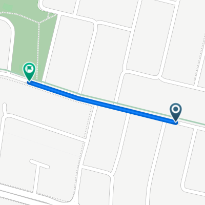 Victory Drive 13, Pakenham to Victory Drive 51, Pakenham
- Distance
- 0,3 km
- Montée
- 0 m
- Descente
- 0 m
- Emplacement
- Officer, Victoria, Australie
 Golden Green Street 18, Pakenham to Moore Mews 39, Pakenham
- Distance
- 0,7 km
- Montée
- 0 m
- Descente
- 0 m
- Emplacement
- Officer, Victoria, Australie
 Steady ride in Pakenham
- Distance
- 3,2 km
- Montée
- 35 m
- Descente
- 29 m
- Emplacement
- Officer, Victoria, Australie