Porirua à vélo
Découvre une carte de 65 itinéraires et pistes cyclables près de Porirua, créés par notre communauté.
Portrait de région
Fais connaissance avec Porirua
Trouve l’itinéraire à vélo qui te convient à Porirua, où nous avons 65 pistes cyclables à explorer.
1 063 km
Distance enregistrée
65
Itinéraires cyclables
50 914
Population
Communauté
Utilisateurs les plus actifs à Porirua
De notre communauté
Les meilleurs itinéraires à vélo dans et autour de Porirua
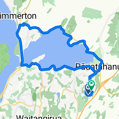
Plimmerton short loop
Itinéraire à vélo à Porirua, Wellington, Nouvelle-Zélande
- 4,9 km
- Distance
- 181 m
- Montée
- 181 m
- Descente
Porirua - Great Cycle Loops - Parks and Harbours
Itinéraire à vélo à Porirua, Wellington, Nouvelle-Zélande
- 24,3 km
- Distance
- 254 m
- Montée
- 255 m
- Descente
Plimmerton to Raumati South
Itinéraire à vélo à Porirua, Wellington, Nouvelle-Zélande
- 22,2 km
- Distance
- 239 m
- Montée
- 232 m
- Descente
Porirua - Wellington
Itinéraire à vélo à Porirua, Wellington, Nouvelle-Zélande
- 28,6 km
- Distance
- 350 m
- Montée
- 350 m
- Descente
Découvrez plus d'itinéraires
 Paremata Station, Porirua to Paremata Station, Porirua
- Distance
- 28,2 km
- Montée
- 773 m
- Descente
- 770 m
- Emplacement
- Porirua, Wellington, Nouvelle-Zélande
 Te Araroa Trail, Porirua to Te Araroa Trail, Porirua
- Distance
- 10,6 km
- Montée
- 292 m
- Descente
- 227 m
- Emplacement
- Porirua, Wellington, Nouvelle-Zélande
 Onepoto Road 33, Porirua to Onepoto Road 23
- Distance
- 9,1 km
- Montée
- 130 m
- Descente
- 122 m
- Emplacement
- Porirua, Wellington, Nouvelle-Zélande
 Castor Crescent 116, Porirua to Castor Crescent 118, Porirua
- Distance
- 6,6 km
- Montée
- 112 m
- Descente
- 112 m
- Emplacement
- Porirua, Wellington, Nouvelle-Zélande
 Marina View 19, Porirua to Paremata Crescent 64, Porirua
- Distance
- 18,7 km
- Montée
- 157 m
- Descente
- 132 m
- Emplacement
- Porirua, Wellington, Nouvelle-Zélande
 69 Endeavour Drive, Whitby to 99 Endeavour Drive, Whitby
- Distance
- 17,4 km
- Montée
- 232 m
- Descente
- 230 m
- Emplacement
- Porirua, Wellington, Nouvelle-Zélande
 Parumoana Street 40, Porirua to Oak Avenue 8A, Porirua
- Distance
- 9,8 km
- Montée
- 97 m
- Descente
- 90 m
- Emplacement
- Porirua, Wellington, Nouvelle-Zélande
 #55 Battle Hill to York Bay
- Distance
- 34,6 km
- Montée
- 401 m
- Descente
- 458 m
- Emplacement
- Porirua, Wellington, Nouvelle-Zélande


