Sutton in Ashfield à vélo
Découvre une carte de 127 itinéraires et pistes cyclables près de Sutton in Ashfield, créés par notre communauté.
Portrait de région
Fais connaissance avec Sutton in Ashfield
Trouve l’itinéraire à vélo qui te convient à Sutton in Ashfield, où nous avons 127 pistes cyclables à explorer. La plupart des gens enfourchent leur vélo pour rouler ici aux mois de août et septembre.
4 390 km
Distance enregistrée
127
Itinéraires cyclables
43 912
Population
Communauté
Utilisateurs les plus actifs à Sutton in Ashfield
De notre communauté
Les meilleurs itinéraires à vélo dans et autour de Sutton in Ashfield
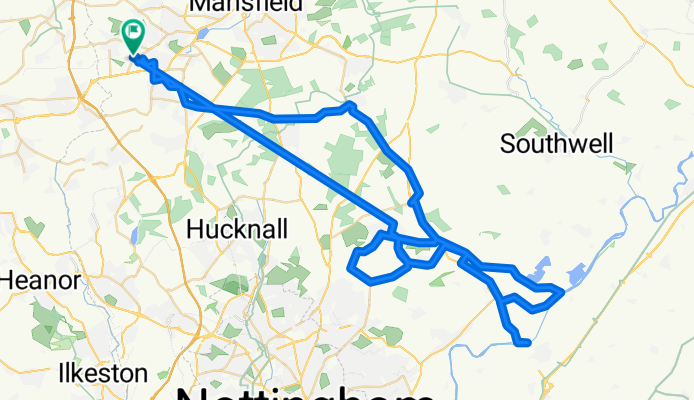
George lane/Gunthorpe
Itinéraire à vélo à Sutton in Ashfield, Angleterre, Royaume-Uni
- 83,4 km
- Distance
- 2 890 m
- Montée
- 2 876 m
- Descente
1st ride on Btwin
Itinéraire à vélo à Sutton in Ashfield, Angleterre, Royaume-Uni
- 58,5 km
- Distance
- 2 476 m
- Montée
- 2 466 m
- Descente
ride to Is
Itinéraire à vélo à Sutton in Ashfield, Angleterre, Royaume-Uni
- 72,7 km
- Distance
- 700 m
- Montée
- 816 m
- Descente
Saturday 25th
Itinéraire à vélo à Sutton in Ashfield, Angleterre, Royaume-Uni
- 33,6 km
- Distance
- 1 359 m
- Montée
- 1 354 m
- Descente
Découvrez plus d'itinéraires
 Sutton in Ashfield to Mablethorpe
- Distance
- 133 km
- Montée
- 306 m
- Descente
- 466 m
- Emplacement
- Sutton in Ashfield, Angleterre, Royaume-Uni
 Hardwick round the back
- Distance
- 22,8 km
- Montée
- 190 m
- Descente
- 192 m
- Emplacement
- Sutton in Ashfield, Angleterre, Royaume-Uni
 Brierley Forest trail
- Distance
- 11,4 km
- Montée
- 79 m
- Descente
- 80 m
- Emplacement
- Sutton in Ashfield, Angleterre, Royaume-Uni
 Lanes Route from Ashfield Pub
- Distance
- 23,8 km
- Montée
- 225 m
- Descente
- 225 m
- Emplacement
- Sutton in Ashfield, Angleterre, Royaume-Uni
 Shenstone Lichfield
- Distance
- 87 km
- Montée
- 240 m
- Descente
- 273 m
- Emplacement
- Sutton in Ashfield, Angleterre, Royaume-Uni
 home to rome uk
- Distance
- 291,9 km
- Montée
- 473 m
- Descente
- 600 m
- Emplacement
- Sutton in Ashfield, Angleterre, Royaume-Uni
 Shentons funeral
- Distance
- 86,7 km
- Montée
- 293 m
- Descente
- 349 m
- Emplacement
- Sutton in Ashfield, Angleterre, Royaume-Uni
 Link Trail Teversal to Skegby to Phoenix Rise 9, Pleasley
- Distance
- 3,8 km
- Montée
- 41 m
- Descente
- 31 m
- Emplacement
- Sutton in Ashfield, Angleterre, Royaume-Uni


