
Veltheim à vélo
Découvre une carte de 120 itinéraires et pistes cyclables près de Veltheim, créés par notre communauté.
Portrait de région
Fais connaissance avec Veltheim
Trouve l’itinéraire à vélo qui te convient à Veltheim, où nous avons 120 pistes cyclables à explorer. La plupart des gens enfourchent leur vélo pour rouler ici aux mois de avril et août.
9 861 km
Distance enregistrée
120
Itinéraires cyclables
1 374
Population
Communauté
Utilisateurs les plus actifs à Veltheim


De notre communauté
Les meilleurs itinéraires à vélo dans et autour de Veltheim

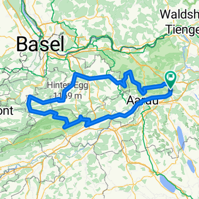
Hochdorf - Herlisberg - Böhler
Itinéraire à vélo à Veltheim, Canton d’Argovie, Suisse
- 89,4 km
- Distance
- 731 m
- Montée
- 731 m
- Descente

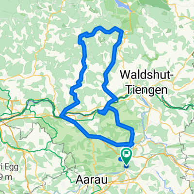
Staffelegg - Kaisten - Laufenburg - Villigen
Itinéraire à vélo à Veltheim, Canton d’Argovie, Suisse
- 68,8 km
- Distance
- 885 m
- Montée
- 885 m
- Descente

Hochdorf-Sempach-Sursee-retour
Itinéraire à vélo à Veltheim, Canton d’Argovie, Suisse
- 93,8 km
- Distance
- 693 m
- Montée
- 693 m
- Descente

Zugersee
Itinéraire à vélo à Veltheim, Canton d’Argovie, Suisse
- 118,7 km
- Distance
- 410 m
- Montée
- 410 m
- Descente
Découvrez plus d'itinéraires
 Buchenegg - Albispass - Ägerisee - Zugersee - Baldeggersee
- Distance
- 179,3 km
- Montée
- 1 362 m
- Descente
- 1 362 m
- Emplacement
- Veltheim, Canton d’Argovie, Suisse
 Staffelegg - Benkerjoch - Saalhöhe - Kaistenberg - Bürersteig - Grünegg - Bözberg - Staffelegg
- Distance
- 132,3 km
- Montée
- 1 913 m
- Descente
- 1 923 m
- Emplacement
- Veltheim, Canton d’Argovie, Suisse
 Weissenstein (Nordrampe)
- Distance
- 143 km
- Montée
- 1 231 m
- Descente
- 1 229 m
- Emplacement
- Veltheim, Canton d’Argovie, Suisse
 Staffelegg - Benkerjoch - Saalhöhe - Bözberg - Geissberg - Staffelegg
- Distance
- 129,5 km
- Montée
- 1 779 m
- Descente
- 1 779 m
- Emplacement
- Veltheim, Canton d’Argovie, Suisse
 Passwang über Langenbruck mit Benkerjoch und Staffelegg
- Distance
- 152,6 km
- Montée
- 1 835 m
- Descente
- 1 832 m
- Emplacement
- Veltheim, Canton d’Argovie, Suisse
 Schwarzwald-Runde
- Distance
- 137,5 km
- Montée
- 1 438 m
- Descente
- 1 435 m
- Emplacement
- Veltheim, Canton d’Argovie, Suisse
 Türlersee - Sihlsee - Ägerisee - Zugersee
- Distance
- 185,5 km
- Montée
- 1 222 m
- Descente
- 1 228 m
- Emplacement
- Veltheim, Canton d’Argovie, Suisse
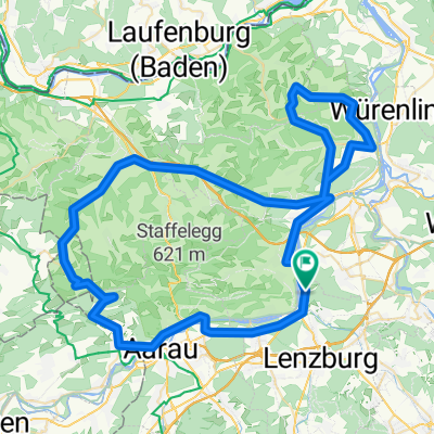 Saalhöhe -Bözberg - Rotberg
- Distance
- 82 km
- Montée
- 1 090 m
- Descente
- 1 090 m
- Emplacement
- Veltheim, Canton d’Argovie, Suisse