Laupersdorf à vélo
Découvre une carte de 40 itinéraires et pistes cyclables près de Laupersdorf, créés par notre communauté.
Portrait de région
Fais connaissance avec Laupersdorf
Trouve l’itinéraire à vélo qui te convient à Laupersdorf, où nous avons 40 pistes cyclables à explorer.
1 914 km
Distance enregistrée
40
Itinéraires cyclables
1 670
Population
Communauté
Utilisateurs les plus actifs à Laupersdorf
De notre communauté
Les meilleurs itinéraires à vélo dans et autour de Laupersdorf
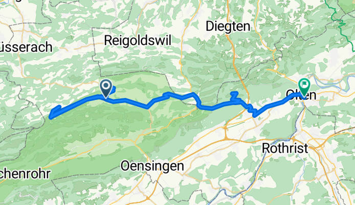
Scheltenpass-Passwang-Allerheiligen-Olten
Itinéraire à vélo à Laupersdorf, Canton de Soleure, Suisse
- 51,4 km
- Distance
- 1 216 m
- Montée
- 1 495 m
- Descente
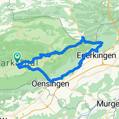
Thal-Aareufer-Balmberg-Schnapswägli-Tour
Itinéraire à vélo à Laupersdorf, Canton de Soleure, Suisse
- 59,5 km
- Distance
- 858 m
- Montée
- 858 m
- Descente
Hellchöpfli
Itinéraire à vélo à Laupersdorf, Canton de Soleure, Suisse
- 24 km
- Distance
- 805 m
- Montée
- 805 m
- Descente
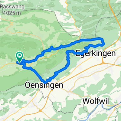
Laupersdorf, Brunnersberg ,Mümliswil, lpd
Itinéraire à vélo à Laupersdorf, Canton de Soleure, Suisse
- 27,4 km
- Distance
- 852 m
- Montée
- 852 m
- Descente
Découvrez plus d'itinéraires
 Oberberg-Bremgarten-Schanzenwägli-Tour
- Distance
- 19 km
- Montée
- 532 m
- Descente
- 529 m
- Emplacement
- Laupersdorf, Canton de Soleure, Suisse
 Laupersdorf-Bärenwil-Oensingen-Laupersdorf
- Distance
- 34,1 km
- Montée
- 744 m
- Descente
- 744 m
- Emplacement
- Laupersdorf, Canton de Soleure, Suisse
 Brunnersberg-Brocheten-Katertürli
- Distance
- 26,7 km
- Montée
- 636 m
- Descente
- 650 m
- Emplacement
- Laupersdorf, Canton de Soleure, Suisse
 Brunnersberg-Lätt Türli
- Distance
- 18,6 km
- Montée
- 582 m
- Descente
- 583 m
- Emplacement
- Laupersdorf, Canton de Soleure, Suisse
 Laupersdorf, Alp, Bluemlismatt, Holderbank, Laupersdorf
- Distance
- 31,7 km
- Montée
- 798 m
- Descente
- 798 m
- Emplacement
- Laupersdorf, Canton de Soleure, Suisse
 Passwang-Mariastein
- Distance
- 35,1 km
- Montée
- 1 178 m
- Descente
- 1 496 m
- Emplacement
- Laupersdorf, Canton de Soleure, Suisse
 jura215
- Distance
- 215 km
- Montée
- 3 130 m
- Descente
- 3 131 m
- Emplacement
- Laupersdorf, Canton de Soleure, Suisse
 Brunnersberg, Welschenrohr, Laupersdorf
- Distance
- 27,8 km
- Montée
- 739 m
- Descente
- 740 m
- Emplacement
- Laupersdorf, Canton de Soleure, Suisse


