Bienne à vélo
Découvre une carte de 1 207 itinéraires et pistes cyclables près de Bienne, créés par notre communauté.
Portrait de région
Fais connaissance avec Bienne
Trouve l’itinéraire à vélo qui te convient à Bienne, où nous avons 1 207 pistes cyclables à explorer. La plupart des gens enfourchent leur vélo pour rouler ici aux mois de mai et juin.
68 616 km
Distance enregistrée
1 207
Itinéraires cyclables
48 614
Population
Communauté
Utilisateurs les plus actifs à Bienne
Itinéraires soigneusement sélectionnés
Découvre Bienne à travers ces collections
De notre communauté
Les meilleurs itinéraires à vélo dans et autour de Bienne
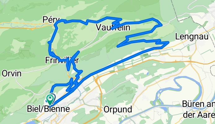
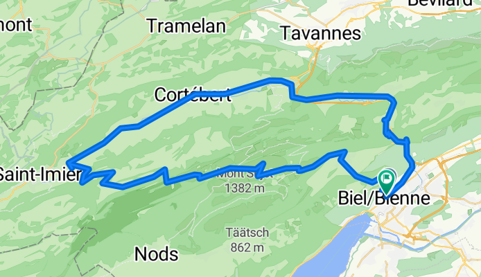
Bözingerbergschlaufe+
Itinéraire à vélo à Bienne, Canton de Berne, Suisse
- 41,9 km
- Distance
- 1 162 m
- Montée
- 1 203 m
- Descente
Zum Chasseral-Gletscher
Itinéraire à vélo à Bienne, Canton de Berne, Suisse
- 57,2 km
- Distance
- 1 285 m
- Montée
- 1 329 m
- Descente
P-Biel/Bienne TRACK2 (16km)
Itinéraire à vélo à Bienne, Canton de Berne, Suisse
- 15,5 km
- Distance
- 242 m
- Montée
- 244 m
- Descente
Découvrez plus d'itinéraires
 Rund um den Bettlachstock
- Distance
- 43,3 km
- Montée
- 1 011 m
- Descente
- 1 068 m
- Emplacement
- Bienne, Canton de Berne, Suisse
 P-BielerSee (85km)
- Distance
- 84,7 km
- Montée
- 736 m
- Descente
- 734 m
- Emplacement
- Bienne, Canton de Berne, Suisse
 P-BielerSee (65km)
- Distance
- 65 km
- Montée
- 850 m
- Descente
- 851 m
- Emplacement
- Bienne, Canton de Berne, Suisse
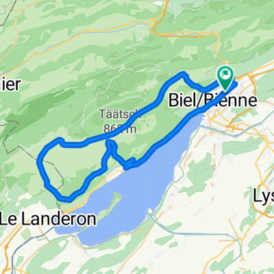 P-Biel/Twann/Lignières/Nods/Orvin/Evilard (47 km)
- Distance
- 47,4 km
- Montée
- 802 m
- Descente
- 802 m
- Emplacement
- Bienne, Canton de Berne, Suisse
 P-GRAVEL-Biel-Hagneck-Aarberg-Lyss-Orpund (41 km)
- Distance
- 41,1 km
- Montée
- 217 m
- Descente
- 214 m
- Emplacement
- Bienne, Canton de Berne, Suisse
 P-Biel/Twann/Lignieres/Enges/Nods/Twannberg/Macolin/Evilard (60km)
- Distance
- 60,1 km
- Montée
- 1 143 m
- Descente
- 1 141 m
- Emplacement
- Bienne, Canton de Berne, Suisse
 P-Biel/Lyss/Frienisberg (82km)
- Distance
- 83 km
- Montée
- 1 119 m
- Descente
- 1 119 m
- Emplacement
- Bienne, Canton de Berne, Suisse
 P-BielerSee (62km)
- Distance
- 61,5 km
- Montée
- 1 003 m
- Descente
- 1 002 m
- Emplacement
- Bienne, Canton de Berne, Suisse
Itinéraires depuis Bienne
Excursion à vélo d’une journée de
Bienne à Berne
À vélo de
Bienne à Nidau
Itinéraires vers Bienne
Excursion à vélo d’une journée de
Berne à Bienne
À vélo de
Nidau à Bienne


