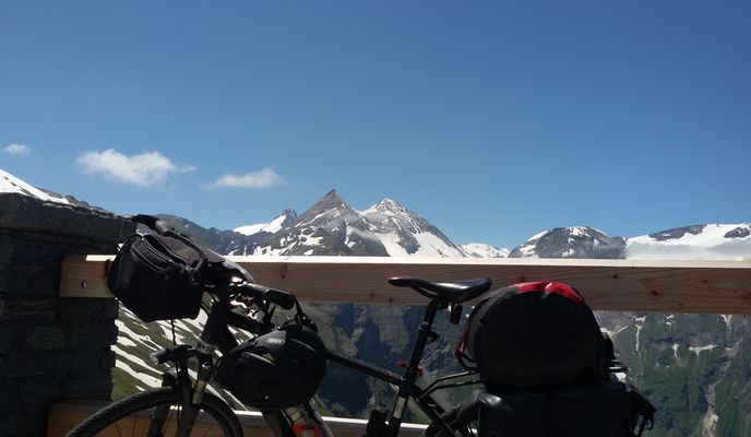
Vienne à vélo
Découvre une carte de 52 956 itinéraires et pistes cyclables près de Vienne, créés par notre communauté.
Portrait de région
Fais connaissance avec Vienne
Trouve l’itinéraire à vélo qui te convient à Vienne, où nous avons 52 956 pistes cyclables à explorer. La plupart des gens enfourchent leur vélo pour rouler ici aux mois de juin et juillet.
2 975 831 km
Distance enregistrée
52 956
Itinéraires cyclables
1,7 millions
Population
Communauté
Utilisateurs les plus actifs à Vienne
Itinéraires soigneusement sélectionnés
Découvre Vienne à travers ces collections
De notre communauté
Les meilleurs itinéraires à vélo dans et autour de Vienne
Augustiner- u Mostalmtrail über Sophienalpe
Itinéraire à vélo à Vienne, Vienne, Autriche
- 32,1 km
- Distance
- 540 m
- Montée
- 534 m
- Descente
Vom Bikemap Office zum Kutschkermarkt
Itinéraire à vélo à Vienne, Vienne, Autriche
- 5 km
- Distance
- 64 m
- Montée
- 38 m
- Descente
Blaue Leberkäsrunde: Donau-Prater(wirt)
Itinéraire à vélo à Vienne, Vienne, Autriche
- 27,5 km
- Distance
- 168 m
- Montée
- 180 m
- Descente
Donau-Radweg: Wien-Bratislava
Itinéraire à vélo à Vienne, Vienne, Autriche
- 70,9 km
- Distance
- 332 m
- Montée
- 340 m
- Descente
De la part de nos rédacteurs
Meilleurs itinéraires à vélo dans et autour de Vienne

Tour with a view
Kahlenberg
Situated on the in the north of Vienna, Kahlenberg (484 m or 1,588 ft) is a favorite spot for those wishing to admire the city from above. The winding Höhenstraße, which leads to the top, is itself an adventure. The scenic road dates back to the 1930s and was partly paved using cobblestones. It’s a shaky ride on a bike, and you'll be sharing it with cars and motorbikes, but the view from the top is worth the effort. You can always stop at a local vineyard to sample some wine on the way down.
Featured routes around Kahlenberg
- Kahlenberg 2.0
- Distance
- 23,8 km
- Montée
- 534 m
- Descente
- 534 m
- Emplacement
- Langenzersdorf, Basse-Autriche, Autriche
- Kahlenberg- & Hadersfeldrunde
- Distance
- 50,4 km
- Montée
- 592 m
- Descente
- 593 m
- Emplacement
- Korneubourg, Basse-Autriche, Autriche
- Kahlenberg Mountainbikestrecke
- Distance
- 22,3 km
- Montée
- 361 m
- Descente
- 358 m
- Emplacement
- Vienne, Vienne, Autriche

Mountain meadow by bike
Sophienalpe
The Sophienalpe, a 477 m (1,565 ft) Alpine mountain meadow, lies west of Vienna. In the late 19th Century a funicular used to take day trippers there. Today Sophienalpe is a popular destination for cyclists. Its steady ascent with a gradient of up to 10 % is easily manageable for most riders. The view from the top is, of course, spectacular and the descent offers moments of pure joy.
Featured routes around Sophienalpe
- Jubiläumswarte Sophienalpe Höhenstrasse
- Distance
- 42,8 km
- Montée
- 714 m
- Descente
- 714 m
- Emplacement
- Vienne, Vienne, Autriche
- Sophienalpe-Tulbinger Kogel - Dopplerhütte
- Distance
- 73,7 km
- Montée
- 737 m
- Descente
- 745 m
- Emplacement
- Vienne, Vienne, Autriche

Bike and the city
Danube Canal Cycle Path
The Danube Canal Cycle Path, a 17 kilometer long urban route, takes you from the Nussdorf weir and lock to the harbour of Vienna. Restaurants and cafes lining the banks of the canal offer plenty of opportunities for refreshments. Whether you cycle the whole way or just along a stretch of this route, the historical inner city is close by with its many sights: Stephansdom, Rathaus, parliament, museums and a neverending choice of things to do. It's also a quick and fun path out of the city via the Danube for day trips to .
Featured routes around the Danube Canal

Along the blue river
The Danube Island
In Vienna, the legendary leads along the Donauinsel (Danube Island), a recreational island constructed as part of an elaborate flood protection system in the 1970s. Tourists and locals alike flock here in the summer months to rollerblade, swim or enjoy the nightlife. A day trip to Bratislava, the Slovak capital, is only 64 kilometers (40 miles) away. After sampling a local beer or two, the high-speed boats of the “twin city liner” take you and your bike back in style.
Featured routes around the Danube Island
- Lobau-Donauinsel-Lobau
- Distance
- 26 km
- Montée
- 101 m
- Descente
- 104 m
- Emplacement
- Groß-Enzersdorf, Basse-Autriche, Autriche

Town to wildlife
Wiental Cycle Path
From the hustle and bustle of the Ring road to the peace and quiet of a wildlife preserve: it’s possible on the 9km long Wiental cycle path leading to Lainzer Tiergarten. Following the Wienfluss river and the track of underground line U4, cyclists ride past the world famous Schönbrunn Palace, taking in foodie heaven Naschmarkt on the way. With 5930 acres of grounds to roam in, Lainzer Tiergarten is the perfect place for a relaxing break - or an invigorating encounter with a wild boar!
Featured routes around the Wiental Cycle Path
- Vom Liesingbach ins Wiental
- Distance
- 51,4 km
- Montée
- 317 m
- Descente
- 313 m
- Emplacement
- Vösendorf, Basse-Autriche, Autriche
- Milleniumstrecke (inkl. 1/8-Ehrenrunde)
- Distance
- 43,1 km
- Montée
- 565 m
- Descente
- 565 m
- Emplacement
- Vienne, Vienne, Autriche
- Naschmarkt, St. Andrä, Hintersdorf, Unterkirchbach, Mauerbach, Wientalradweg
- Distance
- 60,8 km
- Montée
- 362 m
- Descente
- 362 m
- Emplacement
- Vienne, Vienne, Autriche
- Wien: Umrundung mit Höhenstraße
- Distance
- 55,2 km
- Montée
- 542 m
- Descente
- 540 m
- Emplacement
- Purkersdorf, Basse-Autriche, Autriche
- Rund um den Lainzer Tiergarten (offizielle Strecke)
- Distance
- 22,8 km
- Montée
- 642 m
- Descente
- 642 m
- Emplacement
- Purkersdorf, Basse-Autriche, Autriche
Découvrez plus d'itinéraires
- Wien - Haslau an der Donau - Kittsee - Wien
- Distance
- 138,3 km
- Montée
- 371 m
- Descente
- 423 m
- Emplacement
- Vienne, Vienne, Autriche
- After_Work_Training_Standard
- Distance
- 69,7 km
- Montée
- 1 149 m
- Descente
- 1 084 m
- Emplacement
- Vienne, Vienne, Autriche
- MTB im wienerwald
- Distance
- 22,2 km
- Montée
- 562 m
- Descente
- 560 m
- Emplacement
- Vienne, Vienne, Autriche
- Boku-Exelberg-Sophie-Riederb-TulbingK-Königstetten-St-Andrae-Hintersd-Boku
- Distance
- 84,2 km
- Montée
- 1 189 m
- Descente
- 1 189 m
- Emplacement
- Vienne, Vienne, Autriche
- Summer Event
- Distance
- 31,4 km
- Montée
- 186 m
- Descente
- 185 m
- Emplacement
- Vienne, Vienne, Autriche
- Tour de Vienna
- Distance
- 22 km
- Montée
- 105 m
- Descente
- 104 m
- Emplacement
- Vienne, Vienne, Autriche
- Naschmarkt/Klosterneuburg/St. Andrä/Exelberg
- Distance
- 58,1 km
- Montée
- 481 m
- Descente
- 481 m
- Emplacement
- Vienne, Vienne, Autriche
- Kaisermühlen Nationalpark Donau-Auen-Lobau nach Seestadt Aspern
- Distance
- 34,9 km
- Montée
- 235 m
- Descente
- 241 m
- Emplacement
- Vienne, Vienne, Autriche
Itinéraires depuis Vienne
Bikepacking de
Vienne à Budapest I. kerület
Bikepacking de
Vienne à Budapest
Excursion à vélo d’une journée de
Vienne à Mauerbach
Excursion à vélo d’une journée de
Vienne à Aderklaa
Sortie rapide à vélo de
Vienne à Brunn am Gebirge
Sortie rapide à vélo de
Vienne à Klosterneuburg
Itinéraires vers Vienne
Bikepacking de
Budapest à Vienne
Bikepacking de
Brno à Vienne
Excursion à vélo d’une journée de
Mödling à Vienne
Excursion à vélo d’une journée de
Sankt Pölten à Vienne
Sortie rapide à vélo de
Bisamberg à Vienne
Sortie rapide à vélo de
Perchtoldsdorf à Vienne