
Reillanne à vélo
Découvre une carte de 100 itinéraires et pistes cyclables près de Reillanne, créés par notre communauté.
Portrait de région
Fais connaissance avec Reillanne
Trouve l’itinéraire à vélo qui te convient à Reillanne, où nous avons 100 pistes cyclables à explorer. La plupart des gens enfourchent leur vélo pour rouler ici aux mois de mai et juin.
5 924 km
Distance enregistrée
100
Itinéraires cyclables
1 410
Population
Communauté
Utilisateurs les plus actifs à Reillanne


De notre communauté
Les meilleurs itinéraires à vélo dans et autour de Reillanne

Dia 4 - Gite de Chaloux a Domain Saint Victor
Itinéraire à vélo à Reillanne, Provence-Alpes-Côte d'Azur, France
- 52,8 km
- Distance
- 701 m
- Montée
- 997 m
- Descente
Reillanne - Mollégès
Itinéraire à vélo à Reillanne, Provence-Alpes-Côte d'Azur, France
- 85,1 km
- Distance
- 1 187 m
- Montée
- 1 685 m
- Descente
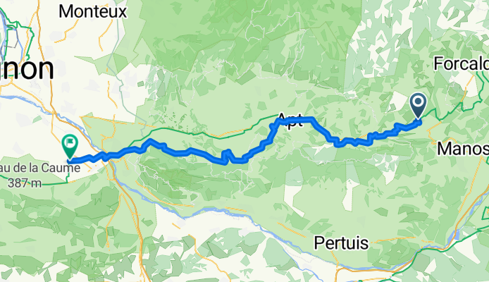
Reillanne - Apt
Itinéraire à vélo à Reillanne, Provence-Alpes-Côte d'Azur, France
- 31,5 km
- Distance
- 277 m
- Montée
- 590 m
- Descente
20250701 Reillanne nach Pertuis
Itinéraire à vélo à Reillanne, Provence-Alpes-Côte d'Azur, France
- 41 km
- Distance
- 459 m
- Montée
- 629 m
- Descente
Découvrez plus d'itinéraires
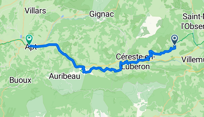
 Ralhana - Peipin
- Distance
- 57,7 km
- Montée
- 1 147 m
- Descente
- 1 235 m
- Emplacement
- Reillanne, Provence-Alpes-Côte d'Azur, France
 Trasa C – kaňonem Oppedette do Manosque
- Distance
- 53,4 km
- Montée
- 886 m
- Descente
- 1 226 m
- Emplacement
- Reillanne, Provence-Alpes-Côte d'Azur, France
 Simiane-La-Rotonde - Rustrel - Oppedete - Manosque
- Distance
- 73,3 km
- Montée
- 1 009 m
- Descente
- 1 312 m
- Emplacement
- Reillanne, Provence-Alpes-Côte d'Azur, France
 Descente sur toulon
- Distance
- 170,7 km
- Montée
- 1 173 m
- Descente
- 1 779 m
- Emplacement
- Reillanne, Provence-Alpes-Côte d'Azur, France
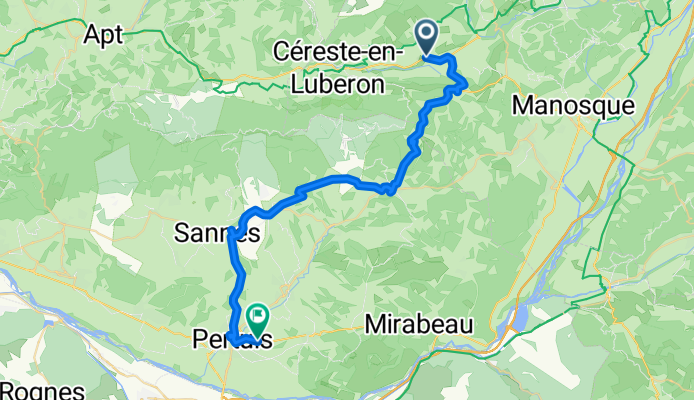
 24-16b Reillanne - Mirabeau
- Distance
- 74 km
- Montée
- 699 m
- Descente
- 879 m
- Emplacement
- Reillanne, Provence-Alpes-Côte d'Azur, France
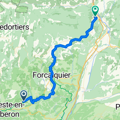
 24-16a Reillanne - Mirabeau
- Distance
- 40,4 km
- Montée
- 694 m
- Descente
- 871 m
- Emplacement
- Reillanne, Provence-Alpes-Côte d'Azur, France
 Reillanne - Volx Veloroute
- Distance
- 45,8 km
- Montée
- 774 m
- Descente
- 803 m
- Emplacement
- Reillanne, Provence-Alpes-Côte d'Azur, France
 De La Place 63, Vachères à Place Pierre Puget 79, La Londe-les-Maures
- Distance
- 140,4 km
- Montée
- 967 m
- Descente
- 1 836 m
- Emplacement
- Reillanne, Provence-Alpes-Côte d'Azur, France