
Paimpol à vélo
Découvre une carte de 120 itinéraires et pistes cyclables près de Paimpol, créés par notre communauté.
Portrait de région
Fais connaissance avec Paimpol
Trouve l’itinéraire à vélo qui te convient à Paimpol, où nous avons 120 pistes cyclables à explorer. La plupart des gens enfourchent leur vélo pour rouler ici aux mois de juillet et août.
6 020 km
Distance enregistrée
120
Itinéraires cyclables
8 603
Population
Communauté
Utilisateurs les plus actifs à Paimpol


De notre communauté
Les meilleurs itinéraires à vélo dans et autour de Paimpol


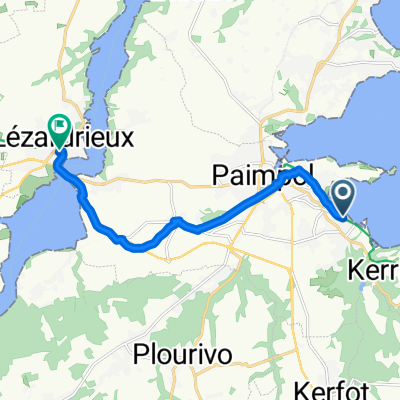
Rue de Cruckin nach Rue de Cruckin
Itinéraire à vélo à Paimpol, Région Bretagne, France
- 60,6 km
- Distance
- 702 m
- Montée
- 757 m
- Descente


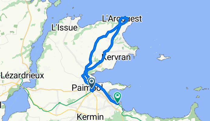
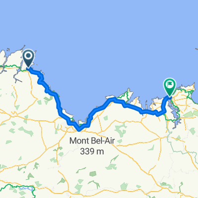
Quai Armand Dayot nach Rue de Cruckin
Itinéraire à vélo à Paimpol, Région Bretagne, France
- 16,7 km
- Distance
- 131 m
- Montée
- 180 m
- Descente
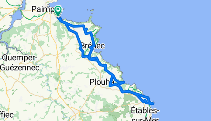
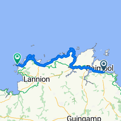
Paimpol - Perros-Guirec
Itinéraire à vélo à Paimpol, Région Bretagne, France
- 57,5 km
- Distance
- 503 m
- Montée
- 501 m
- Descente

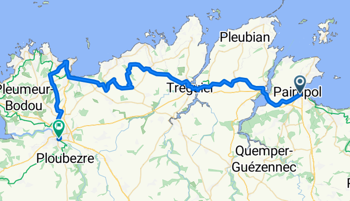
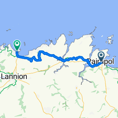
Paimpol - Trèguier
Itinéraire à vélo à Paimpol, Région Bretagne, France
- 18,1 km
- Distance
- 151 m
- Montée
- 132 m
- Descente
Découvrez plus d'itinéraires
 day three extra
- Distance
- 9,2 km
- Montée
- 64 m
- Descente
- 46 m
- Emplacement
- Paimpol, Région Bretagne, France
 From Paimpol to Saint-Malo
- Distance
- 136,9 km
- Montée
- 1 319 m
- Descente
- 1 319 m
- Emplacement
- Paimpol, Région Bretagne, France
 Paimpol - Ile Grande 11.06.2013 / 4th Stage
- Distance
- 82,9 km
- Montée
- 469 m
- Descente
- 478 m
- Emplacement
- Paimpol, Région Bretagne, France
 Paimpol - Perros-Guirec
- Distance
- 44,5 km
- Montée
- 384 m
- Descente
- 341 m
- Emplacement
- Paimpol, Région Bretagne, France
 Paimpol - Ile Grande 11.06.2013 / 4th Stage
- Distance
- 83 km
- Montée
- 464 m
- Descente
- 473 m
- Emplacement
- Paimpol, Région Bretagne, France
 3-й день
- Distance
- 50,1 km
- Montée
- 358 m
- Descente
- 358 m
- Emplacement
- Paimpol, Région Bretagne, France
 Ride des Mousettes - Day 3
- Distance
- 149,8 km
- Montée
- 597 m
- Descente
- 574 m
- Emplacement
- Paimpol, Région Bretagne, France
 12 C. Atlant 5- PAIMPOL- DINAN
- Distance
- 128,8 km
- Montée
- 705 m
- Descente
- 680 m
- Emplacement
- Paimpol, Région Bretagne, France