
Trentin-Haut-Adige à vélo
Découvre une carte de 60 540 itinéraires et pistes cyclables à Trentin-Haut-Adige, créés par notre communauté.
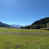
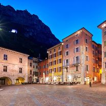
Portrait de région
Fais connaissance avec Trentin-Haut-Adige
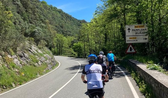
Trouve l’itinéraire à vélo qui te convient à Trentin-Haut-Adige, où nous avons 60 540 pistes cyclables à explorer. La plupart des gens enfourchent leur vélo pour rouler ici aux mois de juillet et août.
4 634 912 km
Distance enregistrée
60 540
Itinéraires cyclables
Communauté
Utilisateurs les plus actifs à Trentin-Haut-Adige


Itinéraires soigneusement sélectionnés
Découvre Trentin-Haut-Adige à travers ces collections
De notre communauté
Les meilleurs itinéraires à vélo à Trentin-Haut-Adige


Val di Stava and Guagiola - Tour 928
Itinéraire à vélo à Predazzo, Trentin-Haut-Adige, Italie
- 38 km
- Distance
- 1 680 m
- Montée
- 1 682 m
- Descente


Missianer Weg nach Missianer Weg
Itinéraire à vélo à San Paolo, Trentin-Haut-Adige, Italie
- 76,3 km
- Distance
- 810 m
- Montée
- 867 m
- Descente


Via Paese Soprabolzano, Renon to Via Beda Weber, Bolzano
Itinéraire à vélo à Soprabolzano, Trentin-Haut-Adige, Italie
- 62,7 km
- Distance
- 1 231 m
- Montée
- 2 185 m
- Descente


Via Benaco nach Piazzale Paolo Orsi
Itinéraire à vélo à Torbole sul Garda, Trentin-Haut-Adige, Italie
- 20,1 km
- Distance
- 262 m
- Montée
- 193 m
- Descente
De la part de nos rédacteurs
Meilleurs itinéraires à vélo dans et autour de Trentin-Haut-Adige

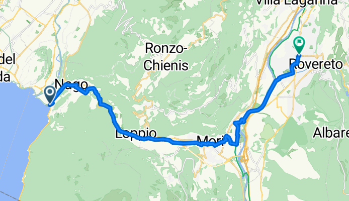
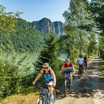
Gentle rides with great views await at the north shore of resort destination Lake Garda. Cycle path Garda Trentino no. 8, for example, is an 18 km (11 miles) long easy bike route connecting Riva del Garda and Torbole. Cyclists of all ages and abilities are sure to enjoy this gentle path along the lake shore and surrounding country. Continuing through the town of Nago, there's a short ascent through the vineyards up to Passo di San Giovanni at an elevation of 210 m (689 ft) before you cycle back downhill to Mori.
Featured routes around Lake Garda
- Nago - Monte Velo -Nago

- Distance
- 44,7 km
- Montée
- 1 142 m
- Descente
- 1 128 m
- Emplacement
- Nago-Torbole, Trentin-Haut-Adige, Italie
- Garda Lake - Randonneur Circuit - Short Course

- Distance
- 146,4 km
- Montée
- 772 m
- Descente
- 771 m
- Emplacement
- Desenzano del Garda, Lombardie, Italie
- Riva del Garda - Monte Baldo

- Distance
- 64,7 km
- Montée
- 2 146 m
- Descente
- 2 153 m
- Emplacement
- Riva del Garda, Trentin-Haut-Adige, Italie
- Riva del Garda - Bocca Larici

- Distance
- 19,4 km
- Montée
- 1 446 m
- Descente
- 1 454 m
- Emplacement
- Riva del Garda, Trentin-Haut-Adige, Italie
- Nago, Brentonico, Monte Altissimo

- Distance
- 51,8 km
- Montée
- 1 921 m
- Descente
- 1 921 m
- Emplacement
- Nago-Torbole, Trentin-Haut-Adige, Italie
- MTB Garda Day 1 - Ledro-Riva del Garda-Torbole-Sarche-Riva del Garda


- Distance
- 76,6 km
- Montée
- 388 m
- Descente
- 979 m
- Emplacement
- Pieve di Ledro, Trentin-Haut-Adige, Italie
- Riva del Garda-Torbole-Nago-Val del Diaol-Nago-Torbole-Riva del Garda

- Distance
- 17,2 km
- Montée
- 495 m
- Descente
- 497 m
- Emplacement
- Riva del Garda, Trentin-Haut-Adige, Italie

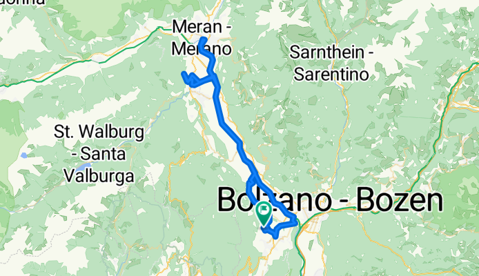
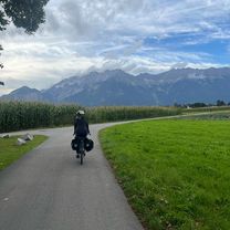
Blessed with a mild climate and 300 days of sunshine a year, Merano is a well-known spa town. You can join the Adige Valley Cycle Path to Bolzano or to the north from here. It's also a great base for bike tours in the surrounding mountains. The road bike highlights include three high mountain passes: Passo del Rombo (Timmelsjoch) across the Ötztal Alps, Passo di Monte Giovo (Jaufenpass) and the nearby Passo delle Palade (Gampenpass). Among the many specialties of Alto Adige is the local grape, Schiava, so be sure to sample some wine from the surrounding vineyards.
- Giro di Merano

- Distance
- 93,5 km
- Montée
- 2 452 m
- Descente
- 2 451 m
- Emplacement
- Merano, Trentin-Haut-Adige, Italie
- Mendel/Gampenpass

- Distance
- 70,3 km
- Montée
- 1 680 m
- Descente
- 1 679 m
- Emplacement
- Nalles, Trentin-Haut-Adige, Italie
- Latsch - Meran - Gampenpass -Latsch


- Distance
- 107 km
- Montée
- 1 654 m
- Descente
- 1 654 m
- Emplacement
- Laces, Trentin-Haut-Adige, Italie


Various long-distance cycle routes pass through the valleys of Trentino and Alto Adige. There is the Ciclopista del Sole, which is part of the EuroVelo 7, an ambitious route slicing north-south through all of Europe. Its Italian section, not surprisingly, leads to Rome, and beyond. The Romans also built the first road across the Alps, Via Claudia Augusta, which will take you south to Veneto or Verona and the Po. From here, you can continue to the EuroVelo 8, which runs close to the Mediterranean coast to Cyprus.
Featured long-distance routes
- Via Claudia Augusta


- Distance
- 700,4 km
- Montée
- 2 242 m
- Descente
- 2 642 m
- Emplacement
- Donauworth, Bavière, Allemagne
- Ciclopista del sole peschiera modena bomporto

- Distance
- 171,3 km
- Montée
- 27 m
- Descente
- 78 m
- Emplacement
- Peschiera del Garda, Vénétie, Italie
- Ciclopista del Sole (eurovelo 7) - Part 5


- Distance
- 64,5 km
- Montée
- 280 m
- Descente
- 356 m
- Emplacement
- Avio, Trentin-Haut-Adige, Italie
- Ciclopista del Sole (eurovelo 7) - Part 9

- Distance
- 298,6 km
- Montée
- 843 m
- Descente
- 901 m
- Emplacement
- Penna in Teverina, Ombrie, Italie
- Ciclopista del Sole (eurovelo 7) - Part 7

- Distance
- 208,1 km
- Montée
- 954 m
- Descente
- 1 368 m
- Emplacement
- Sambuca Pistoiese, Toscane, Italie
- ciclopista del sole tratto bressanone/ bolzano


- Distance
- 44,4 km
- Montée
- 196 m
- Descente
- 504 m
- Emplacement
- Bressanone, Trentin-Haut-Adige, Italie
- Eurovelo 7


- Distance
- 2 087,5 km
- Montée
- 1 535 m
- Descente
- 1 965 m
- Emplacement
- Krakow am See, Mecklembourg-Poméranie, Allemagne

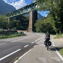
The Adige Valley Cycle Path from Innsbruck to Bolzano leads through the Austrian Tyrol and the Italian South Tyrol, taking in some astonishing Alpine scenery along the way. Following the Inn river at first, you'll pass Imst and Landeck before approaching the Austrian-Italian border. Reschenpass at Nauders marks the highest point of this route but is manageable for most cyclists. Besides, it's mostly downhill from here - past the sunken village in the Reschen lake, where the steeple of a church rises from the otherwise undisturbed surface. Continuing on Italian ground along the Adige river, the ancient Roman trade route Via Augusta will take you through the spa town of Merano and the region's capital, Bolzano. If you find yourself at your destination with enough energy to push on, Kalterer lake is a great tip for a refreshing swim in summer.
- Runde Reschenpass


- Distance
- 128,9 km
- Montée
- 2 083 m
- Descente
- 2 083 m
- Emplacement
- Scuol, Canton des Grisons, Suisse
- Bolzano-Innsbruck


- Distance
- 129,2 km
- Montée
- 1 250 m
- Descente
- 922 m
- Emplacement
- Bolzano, Trentin-Haut-Adige, Italie
- Reschenpass/Stilfserjoch/Reschenpass

- Distance
- 106,1 km
- Montée
- 2 413 m
- Descente
- 2 424 m
- Emplacement
- Curon Venosta, Trentin-Haut-Adige, Italie
- Alto Adige + Termeno

- Distance
- 48,1 km
- Montée
- 656 m
- Descente
- 656 m
- Emplacement
- Cornaiano, Trentin-Haut-Adige, Italie
- bolzano-innsbruck-bolzano

- Distance
- 438,3 km
- Montée
- 3 198 m
- Descente
- 3 198 m
- Emplacement
- Bolzano, Trentin-Haut-Adige, Italie
- BOLZANO GIOVO VIPITENO PENNES BOLZANO

- Distance
- 154 km
- Montée
- 2 952 m
- Descente
- 2 953 m
- Emplacement
- Cornaiano, Trentin-Haut-Adige, Italie


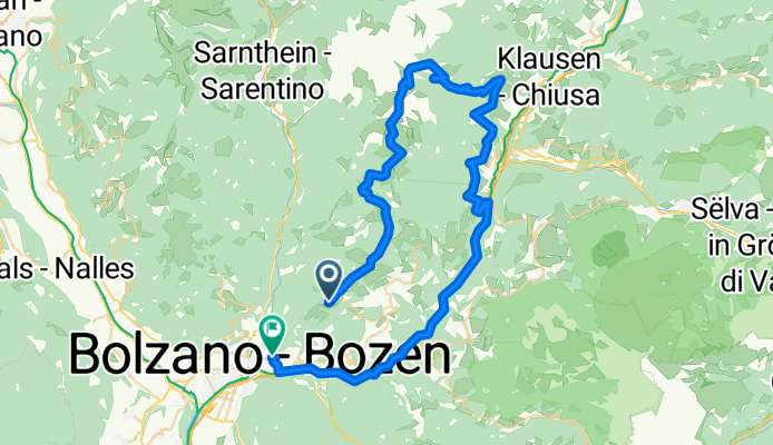
The Lunga Via delle Dolomiti (the long road of the Dolomites)follows the path of an old train line which links Toblach (Dobbiaco) in South Tyrol with Cortina d'Ampezzo and Calalzo di Cadore in Veneto. There are ten original train tunnels, many bridges and some beautiful old train stations along the 66 km (41 miles) long route. The natural views of the Dolomites are stunning - this may well be Italy's most scenic cycle path. The south part of the route is paved but the north is partly gravel. At the border between South Tyrol and Belluno, you'll reach Passo Gimabanche after a 300 m (984 ft) climb from either side. The rest of the route is pretty flat - some stretches are used for cross-country skiing in winter.
- Passo Manghen-Passo Redebus

- Distance
- 106,7 km
- Montée
- 2 695 m
- Descente
- 2 721 m
- Emplacement
- Levico Terme, Trentin-Haut-Adige, Italie
- Giro delle dolomiti di sesto

- Distance
- 88,9 km
- Montée
- 2 017 m
- Descente
- 1 943 m
- Emplacement
- Auronzo di Cadore, Vénétie, Italie
- Toblach- Tre Croci- Cimabanche-Toblach


- Distance
- 65 km
- Montée
- 1 008 m
- Descente
- 1 007 m
- Emplacement
- Dobbiaco, Trentin-Haut-Adige, Italie
- Giro delle Dolomiti del Brenta


- Distance
- 136 km
- Montée
- 2 175 m
- Descente
- 2 154 m
- Emplacement
- Spormaggiore, Trentin-Haut-Adige, Italie
- Lunga Via delle Dolomiti

- Distance
- 64 km
- Montée
- 423 m
- Descente
- 840 m
- Emplacement
- Dobbiaco, Trentin-Haut-Adige, Italie
- Giretto Dolomiti

- Distance
- 96,4 km
- Montée
- 2 080 m
- Descente
- 2 076 m
- Emplacement
- Auronzo di Cadore, Vénétie, Italie
- Maratona delle dolomiti


- Distance
- 138,4 km
- Montée
- 3 620 m
- Descente
- 3 532 m
- Emplacement
- Badia, Trentin-Haut-Adige, Italie
- Nel cuore delle Dolomiti

- Distance
- 87,7 km
- Montée
- 1 672 m
- Descente
- 1 662 m
- Emplacement
- Sesto, Trentin-Haut-Adige, Italie
Découvrez plus d'itinéraires
 Drava Cycle Route - Toblach to Aich/Dob
- Distance
- 288,3 km
- Montée
- 2 961 m
- Descente
- 3 722 m
- Emplacement
- Dobbiaco, Trentin-Haut-Adige, Italie
 Sterzing to Innsbruck
- Distance
- 66,5 km
- Montée
- 1 560 m
- Descente
- 1 944 m
- Emplacement
- Vipiteno, Trentin-Haut-Adige, Italie
 Siusi to Sterzing
- Distance
- 82,2 km
- Montée
- 1 274 m
- Descente
- 2 317 m
- Emplacement
- Ortisei, Trentin-Haut-Adige, Italie
 Umrundung Reschensee und Heidersee
- Distance
- 24,9 km
- Montée
- 234 m
- Descente
- 229 m
- Emplacement
- Curon Venosta, Trentin-Haut-Adige, Italie
 Melag bis Moseben und zurück mit Gravelbike
- Distance
- 23,6 km
- Montée
- 689 m
- Descente
- 697 m
- Emplacement
- Curon Venosta, Trentin-Haut-Adige, Italie
 Fanes-Senes Runde
- Distance
- 45,3 km
- Montée
- 2 428 m
- Descente
- 2 196 m
- Emplacement
- San Genesio, Trentin-Haut-Adige, Italie
 Rondrit Toblach - Oostenrijk via St Jakob & Lienz
- Distance
- 153,4 km
- Montée
- 3 975 m
- Descente
- 3 976 m
- Emplacement
- Dobbiaco, Trentin-Haut-Adige, Italie
 2.7. Trento - Riva del Garda
- Distance
- 53,4 km
- Montée
- 1 069 m
- Descente
- 1 193 m
- Emplacement
- Trente, Trentin-Haut-Adige, Italie
Régions cyclables dans Trentin-Haut-Adige
San Giacomo
193 itinéraires à vélo
Ronchi Valsugana
2 itinéraires à vélo
Rablà
93 itinéraires à vélo
Ragoli
17 itinéraires à vélo
Cagnò
18 itinéraires à vélo
Découvre où les gens font du vélo en Italie
Régions cyclables populaires en Italie


