
Mars Hill à vélo
Découvre une carte de 4 itinéraires et pistes cyclables près de Mars Hill, créés par notre communauté.
Sois un pionnier
Inspire d’autres cyclistes avec ton itinéraire à Mars Hill
Bikemap est une communauté cycliste mondiale avec des millions d’itinéraires créés par des cyclistes comme toi. Il n’y a encore que quelques itinéraires à Mars Hill, alors trace tes parcours préférés sur la carte pour aider les autres à trouver les meilleurs chemins à parcourir.
De notre communauté
Les meilleurs itinéraires à vélo dans et autour de Mars Hill

Hot Doggett Metric Century (2009)
Itinéraire à vélo à Mars Hill, Caroline du Nord, États Unis
- 103 km
- Distance
- 2 651 m
- Montée
- 2 482 m
- Descente

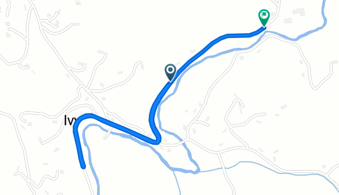
North Main Street 114, Mars Hill to North Main Street 114, Mars Hill
Itinéraire à vélo à Mars Hill, Caroline du Nord, États Unis
- 34 km
- Distance
- 462 m
- Montée
- 462 m
- Descente
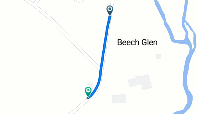
Beech Glen Road to Beech Glen Road
Itinéraire à vélo à Mars Hill, Caroline du Nord, États Unis
- 2,5 km
- Distance
- 52 m
- Montée
- 12 m
- Descente
Beech Glen Road to Blue Herron Road
Itinéraire à vélo à Mars Hill, Caroline du Nord, États Unis
- 0,6 km
- Distance
- 42 m
- Montée
- 0 m
- Descente