
Hopkins à vélo
Découvre une carte de 51 itinéraires et pistes cyclables près de Hopkins, créés par notre communauté.
Portrait de région
Fais connaissance avec Hopkins
Trouve l’itinéraire à vélo qui te convient à Hopkins, où nous avons 51 pistes cyclables à explorer. La plupart des gens enfourchent leur vélo pour rouler ici au mois de juin.
896 km
Distance enregistrée
51
Itinéraires cyclables
17 591
Population
Communauté
Utilisateurs les plus actifs à Hopkins


De notre communauté
Les meilleurs itinéraires à vélo dans et autour de Hopkins

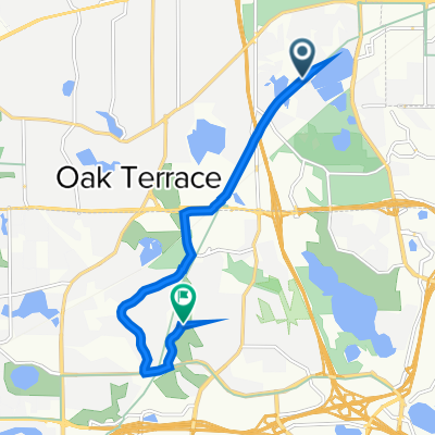
B2B00232 55343 55416 via SWLRT, Cedar Lake Trails
Itinéraire à vélo à Hopkins, Minnesota, United States of America
This route was built to minimize interaction with traffic. A rider comfortable mixing with high volumes of motor vehicle traffic could ride North on Baker to Pymouth to Cedar Lake Road to reach this destination.
- 14,3 km
- Distance
- 48 m
- Montée
- 83 m
- Descente

Unmapped Loop
Itinéraire à vélo à Hopkins, Minnesota, United States of America
- 48,1 km
- Distance
- 182 m
- Montée
- 181 m
- Descente

B2B00245 55346>55431 via Baker Rd, Anderson Lakes Pkwy, W 84th St
Itinéraire à vélo à Hopkins, Minnesota, United States of America
There should be a bike path along Baker, Anderson Lakes Pkwy, Veness Rd, W Bush Lake, W 84th and American Blvd.
- 18,4 km
- Distance
- 137 m
- Montée
- 163 m
- Descente

Home to Work
Itinéraire à vélo à Hopkins, Minnesota, United States of America
- 15,8 km
- Distance
- 141 m
- Montée
- 174 m
- Descente
Découvrez plus d'itinéraires
 B2B Minnetonka to QBP
- Distance
- 17,9 km
- Montée
- 99 m
- Descente
- 131 m
- Emplacement
- Hopkins, Minnesota, United States of America
 Sanibel Drive 5464, Hopkins to State Highway No 100 South 3700, St. Louis Park
- Distance
- 10,8 km
- Montée
- 37 m
- Descente
- 33 m
- Emplacement
- Hopkins, Minnesota, United States of America
 Minnesota River Bluffs Regional Lrt Trail, Minnetonka to 7021 Howard Ln, Eden Prairie
- Distance
- 8,3 km
- Montée
- 74 m
- Descente
- 75 m
- Emplacement
- Hopkins, Minnesota, United States of America
 From Work via Valley View
- Distance
- 13,5 km
- Montée
- 84 m
- Descente
- 119 m
- Emplacement
- Hopkins, Minnesota, United States of America
 From Work via Hillary Ln and Dewey Hill
- Distance
- 13,5 km
- Montée
- 81 m
- Descente
- 112 m
- Emplacement
- Hopkins, Minnesota, United States of America
 crown to knox
- Distance
- 15,1 km
- Montée
- 46 m
- Descente
- 72 m
- Emplacement
- Hopkins, Minnesota, United States of America
 Mt Willy Loop
- Distance
- 4,8 km
- Montée
- 56 m
- Descente
- 56 m
- Emplacement
- Hopkins, Minnesota, United States of America
 Dominick Drive 5301, Minnetonka to Beachside Drive 5215, Hopkins
- Distance
- 29,1 km
- Montée
- 63 m
- Descente
- 27 m
- Emplacement
- Hopkins, Minnesota, United States of America