
Stillwater à vélo
Découvre une carte de 93 itinéraires et pistes cyclables près de Stillwater, créés par notre communauté.
Portrait de région
Fais connaissance avec Stillwater
Trouve l’itinéraire à vélo qui te convient à Stillwater, où nous avons 93 pistes cyclables à explorer. La plupart des gens enfourchent leur vélo pour rouler ici aux mois de juillet et août.
3 598 km
Distance enregistrée
93
Itinéraires cyclables
18 225
Population
Communauté
Utilisateurs les plus actifs à Stillwater
De notre communauté
Les meilleurs itinéraires à vélo dans et autour de Stillwater
St. Croix River Crossing Loop Trail
Itinéraire à vélo à Stillwater, Minnesota, United States of America
- 8,4 km
- Distance
- 123 m
- Montée
- 123 m
- Descente
Brown's Creek State Trail, Stillwater to Brown's Creek State Trail, Stillwater
Itinéraire à vélo à Stillwater, Minnesota, United States of America
- 21,4 km
- Distance
- 142 m
- Montée
- 144 m
- Descente
Stillwater, MN to Woodville, WI
Itinéraire à vélo à Stillwater, Minnesota, United States of America
A detour on St. Croix County, Wisconsin's County Road E sent us south earlier than we had planned during an August 2008 ride from Minneapolis to Stevens Point. This section of the ride leaves Stillwater up a steep but fairly short hill, passes through farm country in rolling terrain, and comes through some small towns north of Interstate 94, ending at a nice, small motel. There is good food in Woodville. The sections of this route on Highway 12 were not bad. Most of the trip was on small country roads with little traffic.
- 52,7 km
- Distance
- 275 m
- Montée
- 139 m
- Descente
68m-Stilwater-Osceola
Itinéraire à vélo à Stillwater, Minnesota, United States of America
Copied from baude's Bikery Solstice century
- 110,2 km
- Distance
- 321 m
- Montée
- 341 m
- Descente
Découvrez plus d'itinéraires
- Stillwater to Hostel Shoppe, Stevens Point, WI
- Distance
- 353,2 km
- Montée
- 1 346 m
- Descente
- 1 225 m
- Emplacement
- Stillwater, Minnesota, United States of America
- B2B00202 55082>55408viaHwy96,Gateway,Como,Greenway
- Distance
- 48,6 km
- Montée
- 223 m
- Descente
- 182 m
- Emplacement
- Stillwater, Minnesota, United States of America
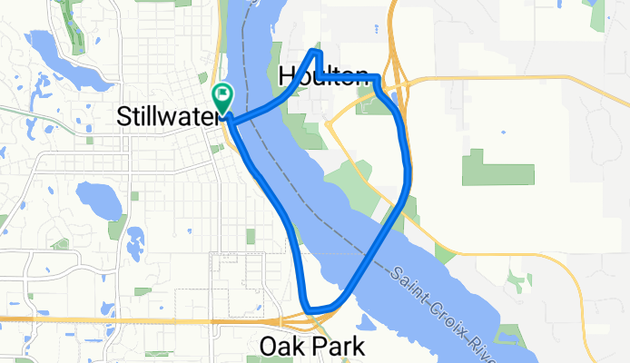
- B2B00869 55082>55014 viaStillwaterRd/75thSt/GatewayTrail/WheelockPkwy/Como/EnergyPk CLONED FROM ROUTE 75356
- Distance
- 32,5 km
- Montée
- 140 m
- Descente
- 140 m
- Emplacement
- Stillwater, Minnesota, United States of America
- B2B00867 55082>55402 via StillwaterRd75thStN/GatewayTrail/WheelockPkwy/Como/Intercampus/4thSE/StoneArch/3rdAv
- Distance
- 41,7 km
- Montée
- 160 m
- Descente
- 177 m
- Emplacement
- Stillwater, Minnesota, United States of America
- BsB00144 Cty.B & Rice to Rutherford School, Stillwater
- Distance
- 23,7 km
- Montée
- 62 m
- Descente
- 59 m
- Emplacement
- Stillwater, Minnesota, United States of America
- B2B00289 55082>55455viaHwy12/GatewayTrl/Arling/WhelckPkwy/Como/Intercampus/Wash
- Distance
- 37,1 km
- Montée
- 143 m
- Descente
- 157 m
- Emplacement
- Stillwater, Minnesota, United States of America
- Cty. B to Rutherford School Stillwater
- Distance
- 23,8 km
- Montée
- 53 m
- Descente
- 54 m
- Emplacement
- Stillwater, Minnesota, United States of America
- B2B00869 55082>55014 viaStillwaterRd/75thSt/GatewayTrail/WheelockPkwy/Como/EnergyPk
- Distance
- 32,5 km
- Montée
- 114 m
- Descente
- 119 m
- Emplacement
- Stillwater, Minnesota, United States of America