
Wellsboro à vélo
Découvre une carte de 33 itinéraires et pistes cyclables près de Wellsboro, créés par notre communauté.
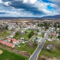
Portrait de région
Fais connaissance avec Wellsboro
Trouve l’itinéraire à vélo qui te convient à Wellsboro, où nous avons 33 pistes cyclables à explorer.
2 112 km
Distance enregistrée
33
Itinéraires cyclables
3 263
Population
Communauté
Utilisateurs les plus actifs à Wellsboro

Itinéraires soigneusement sélectionnés
Découvre Wellsboro à travers ces collections
Tour
De notre communauté
Les meilleurs itinéraires à vélo dans et autour de Wellsboro
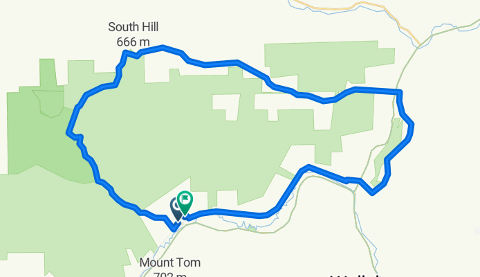
Marsh Creek Road to Marsh Creek Road via Muck
Itinéraire à vélo à Wellsboro, Pennsylvanie, États Unis
- 40,8 km
- Distance
- 565 m
- Montée
- 563 m
- Descente


The Ladle - Day 2 - Ascension Awaits
Itinéraire à vélo à Wellsboro, Pennsylvanie, États Unis
- 95,4 km
- Distance
- 1 164 m
- Montée
- 1 301 m
- Descente

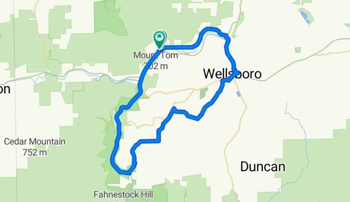
Marsh Creek Road to Marsh Creek Road
Itinéraire à vélo à Wellsboro, Pennsylvanie, États Unis
- 56,6 km
- Distance
- 556 m
- Montée
- 545 m
- Descente

Laurel Flyer Road Race
Itinéraire à vélo à Wellsboro, Pennsylvanie, États Unis
- 38,2 km
- Distance
- 493 m
- Montée
- 478 m
- Descente
Découvrez plus d'itinéraires
 PA Grand Canyon Rail to Trail
- Distance
- 16,1 km
- Montée
- 80 m
- Descente
- 126 m
- Emplacement
- Wellsboro, Pennsylvanie, États Unis
 pine creek rail trail, pa.
- Distance
- 87,4 km
- Montée
- 954 m
- Descente
- 1 137 m
- Emplacement
- Wellsboro, Pennsylvanie, États Unis
 FTO2 - Day 3
- Distance
- 61,7 km
- Montée
- 508 m
- Descente
- 599 m
- Emplacement
- Wellsboro, Pennsylvanie, États Unis
 Pine Creek Trail
- Distance
- 100,9 km
- Montée
- 339 m
- Descente
- 515 m
- Emplacement
- Wellsboro, Pennsylvanie, États Unis
 Grand Canyon of Pennsylvania wrong direction
- Distance
- 14,1 km
- Montée
- 77 m
- Descente
- 77 m
- Emplacement
- Wellsboro, Pennsylvanie, États Unis
 Pine Creek Rail Trail
- Distance
- 102 km
- Montée
- 262 m
- Descente
- 451 m
- Emplacement
- Wellsboro, Pennsylvanie, États Unis
 4758 US-6, Wellsboro to Colton Rd, Wellsboro
- Distance
- 31 km
- Montée
- 794 m
- Descente
- 604 m
- Emplacement
- Wellsboro, Pennsylvanie, États Unis
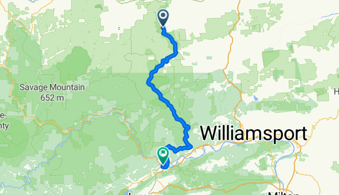
 Wellsboro to Lake Ontario
- Distance
- 369,7 km
- Montée
- 985 m
- Descente
- 1 299 m
- Emplacement
- Wellsboro, Pennsylvanie, États Unis