Williston à vélo
Découvre une carte de 31 itinéraires et pistes cyclables près de Williston, créés par notre communauté.
Portrait de région
Fais connaissance avec Williston
Trouve l’itinéraire à vélo qui te convient à Williston, où nous avons 31 pistes cyclables à explorer.
1 275 km
Distance enregistrée
31
Itinéraires cyclables
8 314
Population
Communauté
Utilisateurs les plus actifs à Williston
De notre communauté
Les meilleurs itinéraires à vélo dans et autour de Williston
20110825 Williston to Burlington
Itinéraire à vélo à Williston, Vermont, United States of America
25 August 2011 A ride from Williston to Burlington, VT through light residential and country roads.
- 19,2 km
- Distance
- 125 m
- Montée
- 192 m
- Descente
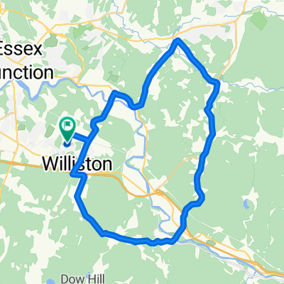
20110824 Around Williston
Itinéraire à vélo à Williston, Vermont, United States of America
24 August 2011 the long way back to my hotel through the neighborhoods and back hills of Williston, VT. A couple of good climbs.
- 17,1 km
- Distance
- 155 m
- Montée
- 124 m
- Descente
ARRB
Itinéraire à vélo à Williston, Vermont, United States of America
140-mile four-gap ride that surmounts App, Roxbury, Rochester and Brandon Gaps. Note that doing this clockwise leaves almost 50 miles to the finish! This ride could easily start in Richmond, where there is a large park & ride. Warning: this ride has some very steep climbs and a few dirt sections (ridable with std road tires).
- 227,9 km
- Distance
- 3 420 m
- Montée
- 3 348 m
- Descente
Richmond-Montgomery Century
Itinéraire à vélo à Williston, Vermont, United States of America
This 100-mile ride travels Pleasant Valley Rd, then climbs Rte 109 and loops through Montgomery to North Enosburg, returning on N. Enosburg Rd and Rte 108, then Lower Pleasant Valley Rd before backtracking largely over the same route. Hilly, but no monster climbs. There's several miles of gradual climbing up Rte 109 and a steeper, but not terribly long climb at the northern end of N. Enosburg Rd. Just a good, northern Vermont century, without any dirt.
- 162,5 km
- Distance
- 1 854 m
- Montée
- 1 756 m
- Descente
Découvrez plus d'itinéraires
 Nice climbing route
- Distance
- 39,7 km
- Montée
- 404 m
- Descente
- 405 m
- Emplacement
- Williston, Vermont, United States of America
 Huntington Hills
- Distance
- 23,6 km
- Montée
- 302 m
- Descente
- 302 m
- Emplacement
- Williston, Vermont, United States of America
 RC BFarm PLV 108 DuxR RC
- Distance
- 105,3 km
- Montée
- 1 034 m
- Descente
- 1 034 m
- Emplacement
- Williston, Vermont, United States of America
 Richmond-Hinesburg 30
- Distance
- 51,7 km
- Montée
- 678 m
- Descente
- 678 m
- Emplacement
- Williston, Vermont, United States of America
 25 M to Johnny Brook via Gov Chitt
- Distance
- 17,9 km
- Montée
- 173 m
- Descente
- 174 m
- Emplacement
- Williston, Vermont, United States of America
 Cross VT Trail 44, Williston to Mill Street 3, Burlington
- Distance
- 14,9 km
- Montée
- 111 m
- Descente
- 217 m
- Emplacement
- Williston, Vermont, United States of America
 Richmond/Hinesburg Route
- Distance
- 47,8 km
- Montée
- 478 m
- Descente
- 480 m
- Emplacement
- Williston, Vermont, United States of America
 Michael Lane 154, Williston to Bayley Hazen Road 643, Peacham
- Distance
- 95 km
- Montée
- 1 549 m
- Descente
- 1 302 m
- Emplacement
- Williston, Vermont, United States of America


