
Littleton à vélo
Découvre une carte de 94 itinéraires et pistes cyclables près de Littleton, créés par notre communauté.
Portrait de région
Fais connaissance avec Littleton
Trouve l’itinéraire à vélo qui te convient à Littleton, où nous avons 94 pistes cyclables à explorer. La plupart des gens enfourchent leur vélo pour rouler ici aux mois de juin et juillet.
2 663 km
Distance enregistrée
94
Itinéraires cyclables
41 737
Population
Communauté
Utilisateurs les plus actifs à Littleton


De notre communauté
Les meilleurs itinéraires à vélo dans et autour de Littleton

LC - Chatfield Loop
Itinéraire à vélo à Littleton, Colorado, États Unis
- 45,4 km
- Distance
- 173 m
- Montée
- 173 m
- Descente

July GBA + Pedal Group Ride (Pleasantville Fun)
Itinéraire à vélo à Littleton, Colorado, États Unis
80% Gravel. 95% Bike Paths (no cars) Bathrooms at mile 2 and 6.1 Water at mile 2 The paths do cross streets. Use the crossings and be careful. There is no official crossing of Holly at mile 10.8, so be especially careful there! Make sure to use the underpasses for University at miles 15.2 and 16. This is a beginner/intermediate ride which may not be suitable to a new-to-gravel riders. (We say this mostly because of the fact that we won’t have specific pace leaders or sweeps.) The route has many nice wide crushed gravel trails, lots of twists and turns, single track, double track, but nothing too terribly technical or steep. You must be comfortable navigating and following a route on your bike computer as the route is complicated with lots of turns onto unexpected trails. Some of the trails will feel like off-roading through grass.
The ride is NOT no-drop, rather, come prepared with the route loaded on your bike computer or phone. There won’t be specific pace group ride leaders or sweeps, but riders will be able toride with similarly paced cyclists. While this is a group ride, you are 100% responsible for yourself. It may be hot. Please bring enough hydration and fuel for the ride as well as sunscreen or anything else you might require. Make sure your bike is in good working order and you have the suppliesto fix a mechanical issue or flat. Helmets required. 32mm width (or wider) and tubeless tires strongly recommended.
All genders are welcome. We’ll plan to go to Breckenridge Brewery after the ride is over for those of you that want to hang out, have a drink and chat. Route notes: * On aSunday morning, the trails will be used by pedestrians and dog walkers. Please be kind, give people room and call your pass. * Bathrooms at mile 2, 6.1 * Water available at mile 2 * The paths do cross streets. Use the crossings and be careful. * On the Cherry Trail you will be flanked on both sides by fences/private property. Please follow the route closely to avoid going onto private property. We found we had to zoom way in on the route map to be able to follow it accurately. * There is no official crossing of Holly at mile 10.8, so be especially careful there! * Make sure to use the underpasses for University at miles 15.2 and 16.
- 56,8 km
- Distance
- 190 m
- Montée
- 190 m
- Descente

Tesla to Home #1
Itinéraire à vélo à Littleton, Colorado, États Unis
Highline the whole way
×
×
- 19,1 km
- Distance
- 45 m
- Montée
- 49 m
- Descente

Mary Carter Greenway Trail, Littleton to 8540 S Colorado Blvd, Highlands Ranch
Itinéraire à vélo à Littleton, Colorado, États Unis
- 21,9 km
- Distance
- 189 m
- Montée
- 47 m
- Descente
Découvrez plus d'itinéraires
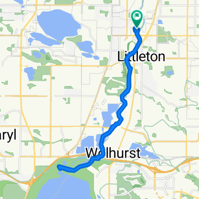
 2469 W Main St, Littleton to 4737 S Xenophon Way, Morrison
- Distance
- 18,8 km
- Montée
- 1 867 m
- Descente
- 1 759 m
- Emplacement
- Littleton, Colorado, États Unis
 Landmark
- Distance
- 17,1 km
- Montée
- 199 m
- Descente
- 85 m
- Emplacement
- Littleton, Colorado, États Unis
 South Broadway 5898, Littleton to South Broadway 2634, Denver
- Distance
- 23,5 km
- Montée
- 30 m
- Descente
- 77 m
- Emplacement
- Littleton, Colorado, États Unis
 To The Lake And Back
- Distance
- 23,3 km
- Montée
- 85 m
- Descente
- 85 m
- Emplacement
- Littleton, Colorado, États Unis
 5800 S Prince St, Littleton to 4501 Homestead St, Bow Mar
- Distance
- 5 km
- Montée
- 47 m
- Descente
- 9 m
- Emplacement
- Littleton, Colorado, États Unis
 South Broadway 5898, Littleton to South Broadway 3080, Englewood
- Distance
- 5,8 km
- Montée
- 7 m
- Descente
- 46 m
- Emplacement
- Littleton, Colorado, États Unis
 North Ride
- Distance
- 24,4 km
- Montée
- 51 m
- Descente
- 50 m
- Emplacement
- Littleton, Colorado, États Unis
 3084 W Chenango Ave, Englewood to 76005022 Landmark Way, Greenwood Village
- Distance
- 17,2 km
- Montée
- 147 m
- Descente
- 47 m
- Emplacement
- Littleton, Colorado, États Unis