
Port Orford à vélo
Découvre une carte de 31 itinéraires et pistes cyclables près de Port Orford, créés par notre communauté.
Portrait de région
Fais connaissance avec Port Orford
Trouve l’itinéraire à vélo qui te convient à Port Orford, où nous avons 31 pistes cyclables à explorer.
2 833 km
Distance enregistrée
31
Itinéraires cyclables
1 133
Population
Communauté
Utilisateurs les plus actifs à Port Orford


De notre communauté
Les meilleurs itinéraires à vélo dans et autour de Port Orford

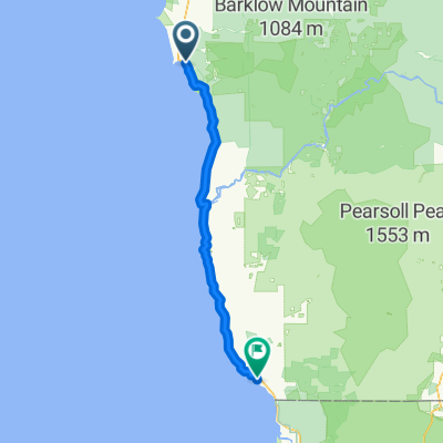
Oregon Coast 2016 Day 2
Itinéraire à vélo à Port Orford, Oregon, États Unis
- 101,7 km
- Distance
- 898 m
- Montée
- 879 m
- Descente


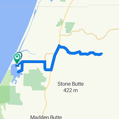
Moderate route in Port Orford
Itinéraire à vélo à Port Orford, Oregon, États Unis
- 0,2 km
- Distance
- 0 m
- Montée
- 0 m
- Descente
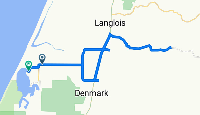
Floras Lake Road 93040, Langlois to Floras Lake Road 92854, Langlois
Itinéraire à vélo à Port Orford, Oregon, États Unis
- 26,6 km
- Distance
- 187 m
- Montée
- 152 m
- Descente
Découvrez plus d'itinéraires
 Oregon Coast 2016 Day 7
- Distance
- 90,3 km
- Montée
- 500 m
- Descente
- 514 m
- Emplacement
- Port Orford, Oregon, États Unis
 High-speed route
- Distance
- 27,4 km
- Montée
- 187 m
- Descente
- 155 m
- Emplacement
- Port Orford, Oregon, États Unis
 Blistering ride in Port Orford
- Distance
- 0,7 km
- Montée
- 0 m
- Descente
- 8 m
- Emplacement
- Port Orford, Oregon, États Unis
 WC day 21
- Distance
- 84,1 km
- Montée
- 889 m
- Descente
- 874 m
- Emplacement
- Port Orford, Oregon, États Unis
 Tag_08
- Distance
- 120,5 km
- Montée
- 670 m
- Descente
- 665 m
- Emplacement
- Port Orford, Oregon, États Unis
 307-> PORT ORFORD - CRESCENT CITY
- Distance
- 133,8 km
- Montée
- 679 m
- Descente
- 686 m
- Emplacement
- Port Orford, Oregon, États Unis
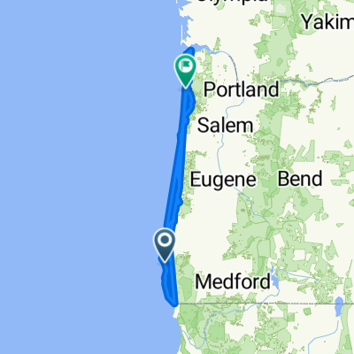 Oregon Coast Bike Route
- Distance
- 575,4 km
- Montée
- 977 m
- Descente
- 1 009 m
- Emplacement
- Port Orford, Oregon, États Unis
 Port Orford - Harbor
- Distance
- 92,5 km
- Montée
- 1 613 m
- Descente
- 1 619 m
- Emplacement
- Port Orford, Oregon, États Unis