Abbotsford à vélo
Découvre une carte de 311 itinéraires et pistes cyclables près de Abbotsford, créés par notre communauté.
Portrait de région
Fais connaissance avec Abbotsford
Trouve l’itinéraire à vélo qui te convient à Abbotsford, où nous avons 311 pistes cyclables à explorer. La plupart des gens enfourchent leur vélo pour rouler ici aux mois de juillet et août.
16 711 km
Distance enregistrée
311
Itinéraires cyclables
151 683
Population
Communauté
Utilisateurs les plus actifs à Abbotsford
De notre communauté
Les meilleurs itinéraires à vélo dans et autour de Abbotsford
North Abbotsford Loop
Itinéraire à vélo à Abbotsford, Colombie-Britannique, Canada
- 23,8 km
- Distance
- 168 m
- Montée
- 172 m
- Descente
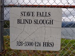
Mission Stave Falls
Itinéraire à vélo à Abbotsford, Colombie-Britannique, Canada
- 46,3 km
- Distance
- 575 m
- Montée
- 570 m
- Descente
Mission to Chilliwack
Itinéraire à vélo à Abbotsford, Colombie-Britannique, Canada
- 51,2 km
- Distance
- 237 m
- Montée
- 317 m
- Descente
Mission - Circle to Hayward Lake
Itinéraire à vélo à Abbotsford, Colombie-Britannique, Canada
- 36,3 km
- Distance
- 758 m
- Montée
- 755 m
- Descente
Découvrez plus d'itinéraires
 Mission - Circle to Durieu 2
- Distance
- 40,4 km
- Montée
- 664 m
- Descente
- 667 m
- Emplacement
- Abbotsford, Colombie-Britannique, Canada
 Mission - Circle to Durieu
- Distance
- 39 km
- Montée
- 594 m
- Descente
- 593 m
- Emplacement
- Abbotsford, Colombie-Britannique, Canada
 Picton Street 3582, Abbotsford to Picton Street 3582, Abbotsford
- Distance
- 60,2 km
- Montée
- 174 m
- Descente
- 150 m
- Emplacement
- Abbotsford, Colombie-Britannique, Canada
 Westerly Street 2304, Abbotsford to Westerly Street 2301, Abbotsford
- Distance
- 9,9 km
- Montée
- 76 m
- Descente
- 81 m
- Emplacement
- Abbotsford, Colombie-Britannique, Canada
 Ride to Work
- Distance
- 46,1 km
- Montée
- 204 m
- Descente
- 292 m
- Emplacement
- Abbotsford, Colombie-Britannique, Canada
 First 50k
- Distance
- 50,7 km
- Montée
- 350 m
- Descente
- 353 m
- Emplacement
- Abbotsford, Colombie-Britannique, Canada
 Relaxed route in Abbotsford
- Distance
- 24,5 km
- Montée
- 86 m
- Descente
- 85 m
- Emplacement
- Abbotsford, Colombie-Britannique, Canada
 gentle ride
- Distance
- 15 km
- Montée
- 99 m
- Descente
- 104 m
- Emplacement
- Abbotsford, Colombie-Britannique, Canada


