
Sault-Sainte-Marie à vélo
Découvre une carte de 54 itinéraires et pistes cyclables près de Sault-Sainte-Marie, créés par notre communauté.
Portrait de région
Fais connaissance avec Sault-Sainte-Marie
Trouve l’itinéraire à vélo qui te convient à Sault-Sainte-Marie, où nous avons 54 pistes cyclables à explorer. La plupart des gens enfourchent leur vélo pour rouler ici aux mois de mai et août.
16 611 km
Distance enregistrée
54
Itinéraires cyclables
74 948
Population
Communauté
Utilisateurs les plus actifs à Sault-Sainte-Marie


De notre communauté
Les meilleurs itinéraires à vélo dans et autour de Sault-Sainte-Marie

Huron - Day 4-Sault Ste Marie to Blind River
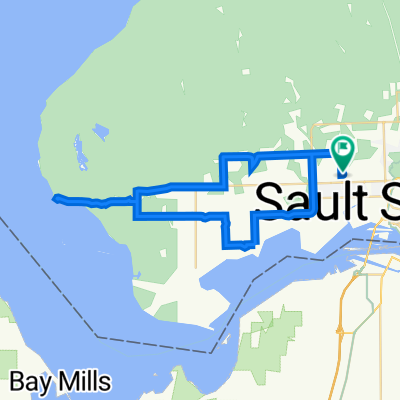
Itinéraire à vélo à Sault-Sainte-Marie, Ontario, Canada
This ride is mostly along highway 17. The ride off of 17 is in the country has one good hill but it is worth getting off the main hwy.
- 139,1 km
- Distance
- 242 m
- Montée
- 251 m
- Descente

spring eastend
Itinéraire à vélo à Sault-Sainte-Marie, Ontario, Canada
east end of sault ste. marie to begin spring outside riding
- 16,3 km
- Distance
- 23 m
- Montée
- 23 m
- Descente

6of12 SouthCentralON - 01 Sault Ste. Marie, ON to Thessalon, ON (Thessalon Lakeside Park Campground) 84km
Itinéraire à vélo à Sault-Sainte-Marie, Ontario, Canada
6of12 SouthCentralON - 01 Sault Ste. Marie, ON to Thessalon, ON (Thessalon Lakeside Park Campground) 84km
For this section, there is the option of taking the Great Lakes Waterfront Trail, however, it takes you along backroads, when the highway shoulder should be wide enough for cyclists.
The town of Bruce Mines does have multiple accommodation points.
Further down the road at 114km, there is the Yellow Butterfly Trading Post campground just before (west of) Iron Bridge, ON where there is multiple accommodation points.
Thessalon, ON was chosen as the destination for this segment as it's less than 100km, suitable for the fully loaded cyclist(s).
---
Copyright Creative Commons - Attribution (please do share this work, just source back to where it came from)
- 84 km
- Distance
- 159 m
- Montée
- 226 m
- Descente

Michigan-Ontario Trip 2016
Itinéraire à vélo à Sault-Sainte-Marie, Ontario, Canada
Sault Sainte Marie, ON to Marine City, MI
Sombra ON, to Saint-Anne-de-Bellevue QC Hitchhiked 45 mi (72 km) from Cobourg, ON to Belleville, ON for bicycle repair.
- 1 851,1 km
- Distance
- 657 m
- Montée
- 825 m
- Descente
Découvrez plus d'itinéraires
 June 29 Ride
- Distance
- 17,3 km
- Montée
- 49 m
- Descente
- 49 m
- Emplacement
- Sault-Sainte-Marie, Ontario, Canada
 Thursday
- Distance
- 44,5 km
- Montée
- 210 m
- Descente
- 210 m
- Emplacement
- Sault-Sainte-Marie, Ontario, Canada
 50 Eastern Ave, Sault Ste. Marie to 54 Eastern Ave, Sault Ste. Marie
- Distance
- 25,1 km
- Montée
- 96 m
- Descente
- 100 m
- Emplacement
- Sault-Sainte-Marie, Ontario, Canada
 QB 2023
- Distance
- 1 823,2 km
- Montée
- 2 937 m
- Descente
- 2 920 m
- Emplacement
- Sault-Sainte-Marie, Ontario, Canada
 Here and there around the city
- Distance
- 30,3 km
- Montée
- 124 m
- Descente
- 124 m
- Emplacement
- Sault-Sainte-Marie, Ontario, Canada
 50 Eastern Ave, Sault Ste. Marie to 699 Trunk Rd, Sault Ste. Marie
- Distance
- 24,2 km
- Montée
- 78 m
- Descente
- 79 m
- Emplacement
- Sault-Sainte-Marie, Ontario, Canada
 40km Airport Way
- Distance
- 41,9 km
- Montée
- 136 m
- Descente
- 139 m
- Emplacement
- Sault-Sainte-Marie, Ontario, Canada
 495 Industrial Park Cres, Sault Ste. Marie to 699 Trunk Rd, Sault Ste. Marie
- Distance
- 8,9 km
- Montée
- 29 m
- Descente
- 64 m
- Emplacement
- Sault-Sainte-Marie, Ontario, Canada