
Isle of Benbecula à vélo
Découvre une carte de 13 itinéraires et pistes cyclables près de Isle of Benbecula, créés par notre communauté.
Portrait de région
Fais connaissance avec Isle of Benbecula
Trouve l’itinéraire à vélo qui te convient à Isle of Benbecula, où nous avons 13 pistes cyclables à explorer.
899 km
Distance enregistrée
13
Itinéraires cyclables
1 219
Population
Communauté
Utilisateurs les plus actifs à Isle of Benbecula


De notre communauté
Les meilleurs itinéraires à vélo dans et autour de Isle of Benbecula

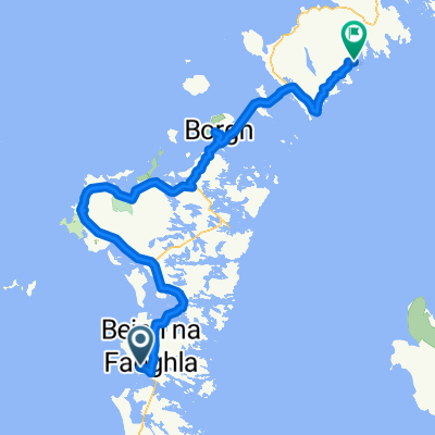
Day 2 Carinish North Uist to Tarbert
Itinéraire à vélo à Isle of Benbecula, Scotland, United Kingdom
47k Carinish to Berneray, 12k ferry to Leverburgh, 33.4k to Tarbert
- 92,5 km
- Distance
- 286 m
- Montée
- 284 m
- Descente
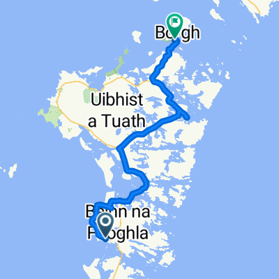
Iochdar graveyard
Itinéraire à vélo à Isle of Benbecula, Scotland, United Kingdom
- 12,2 km
- Distance
- 38 m
- Montée
- 112 m
- Descente

Tue 31st May. Carinish, N Uist - Loch Erisort, Lewis 113 km
Itinéraire à vélo à Isle of Benbecula, Scotland, United Kingdom
Carinish, W coast of N Uist, Berneray, Ferry to S Harris ( 13 km 10.30 & 1.30 from Berneray), W Coast of S Harris, Tarbert, Loch Seaforth, Loch Erisort. Overnight, Loch Erisort Inn.
- 126,9 km
- Distance
- 434 m
- Montée
- 411 m
- Descente
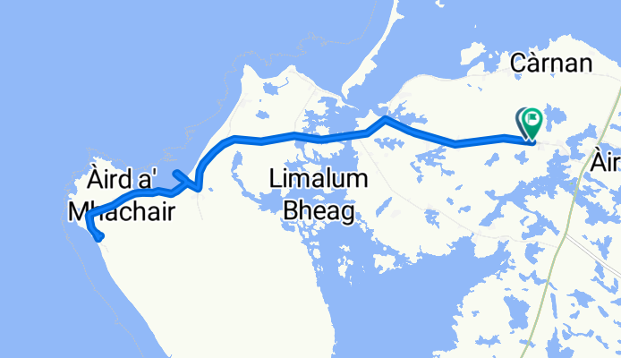
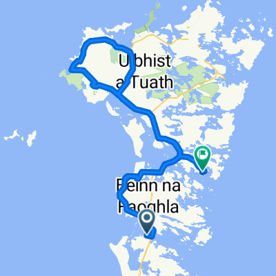
3 Benbecula to North Uist
Itinéraire à vélo à Isle of Benbecula, Scotland, United Kingdom
- 37,9 km
- Distance
- 74 m
- Montée
- 76 m
- Descente
Découvrez plus d'itinéraires
 Isle of Benbecula Cycling
- Distance
- 56,5 km
- Montée
- 164 m
- Descente
- 173 m
- Emplacement
- Isle of Benbecula, Scotland, United Kingdom
 scot 4
- Distance
- 97,1 km
- Montée
- 251 m
- Descente
- 226 m
- Emplacement
- Isle of Benbecula, Scotland, United Kingdom
 4. Hebrides 2
- Distance
- 99,8 km
- Montée
- 270 m
- Descente
- 266 m
- Emplacement
- Isle of Benbecula, Scotland, United Kingdom
 Hebriden Islands step 3 + Isle of Sye step 1: Cladach - Lochmaddy + Ferry + Uig - Portree
- Distance
- 124,4 km
- Montée
- 624 m
- Descente
- 610 m
- Emplacement
- Isle of Benbecula, Scotland, United Kingdom
 N uist Cairinis (moorcroft camping) to Balranald campsite
- Distance
- 20,6 km
- Montée
- 70 m
- Descente
- 69 m
- Emplacement
- Isle of Benbecula, Scotland, United Kingdom
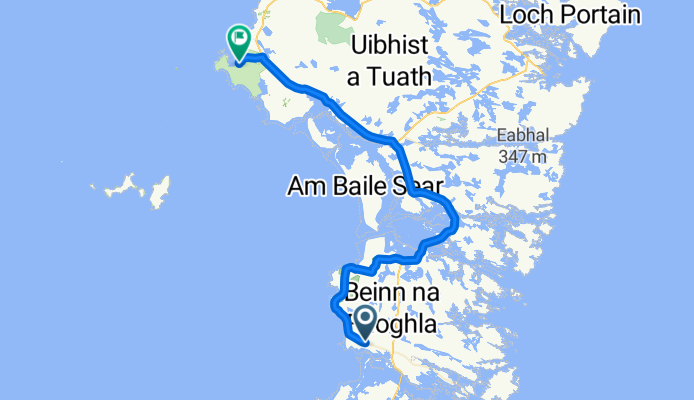
 From Benbecula to North Uist
- Distance
- 81,2 km
- Montée
- 248 m
- Descente
- 245 m
- Emplacement
- Isle of Benbecula, Scotland, United Kingdom
 Geirinis to Post Office
- Distance
- 60,7 km
- Montée
- 383 m
- Descente
- 379 m
- Emplacement
- Isle of Benbecula, Scotland, United Kingdom
 Day 2: Benbecula & N Uist
- Distance
- 70,3 km
- Montée
- 99 m
- Descente
- 86 m
- Emplacement
- Isle of Benbecula, Scotland, United Kingdom