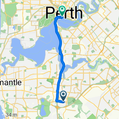
City of Cockburn à vélo
Découvre une carte de 58 itinéraires et pistes cyclables près de City of Cockburn, créés par notre communauté.
Portrait de région
Fais connaissance avec City of Cockburn
Trouve l’itinéraire à vélo qui te convient à City of Cockburn, où nous avons 58 pistes cyclables à explorer.
6 335 km
Distance enregistrée
58
Itinéraires cyclables
Communauté
Utilisateurs les plus actifs à City of Cockburn
De notre communauté
Les meilleurs itinéraires à vélo dans et autour de City of Cockburn
Scarborough run
Itinéraire à vélo à City of Cockburn, Australie-Occidentale, Australie
- 71,3 km
- Distance
- 272 m
- Montée
- 276 m
- Descente
Lengthy ride through Leeming
Itinéraire à vélo à City of Cockburn, Australie-Occidentale, Australie
- 64,1 km
- Distance
- 174 m
- Montée
- 171 m
- Descente
perth - broken hill ,rail track and road 1988
Itinéraire à vélo à City of Cockburn, Australie-Occidentale, Australie
landed back in perth on way back from thailand, 6 week tour with a friend from sydney, start perth airport, finish broken hill bus station , many sand stretchs , the longest being about 20 km, rode following the service road beside the rail track
sept- oct 88
- 2 747 km
- Distance
- 1 493 m
- Montée
- 1 215 m
- Descente
perth - halls creek 1982, via cannning and wolfe creater
Itinéraire à vélo à City of Cockburn, Australie-Occidentale, Australie
had planned this trip a couple of years after reading a book on the stock route ,while in nepal decided I had time after the pakistan / nepal tour , so flew to perth, part of this route was sand in places, very few people, mostly bore water, took 6 weeks , met a japanese cyclist travelling north south camped the night and he planted the idea of my later cycling the rail line west - east, but planted the idea for my later trip , caught bus's back from halls creek
- 2 350,7 km
- Distance
- 1 635 m
- Montée
- 1 259 m
- Descente
Découvrez plus d'itinéraires
- Moondarra Circle 7, South Lake to Pozieres Road 1, Swanbourne
- Distance
- 25,8 km
- Montée
- 147 m
- Descente
- 100 m
- Emplacement
- City of Cockburn, Australie-Occidentale, Australie
- Airfield
- Distance
- 40,9 km
- Montée
- 73 m
- Descente
- 85 m
- Emplacement
- City of Cockburn, Australie-Occidentale, Australie
- Tonkin Guilford Kwinana Roe
- Distance
- 58,5 km
- Montée
- 315 m
- Descente
- 318 m
- Emplacement
- City of Cockburn, Australie-Occidentale, Australie
- Relaxed route in Leeming
- Distance
- 0,4 km
- Montée
- 0 m
- Descente
- 0 m
- Emplacement
- City of Cockburn, Australie-Occidentale, Australie
- Pilatus Street, Jandakot to Lyon Road 79, Atwell
- Distance
- 32,9 km
- Montée
- 23 m
- Descente
- 21 m
- Emplacement
- City of Cockburn, Australie-Occidentale, Australie
- Berrigan Drive 233, Jandakot to Veneta Circuit 36, Atwell
- Distance
- 30,1 km
- Montée
- 45 m
- Descente
- 43 m
- Emplacement
- City of Cockburn, Australie-Occidentale, Australie
- Lap via success, Freo and apple cross
- Distance
- 55,8 km
- Montée
- 180 m
- Descente
- 179 m
- Emplacement
- City of Cockburn, Australie-Occidentale, Australie
- Farrington Road, Murdoch to Kinship Street 16, Willetton
- Distance
- 8,9 km
- Montée
- 76 m
- Descente
- 75 m
- Emplacement
- City of Cockburn, Australie-Occidentale, Australie