
Hall bei Admont à vélo
Découvre une carte de 41 itinéraires et pistes cyclables près de Hall bei Admont, créés par notre communauté.
Portrait de région
Fais connaissance avec Hall bei Admont
Trouve l’itinéraire à vélo qui te convient à Hall bei Admont, où nous avons 41 pistes cyclables à explorer.
2 905 km
Distance enregistrée
41
Itinéraires cyclables
1 744
Population
Communauté
Utilisateurs les plus actifs à Hall bei Admont


De notre communauté
Les meilleurs itinéraires à vélo dans et autour de Hall bei Admont

Rakousko 2012-6.den-19.7.Čt
Itinéraire à vélo à Hall bei Admont, Styrie, Autriche
Admont - Treffner - Frauenberg - Ardning - Pürgschachen - Liezen - spaní před Wörschach
- 35,5 km
- Distance
- 204 m
- Montée
- 195 m
- Descente

Enns - Duna - 2009 - 3.deň
Itinéraire à vélo à Hall bei Admont, Styrie, Autriche
<span style="font-size: xx-small;"><font face="Arial, sans-serif">Etapa
: </font></span><span><span style="text-decoration: none;"><span style="font-size: xx-small;"><font face="Arial, sans-serif"><font color="#000000">Hall
Großraming</font></font></span></span></span>
<span style="font-family: Arial,sans-serif;"><font style="font-size: 8pt;" size="1">celá
trasa po značenej cykloturistickej ceste</font></span>
<span style="font-size: xx-small;"><font face="Arial, sans-serif">ubytovanie
: </font></span><span><span style="text-decoration: none;"><span style="font-style: normal;"><span style="font-size: xx-small;"><font face="Arial, sans-serif"><font color="#000000">Campingplatz
Aschatal Großraming</font></font></span></span></span></span>
E-mail :<gemeinde@grossraming.ooe.gv.at>
<span style="font-family: Arial,sans-serif;"><font style="font-size: 8pt;" size="1">magyar
nyelven info : pipper@inmail.sk</font></span>
- 74,9 km
- Distance
- 839 m
- Montée
- 1 097 m
- Descente

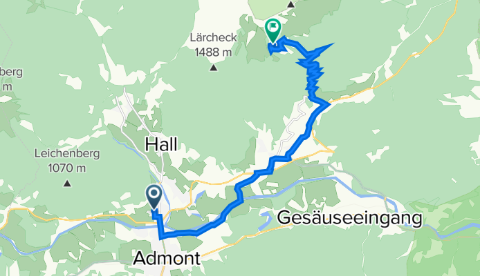
Hall Johnsbach
Itinéraire à vélo à Hall bei Admont, Styrie, Autriche
- 16,9 km
- Distance
- 439 m
- Montée
- 315 m
- Descente
Hall 496, Admont nach Weng 37, Admont
Itinéraire à vélo à Hall bei Admont, Styrie, Autriche
- 12,3 km
- Distance
- 783 m
- Montée
- 23 m
- Descente
Découvrez plus d'itinéraires
 Admont 2
- Distance
- 43,2 km
- Montée
- 570 m
- Descente
- 566 m
- Emplacement
- Hall bei Admont, Styrie, Autriche
 den2b
den2b- Distance
- 32,1 km
- Montée
- 1 142 m
- Descente
- 1 462 m
- Emplacement
- Hall bei Admont, Styrie, Autriche
 2020_Hochscheibenalm
- Distance
- 62,5 km
- Montée
- 1 267 m
- Descente
- 1 264 m
- Emplacement
- Hall bei Admont, Styrie, Autriche
 2008_Admonter Bergrunde
- Distance
- 45,5 km
- Montée
- 620 m
- Descente
- 614 m
- Emplacement
- Hall bei Admont, Styrie, Autriche
 2008_Admonter Bergrunde
- Distance
- 45,6 km
- Montée
- 610 m
- Descente
- 604 m
- Emplacement
- Hall bei Admont, Styrie, Autriche
 etapa 6 do Radstatu
- Distance
- 102,6 km
- Montée
- 447 m
- Descente
- 198 m
- Emplacement
- Hall bei Admont, Styrie, Autriche
 20150915_090705
- Distance
- 68,6 km
- Montée
- 555 m
- Descente
- 787 m
- Emplacement
- Hall bei Admont, Styrie, Autriche
 Weng im Gesäuse-St Galen-Großraming
- Distance
- 71,4 km
- Montée
- 876 m
- Descente
- 1 176 m
- Emplacement
- Hall bei Admont, Styrie, Autriche