
Glenelg East à vélo
Découvre une carte de 79 itinéraires et pistes cyclables près de Glenelg East, créés par notre communauté.
Portrait de région
Fais connaissance avec Glenelg East
Trouve l’itinéraire à vélo qui te convient à Glenelg East, où nous avons 79 pistes cyclables à explorer. La plupart des gens enfourchent leur vélo pour rouler ici aux mois de février et juin.
3 017 km
Distance enregistrée
79
Itinéraires cyclables
3 701
Population
Communauté
Utilisateurs les plus actifs à Glenelg East


De notre communauté
Les meilleurs itinéraires à vélo dans et autour de Glenelg East

Camden Park - Marino Rocks - City Loop
Itinéraire à vélo à Glenelg East, Australie-Méridionale, Australie
- 48,3 km
- Distance
- 241 m
- Montée
- 239 m
- Descente

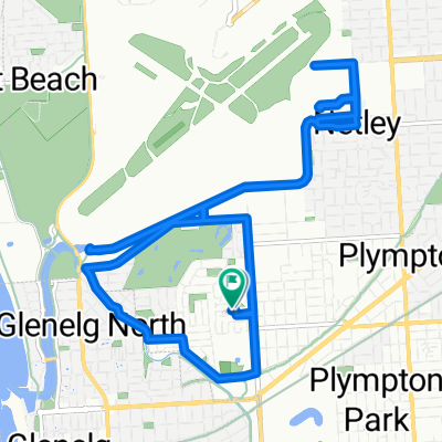
Easty ride west to Adelaide cityRoute to work
Itinéraire à vélo à Glenelg East, Australie-Méridionale, Australie
- 9 km
- Distance
- 50 m
- Montée
- 8 m
- Descente

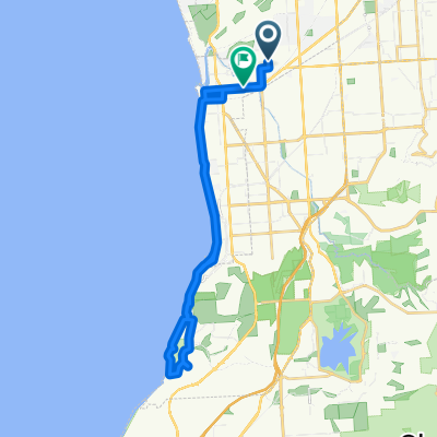
Glenelg East to the Blanche Harbour Shacks
Itinéraire à vélo à Glenelg East, Australie-Méridionale, Australie
- 337,4 km
- Distance
- 392 m
- Montée
- 397 m
- Descente

Margie’s Way
Itinéraire à vélo à Glenelg East, Australie-Méridionale, Australie
- 9,9 km
- Distance
- 36 m
- Montée
- 0 m
- Descente
Découvrez plus d'itinéraires
 42.5km along River Torrens/Mike Turtur
- Distance
- 42,5 km
- Montée
- 196 m
- Descente
- 194 m
- Emplacement
- Glenelg East, Australie-Méridionale, Australie
 Training - Home - Norton Summit - Lofty
- Distance
- 59,2 km
- Montée
- 695 m
- Descente
- 693 m
- Emplacement
- Glenelg East, Australie-Méridionale, Australie
 Camden Park to Dernancourt along the River Torrens
- Distance
- 54,1 km
- Montée
- 204 m
- Descente
- 204 m
- Emplacement
- Glenelg East, Australie-Méridionale, Australie
 Camden Park to Willunga Hill
- Distance
- 98 km
- Montée
- 1 186 m
- Descente
- 1 185 m
- Emplacement
- Glenelg East, Australie-Méridionale, Australie
 Scott Court to Scott Court
- Distance
- 17,5 km
- Montée
- 37 m
- Descente
- 39 m
- Emplacement
- Glenelg East, Australie-Méridionale, Australie
 451 ANZAC Highway, Camden Park to 46 Clifton Street, Camden Park
- Distance
- 28,2 km
- Montée
- 6 m
- Descente
- 14 m
- Emplacement
- Glenelg East, Australie-Méridionale, Australie
 Pine ave to south tce - Mike Turtur Bikeway
- Distance
- 18,6 km
- Montée
- 61 m
- Descente
- 61 m
- Emplacement
- Glenelg East, Australie-Méridionale, Australie
 Slow ride in Camden Park
- Distance
- 32,5 km
- Montée
- 13 m
- Descente
- 22 m
- Emplacement
- Glenelg East, Australie-Méridionale, Australie