
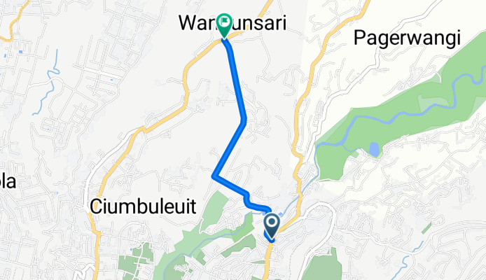
Modèle d’itinéraire
De Bandung à Lembang

- 1 h 51 min
- Durée
- 19,2 km
- Distance
- 652 m
- Montée
- 130 m
- Descente
- 10,4 km/h
- Vit. moyenne
- 1 279 m
- Altitude max.
This ride takes you from the bustling heart of Bandung up to the cool, scenic hills of Lembang—perfect for anyone craving fresh air and a good leg workout! Starting out in Bandung, famous for its vibrant artsy vibes and colonial history, you'll pedal north out of the city, quickly swapping city traffic for quieter roads and lush views.
The climb is real (over 650 meters up!), so pace yourself as you pass through charming neighborhoods and stretches where urban life shifts into leafy countryside. The road is mostly paved, though you might hit a few sections where the surface is a mystery—adds a bit of adventure, right?
Once you reach Lembang, treat yourself to a coffee or some strawberries; this area is known for its tea plantations, fresh produce, and cool mountain air. With the city behind you and volcanoes on the horizon, you’ll feel a world away after just under 20 km of solid riding.
Communauté
Meilleurs utilisateurs dans cette région


De notre communauté
Les meilleurs itinéraires à vélo de Bandung à Lembang

Puncak Bintang via Jatihandap
Itinéraire à vélo à Bandung, Java occidental, Indonésie
- 8,9 km
- Distance
- 702 m
- Montée
- 41 m
- Descente

Puncak Bintang via Caringin Tilu
Itinéraire à vélo à Bandung, Java occidental, Indonésie
- 2,5 km
- Distance
- 270 m
- Montée
- 54 m
- Descente


Tebing Keraton
Itinéraire à vélo à Bandung, Java occidental, Indonésie
- 5,9 km
- Distance
- 725 m
- Montée
- 335 m
- Descente

Route to Gunung Bukittunggul
Itinéraire à vélo à Bandung, Java occidental, Indonésie
- 28,1 km
- Distance
- 1 866 m
- Montée
- 422 m
- Descente

Bandung to Gn Meong (Subang)
Itinéraire à vélo à Bandung, Java occidental, Indonésie
- 29,2 km
- Distance
- 922 m
- Montée
- 314 m
- Descente

DAGO (BALUBUR) - WARUNG BANDREK (WARBAN)
Itinéraire à vélo à Bandung, Java occidental, Indonésie
- 8,4 km
- Distance
- 586 m
- Montée
- 167 m
- Descente

Puncak Bintang
Itinéraire à vélo à Bandung, Java occidental, Indonésie
- 8,6 km
- Distance
- 755 m
- Montée
- 39 m
- Descente
dago pojok - puclut
Itinéraire à vélo à Bandung, Java occidental, Indonésie
- 2,4 km
- Distance
- 225 m
- Montée
- 52 m
- Descente

Cartil - Tebing Karaton
Itinéraire à vélo à Bandung, Java occidental, Indonésie
- 7,1 km
- Distance
- 431 m
- Montée
- 297 m
- Descente

Warban Climb
Itinéraire à vélo à Bandung, Java occidental, Indonésie
- 12,6 km
- Distance
- 479 m
- Montée
- 64 m
- Descente

Tanjakan Langit Cibodas
Itinéraire à vélo à Bandung, Java occidental, Indonésie
- 18,7 km
- Distance
- 804 m
- Montée
- 366 m
- Descente

Puncak Eurad
Itinéraire à vélo à Bandung, Java occidental, Indonésie
- 15,1 km
- Distance
- 815 m
- Montée
- 219 m
- Descente
Découvrez plus d'itinéraires
 Bandung to Gn Meong (Subang)
- Distance
- 29,2 km
- Montée
- 922 m
- Descente
- 314 m
- Emplacement
- Bandung, Java occidental, Indonésie
 DAGO (BALUBUR) - WARUNG BANDREK (WARBAN)
- Distance
- 8,4 km
- Montée
- 586 m
- Descente
- 167 m
- Emplacement
- Bandung, Java occidental, Indonésie
 Puncak Bintang
- Distance
- 8,6 km
- Montée
- 755 m
- Descente
- 39 m
- Emplacement
- Bandung, Java occidental, Indonésie
 dago pojok - puclut
- Distance
- 2,4 km
- Montée
- 225 m
- Descente
- 52 m
- Emplacement
- Bandung, Java occidental, Indonésie
 Cartil - Tebing Karaton
- Distance
- 7,1 km
- Montée
- 431 m
- Descente
- 297 m
- Emplacement
- Bandung, Java occidental, Indonésie
 Warban Climb
- Distance
- 12,6 km
- Montée
- 479 m
- Descente
- 64 m
- Emplacement
- Bandung, Java occidental, Indonésie
 Tanjakan Langit Cibodas
- Distance
- 18,7 km
- Montée
- 804 m
- Descente
- 366 m
- Emplacement
- Bandung, Java occidental, Indonésie
 Puncak Eurad
- Distance
- 15,1 km
- Montée
- 815 m
- Descente
- 219 m
- Emplacement
- Bandung, Java occidental, Indonésie