
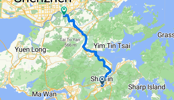
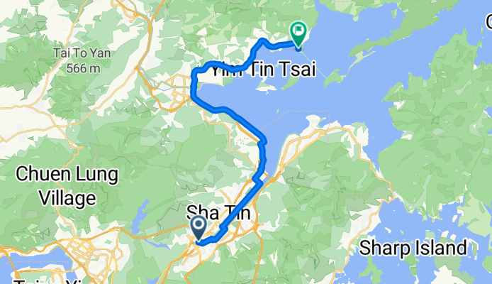
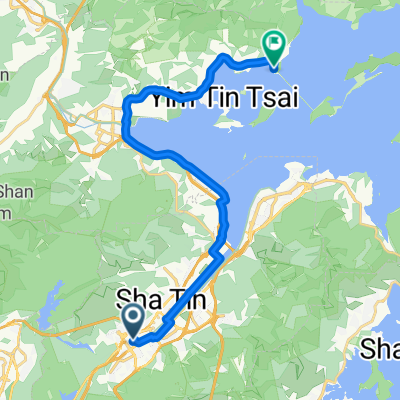
Modèle d’itinéraire
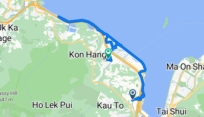
De Sha Tin à Tai Po

- 1 h
- Durée
- 16,6 km
- Distance
- 138 m
- Montée
- 228 m
- Descente
- 16,6 km/h
- Vit. moyenne
- 114 m
- Altitude max.
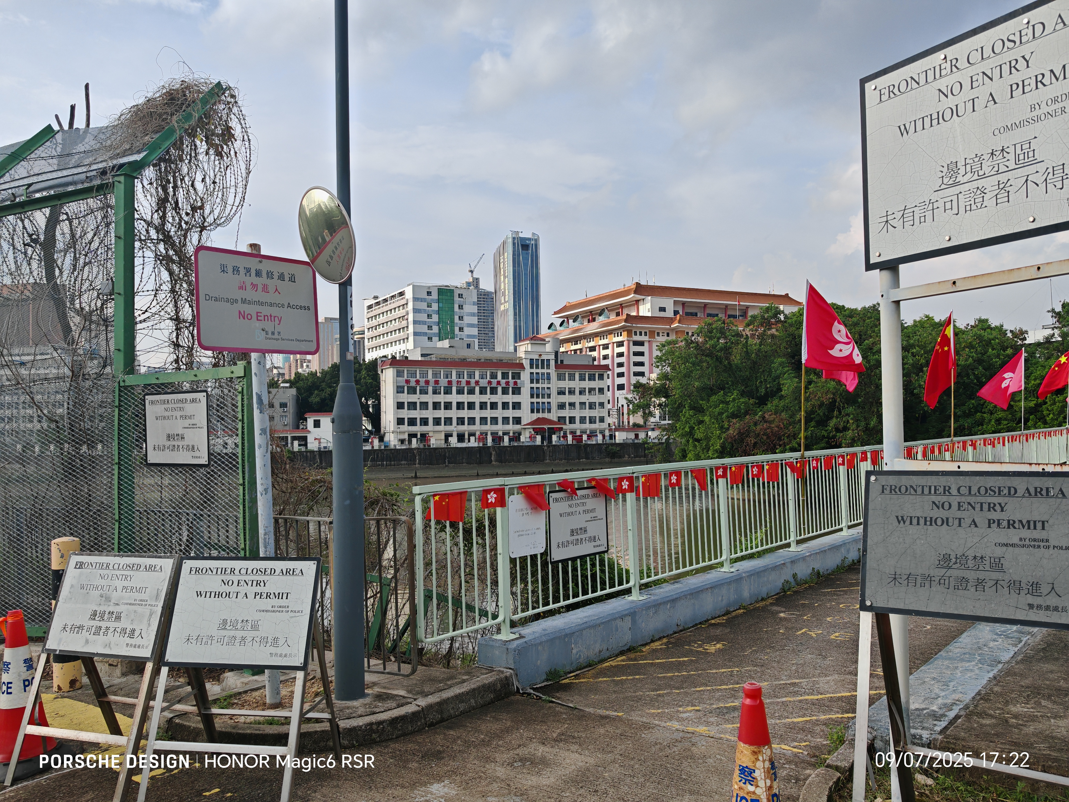
This route takes you on a relaxed ride from Shatin to Tai Po, weaving through some of the best cycling paths in the New Territories. Starting in the bustling heart of Shatin—famous for its riverside promenade, shopping centers, and the iconic 10,000 Buddhas Monastery—you’ll glide mostly along dedicated cycleways, making this a pretty chill spin for riders of all levels.
The ride covers a bit over 16.5 km, with gentle ups and downs and a maximum elevation just above 114 meters. You’ll travel beside the scenic Shing Mun River and then cruise north towards Tai Po. Most of the route is well-paved and smooth, though keep an eye out for some missing segments that might be a bit rougher under tire.
Once you roll into Tai Po, you'll find a charming blend of local markets, heritage spots, and waterfront parks—perfect for a coffee stop or a stroll. With over three-quarters of the route on cycleways and mostly away from busy traffic, this is one of Hong Kong’s classic, stress-free bike routes. Enjoy the ride!
Communauté
Meilleurs utilisateurs dans cette région


De notre communauté
Les meilleurs itinéraires à vélo de Sha Tin à Tai Po


澤祥街, 馬料水 to 優景里, 馬料水
Itinéraire à vélo à Sha Tin, Sha Tin, Hong Kong
- 12,6 km
- Distance
- 241 m
- Montée
- 237 m
- Descente
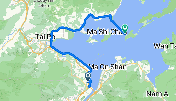
大學-科學園-大尾篤
Itinéraire à vélo à Sha Tin, Sha Tin, Hong Kong
- 19,2 km
- Distance
- 165 m
- Montée
- 182 m
- Descente

Yat Cheung St, Ma Liu Shui, Sha Tin to Plover Cove Rd, Tai Po
Itinéraire à vélo à Sha Tin, Sha Tin, Hong Kong
- 7,8 km
- Distance
- 90 m
- Montée
- 70 m
- Descente

Tai Wan- Fanling
Itinéraire à vélo à Sha Tin, Sha Tin, Hong Kong
- 40,4 km
- Distance
- 216 m
- Montée
- 203 m
- Descente


橫壆街, 沙田 to 安邦路8號, 太和
Itinéraire à vélo à Sha Tin, Sha Tin, Hong Kong
- 12,7 km
- Distance
- 42 m
- Montée
- 55 m
- Descente

From Tai Wai to Ting Kok
Itinéraire à vélo à Sha Tin, Sha Tin, Hong Kong
- 22,4 km
- Distance
- 181 m
- Montée
- 190 m
- Descente


bike tour from Fo Tan to Tai Mei Tuk
Itinéraire à vélo à Sha Tin, Sha Tin, Hong Kong
- 19,6 km
- Distance
- 64 m
- Montée
- 69 m
- Descente

大圍-> 西沙->吐露->新娘潭->沙頭角->大埔
Itinéraire à vélo à Sha Tin, Sha Tin, Hong Kong
- 67,4 km
- Distance
- 288 m
- Montée
- 276 m
- Descente
Découvrez plus d'itinéraires
 Tai Wan- Fanling
- Distance
- 40,4 km
- Montée
- 216 m
- Descente
- 203 m
- Emplacement
- Sha Tin, Sha Tin, Hong Kong
 大圍 去 大尾篤
- Distance
- 21,9 km
- Montée
- 74 m
- Descente
- 54 m
- Emplacement
- Sha Tin, Sha Tin, Hong Kong
 橫壆街, 沙田 to 安邦路8號, 太和
- Distance
- 12,7 km
- Montée
- 42 m
- Descente
- 55 m
- Emplacement
- Sha Tin, Sha Tin, Hong Kong
 大埔 鹿頸 大圍
- Distance
- 54,8 km
- Montée
- 356 m
- Descente
- 355 m
- Emplacement
- Sha Tin, Sha Tin, Hong Kong
 From Tai Wai to Ting Kok
- Distance
- 22,4 km
- Montée
- 181 m
- Descente
- 190 m
- Emplacement
- Sha Tin, Sha Tin, Hong Kong
 大圍->大尾篤
- Distance
- 19,9 km
- Montée
- 143 m
- Descente
- 148 m
- Emplacement
- Sha Tin, Sha Tin, Hong Kong
 bike tour from Fo Tan to Tai Mei Tuk
- Distance
- 19,6 km
- Montée
- 64 m
- Descente
- 69 m
- Emplacement
- Sha Tin, Sha Tin, Hong Kong
 大圍-> 西沙->吐露->新娘潭->沙頭角->大埔
- Distance
- 67,4 km
- Montée
- 288 m
- Descente
- 276 m
- Emplacement
- Sha Tin, Sha Tin, Hong Kong
Itinéraires depuis Sha Tin
Excursion à vélo d’une journée de
Sha Tin à Tuen Mun
Excursion à vélo d’une journée de
Sha Tin à Sai Kung
Itinéraires vers Tai Po
Excursion à vélo d’une journée de
Tuen Mun à Tai Po
Excursion à vélo d’une journée de
Tsuen Wan à Tai Po