
Excursion à vélo d’une journée de Gwangmyeong à Goyang-si
Personnalise ton propre itinéraire à partir de notre modèle ou découvre comment notre communauté préfère rouler de Gwangmyeong à Goyang-si.
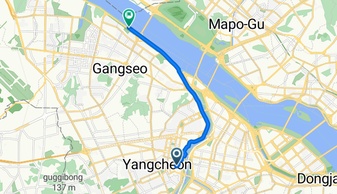
Modèle d’itinéraire
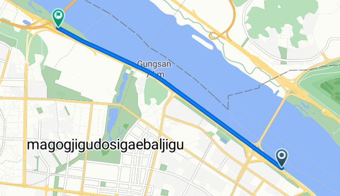
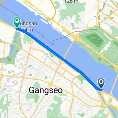
De Gwangmyeong à Goyang-si
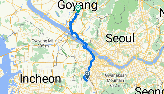
- 1 h 55 min
- Durée
- 32,6 km
- Distance
- 211 m
- Montée
- 220 m
- Descente
- 17,1 km/h
- Vit. moyenne
- 62 m
- Altitude max.
Hop on your bike for a satisfying 32 km ride from Gwangmyeong to Goyang-si—a journey that lets you escape the bustle but keeps you connected with urban scenery and stretches of nature. Kicking off in Gwangmyeong, known for the jaw-dropping Gwangmyeong Cave (one of Korea’s coolest repurposed mines), you'll weave primarily along cycleways and quiet roads. This means minimal traffic, so you can settle into the rhythm and actually enjoy the ride.
The route is mostly flat with a couple of gentle ups and downs that total out to about 210 meters of ascent—just enough to get your legs working without being a slog. Surfaces are largely paved or asphalt, though you’ll hit some sections with less definite surfacing, so sturdy tires are handy.
Roll into Goyang-si, a vibrant satellite city boasting green parks and Lake Park, one of the largest man-made lakes in Asia—perfect for a post-ride stroll. Plan for around 3–4 leisurely hours, depending on your pace and stops. This route gives you a mix of suburban discovery, fresh air, and a real slice of everyday life between two of the Seoul area’s most dynamic cities.
Communauté
Meilleurs utilisateurs dans cette région


De notre communauté
Les meilleurs itinéraires à vélo de Gwangmyeong à Goyang-si

ara waterway
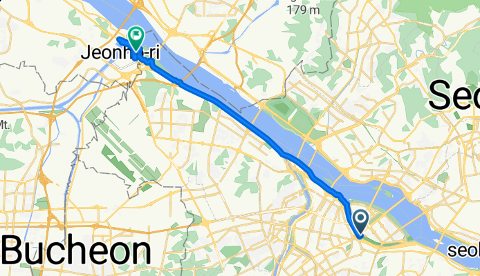
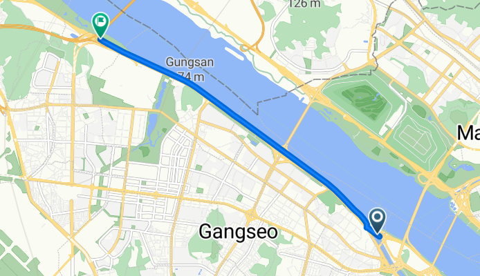
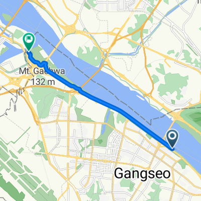
Itinéraire à vélo à Gwangmyeong, Gyeonggi-do, Corée du Sud
- 14,7 km
- Distance
- 92 m
- Montée
- 99 m
- Descente
![Ph0]에서 경로당산동6가 227-1](https://media.bikemap.net/routes/17411597/gallery/thumbs/e9cec406-26bc-4f8f-ad1a-d863c35205cf.jpg.0x384_q80.jpg)
![Ph0]에서 경로당산동6가 227-1](https://media.bikemap.net/routes/17411597/gallery/thumbs/65cd521d-a3b1-41c3-9724-b11d71477d91.jpg.0x384_q80.jpg)
![Ph0]에서 경로당산동6가 227-1](https://media.bikemap.net/routes/17411597/gallery/thumbs/15641723-3024-4086-844f-a18b17aefaed.jpg.0x384_q80.jpg)
![Ph0]에서 경로당산동6가 227-1](https://media.bikemap.net/routes/17411597/staticmaps/in_b7d06a5e-e5f4-453d-964e-ecc399657274_694x400_bikemap-2021-3D-static.png)
Ph0]에서 경로당산동6가 227-1
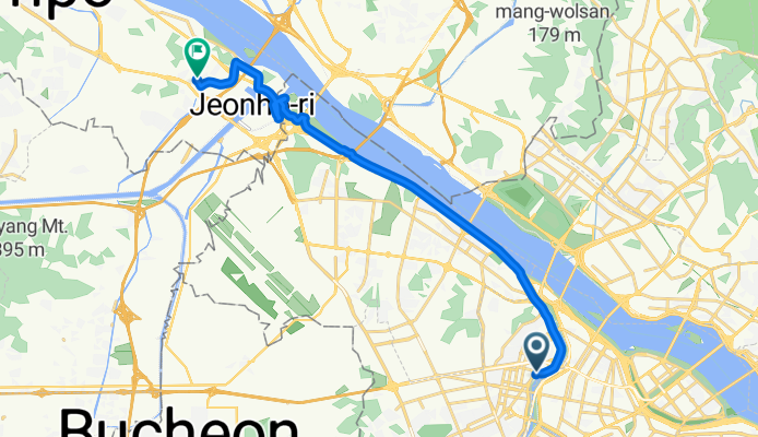
Itinéraire à vélo à Gwangmyeong, Gyeonggi-do, Corée du Sud
- 10 km
- Distance
- 10 m
- Montée
- 38 m
- Descente
kakaomap
Itinéraire à vélo à Gwangmyeong, Gyeonggi-do, Corée du Sud
- 17,3 km
- Distance
- 28 m
- Montée
- 28 m
- Descente
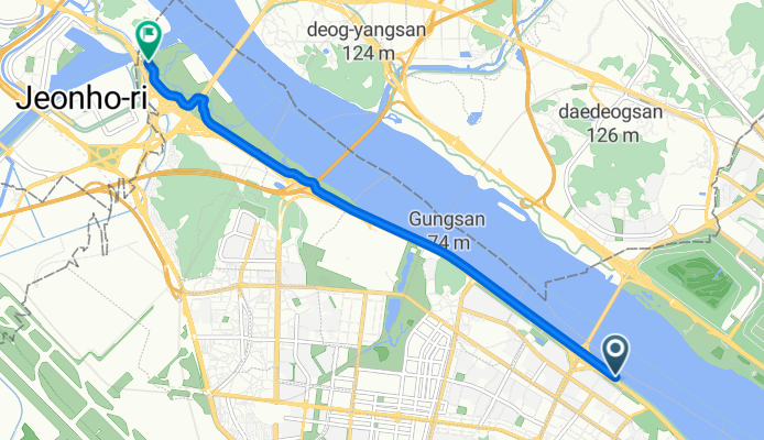
올림픽대로, 서울특별시에서 개화동, 서울특별시까지
Itinéraire à vélo à Gwangmyeong, Gyeonggi-do, Corée du Sud
- 7,6 km
- Distance
- 16 m
- Montée
- 13 m
- Descente
신목로12길, 서울특별시에서 가양동, 서울특별시까지
Itinéraire à vélo à Gwangmyeong, Gyeonggi-do, Corée du Sud
- 7,6 km
- Distance
- 40 m
- Montée
- 36 m
- Descente
![향동동 518-1Ph0]으로 라우팅](https://media.bikemap.net/routes/17489013/staticmaps/in_d8572abc-be2e-416e-ada8-7b2480ceaaed_694x400_bikemap-2021-3D-static.png)
향동동 518-1Ph0]으로 라우팅
Itinéraire à vélo à Gwangmyeong, Gyeonggi-do, Corée du Sud
- 16 km
- Distance
- 311 m
- Montée
- 326 m
- Descente
짜릿한 승차감
Itinéraire à vélo à Gwangmyeong, Gyeonggi-do, Corée du Sud
- 6,6 km
- Distance
- 43 m
- Montée
- 45 m
- Descente
크래킹 라이딩
Itinéraire à vélo à Gwangmyeong, Gyeonggi-do, Corée du Sud
- 4,8 km
- Distance
- 7 m
- Montée
- 37 m
- Descente
크래킹 라이딩
Itinéraire à vélo à Gwangmyeong, Gyeonggi-do, Corée du Sud
- 4,7 km
- Distance
- 4 m
- Montée
- 26 m
- Descente
![Ph0]에서 경로목동 534-41](https://media.bikemap.net/routes/17115712/staticmaps/in_4c1e480e-0502-4882-b010-fcc750364b1b_694x400_bikemap-2021-3D-static.png)
Ph0]에서 경로목동 534-41
Itinéraire à vélo à Gwangmyeong, Gyeonggi-do, Corée du Sud
- 258,3 km
- Distance
- 3 946 m
- Montée
- 3 979 m
- Descente
Découvrez plus d'itinéraires
 올림픽대로, 서울특별시에서 개화동, 서울특별시까지
- Distance
- 7,6 km
- Montée
- 16 m
- Descente
- 13 m
- Emplacement
- Gwangmyeong, Gyeonggi-do, Corée du Sud
 신목로12길, 서울특별시에서 가양동, 서울특별시까지
- Distance
- 7,6 km
- Montée
- 40 m
- Descente
- 36 m
- Emplacement
- Gwangmyeong, Gyeonggi-do, Corée du Sud
![향동동 518-1Ph0]으로 라우팅](https://media.bikemap.net/routes/17489013/staticmaps/in_d8572abc-be2e-416e-ada8-7b2480ceaaed_400x400_bikemap-2021-3D-static.png) 향동동 518-1Ph0]으로 라우팅
향동동 518-1Ph0]으로 라우팅- Distance
- 16 km
- Montée
- 311 m
- Descente
- 326 m
- Emplacement
- Gwangmyeong, Gyeonggi-do, Corée du Sud
 짜릿한 승차감
- Distance
- 6,6 km
- Montée
- 43 m
- Descente
- 45 m
- Emplacement
- Gwangmyeong, Gyeonggi-do, Corée du Sud
 크래킹 라이딩
- Distance
- 4,8 km
- Montée
- 7 m
- Descente
- 37 m
- Emplacement
- Gwangmyeong, Gyeonggi-do, Corée du Sud
 빠른 승차감
- Distance
- 4,7 km
- Montée
- 0 m
- Descente
- 33 m
- Emplacement
- Gwangmyeong, Gyeonggi-do, Corée du Sud
 크래킹 라이딩
- Distance
- 4,7 km
- Montée
- 4 m
- Descente
- 26 m
- Emplacement
- Gwangmyeong, Gyeonggi-do, Corée du Sud
![Ph0]에서 경로목동 534-41](https://media.bikemap.net/routes/17115712/staticmaps/in_4c1e480e-0502-4882-b010-fcc750364b1b_400x400_bikemap-2021-3D-static.png) Ph0]에서 경로목동 534-41
Ph0]에서 경로목동 534-41- Distance
- 258,3 km
- Montée
- 3 946 m
- Descente
- 3 979 m
- Emplacement
- Gwangmyeong, Gyeonggi-do, Corée du Sud
Itinéraires depuis Gwangmyeong
Excursion à vélo d’une journée de
Gwangmyeong à Séoul
Sortie rapide à vélo de
Gwangmyeong à Anyang-si
Sortie rapide à vélo de
Gwangmyeong à Bucheon-si
Itinéraires vers Goyang-si
Excursion à vélo d’une journée de
Séoul à Goyang-si