
Sortie rapide à vélo de Borough londonien de Wandsworth à Brentford
Personnalise ton propre itinéraire à partir de notre modèle ou découvre comment notre communauté préfère rouler de Borough londonien de Wandsworth à Brentford.
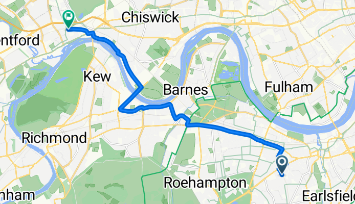
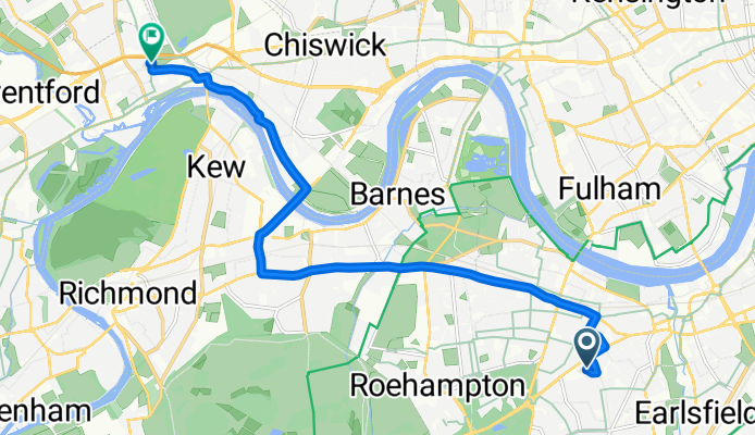
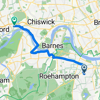
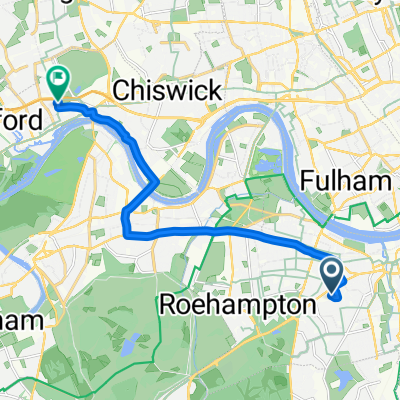
Modèle d’itinéraire
De Borough londonien de Wandsworth à Brentford
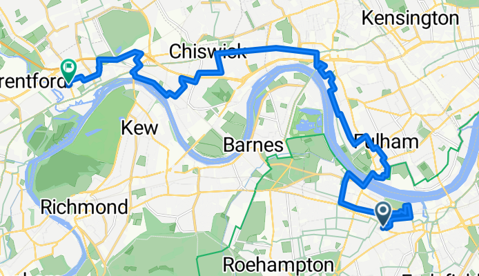
- 59 min
- Durée
- 17,5 km
- Distance
- 37 m
- Montée
- 46 m
- Descente
- 17,9 km/h
- Vit. moyenne
- 23 m
- Altitude max.
Roll out from Wandsworth Town to the Thames, then spin west to Putney Embankment. Cross Putney Bridge to the north bank and follow the riverside towards Hammersmith—expect rowers, big river views, and a mostly flat, easy-going ride. Thread through quiet backstreets and cycleways past Chiswick and the pretty Strand-on-the-Green, then continue to Kew Bridge and into Brentford via the waterside paths around Brentford Lock and the Grand Union Canal.
It’s about 17.5 km, largely on quiet roads and cycleways, with only gentle ups and downs. Surfaces are mostly paved, but you’ll meet the odd bumpy patch near the river; watch for pedestrians on shared sections. Prefer protected lanes? You can hop onto Cycleway 9 along Hammersmith/Chiswick High Road for a faster, direct run.
Fun bits: Wandsworth takes its name from the River Wandle, which meets the Thames right where you start. Brentford sits at the confluence of the River Brent and the Thames, home to canalside warehouses, Syon Park nearby, the London Museum of Water & Steam, and Brentford FC’s Gtech Community Stadium near Kew Bridge. Perfect for a scenic, unrushed riverside spin.
Communauté
Meilleurs utilisateurs dans cette région


De notre communauté
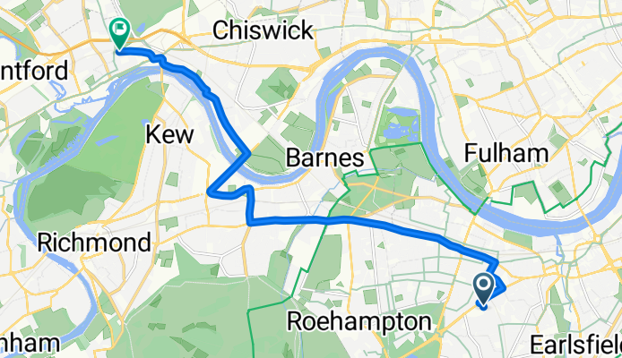
Les meilleurs itinéraires à vélo de Borough londonien de Wandsworth à Brentford

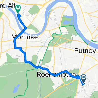
Thames Path
Itinéraire à vélo à Borough londonien de Wandsworth, Angleterre, Royaume-Uni
- 11 km
- Distance
- 46 m
- Montée
- 50 m
- Descente
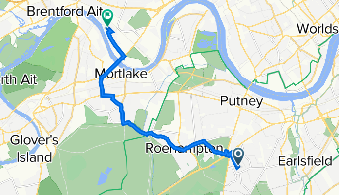
Repton House, London to Clayponds Lane, Brentford
Itinéraire à vélo à Borough londonien de Wandsworth, Angleterre, Royaume-Uni
- 10,8 km
- Distance
- 41 m
- Montée
- 55 m
- Descente

Repton House, London to Clayponds Lane, Brentford
Itinéraire à vélo à Borough londonien de Wandsworth, Angleterre, Royaume-Uni
- 10,8 km
- Distance
- 36 m
- Montée
- 56 m
- Descente
Repton House, London to Clayponds Lane, Brentford
Itinéraire à vélo à Borough londonien de Wandsworth, Angleterre, Royaume-Uni
- 10,5 km
- Distance
- 23 m
- Montée
- 45 m
- Descente
51.452, -0.212 to 51.490, -0.299
Itinéraire à vélo à Borough londonien de Wandsworth, Angleterre, Royaume-Uni
- 11,4 km
- Distance
- 32 m
- Montée
- 64 m
- Descente
Repton House, London to Clayponds Lane, Brentford
Itinéraire à vélo à Borough londonien de Wandsworth, Angleterre, Royaume-Uni
- 10,7 km
- Distance
- 23 m
- Montée
- 45 m
- Descente
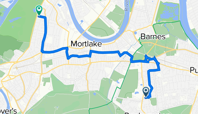
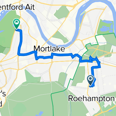
Stormont House, London to Clayponds Lane, Brentford
Itinéraire à vélo à Borough londonien de Wandsworth, Angleterre, Royaume-Uni
- 10,8 km
- Distance
- 33 m
- Montée
- 55 m
- Descente
Repton House, London to Clayponds Lane, Brentford
Itinéraire à vélo à Borough londonien de Wandsworth, Angleterre, Royaume-Uni
- 10,3 km
- Distance
- 27 m
- Montée
- 47 m
- Descente
Scott Avenue, London to Clayponds Lane, Brentford
Itinéraire à vélo à Borough londonien de Wandsworth, Angleterre, Royaume-Uni
- 12,6 km
- Distance
- 56 m
- Montée
- 78 m
- Descente
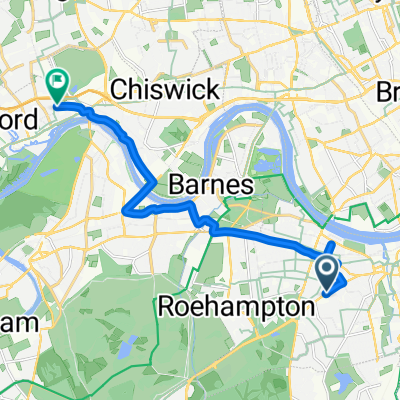
Repton House, London to Clayponds Lane, Brentford
Itinéraire à vélo à Borough londonien de Wandsworth, Angleterre, Royaume-Uni
- 10,9 km
- Distance
- 49 m
- Montée
- 61 m
- Descente
57 Swanton Gardens, London do 64 Grove Park Road, London
Itinéraire à vélo à Borough londonien de Wandsworth, Angleterre, Royaume-Uni
- 8,4 km
- Distance
- 21 m
- Montée
- 70 m
- Descente
Queen Marys Hospital, Roehampton Lane, London to 2 Lichfield Road, Richmond
Itinéraire à vélo à Borough londonien de Wandsworth, Angleterre, Royaume-Uni
- 8 km
- Distance
- 83 m
- Montée
- 118 m
- Descente
Découvrez plus d'itinéraires
 51.452, -0.212 to 51.490, -0.299
- Distance
- 11,4 km
- Montée
- 32 m
- Descente
- 64 m
- Emplacement
- Borough londonien de Wandsworth, Angleterre, Royaume-Uni
 Repton House, London to Clayponds Lane, Brentford
- Distance
- 10,7 km
- Montée
- 23 m
- Descente
- 45 m
- Emplacement
- Borough londonien de Wandsworth, Angleterre, Royaume-Uni
 Stormont House, London to Clayponds Lane, Brentford
- Distance
- 10,8 km
- Montée
- 33 m
- Descente
- 55 m
- Emplacement
- Borough londonien de Wandsworth, Angleterre, Royaume-Uni
 Repton House, London to Clayponds Lane, Brentford
- Distance
- 10,3 km
- Montée
- 27 m
- Descente
- 47 m
- Emplacement
- Borough londonien de Wandsworth, Angleterre, Royaume-Uni
 Scott Avenue, London to Clayponds Lane, Brentford
- Distance
- 12,6 km
- Montée
- 56 m
- Descente
- 78 m
- Emplacement
- Borough londonien de Wandsworth, Angleterre, Royaume-Uni
 Repton House, London to Clayponds Lane, Brentford
- Distance
- 10,9 km
- Montée
- 49 m
- Descente
- 61 m
- Emplacement
- Borough londonien de Wandsworth, Angleterre, Royaume-Uni
 57 Swanton Gardens, London do 64 Grove Park Road, London
- Distance
- 8,4 km
- Montée
- 21 m
- Descente
- 70 m
- Emplacement
- Borough londonien de Wandsworth, Angleterre, Royaume-Uni
 Queen Marys Hospital, Roehampton Lane, London to 2 Lichfield Road, Richmond
- Distance
- 8 km
- Montée
- 83 m
- Descente
- 118 m
- Emplacement
- Borough londonien de Wandsworth, Angleterre, Royaume-Uni
Itinéraires depuis Borough londonien de Wandsworth
Excursion à vélo d’une journée de
Borough londonien de Wandsworth à Cobham
Sortie rapide à vélo de
Borough londonien de Wandsworth à Cité de Londres
Sortie rapide à vélo de
Borough londonien de Wandsworth à Kingston-upon-Thames