
À vélo de Erith à Abbey Wood
Personnalise ton propre itinéraire à partir de notre modèle ou découvre comment notre communauté préfère rouler de Erith à Abbey Wood.
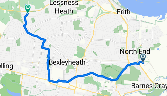
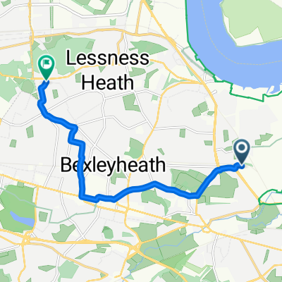
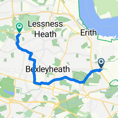
Modèle d’itinéraire
De Erith à Abbey Wood
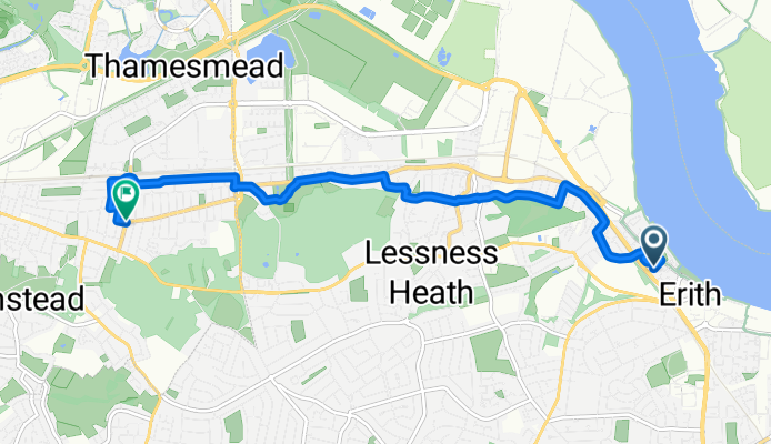
- 23 min
- Durée
- 6,8 km
- Distance
- 49 m
- Montée
- 49 m
- Descente
- 17,8 km/h
- Vit. moyenne
- 33 m
- Altitude max.
Spin out from riverside Erith, a Thames-side town with Victorian industrial roots and a long public pier, then wind inland on quiet back streets. The route climbs gently for a bit (about 50 m total up) as you pass through peaceful residential areas, then levels off and picks up a handy stretch of cycleway on the approach to Abbey Wood. Surfaces are mostly paved, with a brief track-like section—fine on regular tyres, but it could be a touch mucky after rain.
It’s a short hop at roughly 6.8 km, with about the same amount of descent on the way down. Expect mostly low-traffic roads and a calm vibe; you’ll likely only need to cross a couple of busier links.
Finish in Abbey Wood, home to Lesnes Abbey Woods and the atmospheric 12th‑century abbey ruins—well worth a detour for views over southeast London. If you’re heading back, Abbey Wood’s Elizabeth line station makes returning a breeze.
Communauté
Meilleurs utilisateurs dans cette région


De notre communauté
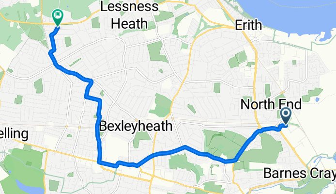
Les meilleurs itinéraires à vélo de Erith à Abbey Wood

Optima Park to Woolwich Road
Itinéraire à vélo à Erith, Angleterre, Royaume-Uni
- 8 km
- Distance
- 90 m
- Montée
- 80 m
- Descente

Shearwood Crescent to Woolwich Road
Itinéraire à vélo à Erith, Angleterre, Royaume-Uni
- 7,6 km
- Distance
- 67 m
- Montée
- 59 m
- Descente
Optima Park to Woolwich Road
Itinéraire à vélo à Erith, Angleterre, Royaume-Uni
- 7,9 km
- Distance
- 70 m
- Montée
- 59 m
- Descente
Slade Green to New Road (Stop H)
Itinéraire à vélo à Erith, Angleterre, Royaume-Uni
- 8,1 km
- Distance
- 69 m
- Montée
- 63 m
- Descente
Optima Park to Woolwich Road
Itinéraire à vélo à Erith, Angleterre, Royaume-Uni
- 8 km
- Distance
- 109 m
- Montée
- 101 m
- Descente

Optima Park to Woolwich Road
Itinéraire à vélo à Erith, Angleterre, Royaume-Uni
- 8 km
- Distance
- 68 m
- Montée
- 61 m
- Descente

Thomas Road to Woolwich Road
Itinéraire à vélo à Erith, Angleterre, Royaume-Uni
- 8 km
- Distance
- 68 m
- Montée
- 69 m
- Descente

Thames Road to Woolwich Road
Itinéraire à vélo à Erith, Angleterre, Royaume-Uni
- 8 km
- Distance
- 73 m
- Montée
- 68 m
- Descente

Thomas Road to Woolwich Road
Itinéraire à vélo à Erith, Angleterre, Royaume-Uni
- 7,9 km
- Distance
- 69 m
- Montée
- 58 m
- Descente
Thames Road to New Road (Stop H)
Itinéraire à vélo à Erith, Angleterre, Royaume-Uni
- 8 km
- Distance
- 82 m
- Montée
- 74 m
- Descente

LOKN STORE OPTIMA to Woolwich Road
Itinéraire à vélo à Erith, Angleterre, Royaume-Uni
- 7,9 km
- Distance
- 57 m
- Montée
- 47 m
- Descente

Thames Road to Woolwich Road
Itinéraire à vélo à Erith, Angleterre, Royaume-Uni
- 7,9 km
- Distance
- 64 m
- Montée
- 59 m
- Descente
Découvrez plus d'itinéraires
 Optima Park to Woolwich Road
- Distance
- 8 km
- Montée
- 109 m
- Descente
- 101 m
- Emplacement
- Erith, Angleterre, Royaume-Uni
 Optima Park to Woolwich Road
- Distance
- 8 km
- Montée
- 68 m
- Descente
- 61 m
- Emplacement
- Erith, Angleterre, Royaume-Uni
 Thomas Road to Woolwich Road
- Distance
- 8 km
- Montée
- 68 m
- Descente
- 69 m
- Emplacement
- Erith, Angleterre, Royaume-Uni
 Thames Road to Woolwich Road
- Distance
- 8 km
- Montée
- 73 m
- Descente
- 68 m
- Emplacement
- Erith, Angleterre, Royaume-Uni
 Thomas Road to Woolwich Road
- Distance
- 7,9 km
- Montée
- 69 m
- Descente
- 58 m
- Emplacement
- Erith, Angleterre, Royaume-Uni
 Thames Road to New Road (Stop H)
- Distance
- 8 km
- Montée
- 82 m
- Descente
- 74 m
- Emplacement
- Erith, Angleterre, Royaume-Uni
 LOKN STORE OPTIMA to Woolwich Road
- Distance
- 7,9 km
- Montée
- 57 m
- Descente
- 47 m
- Emplacement
- Erith, Angleterre, Royaume-Uni
 Thames Road to Woolwich Road
- Distance
- 7,9 km
- Montée
- 64 m
- Descente
- 59 m
- Emplacement
- Erith, Angleterre, Royaume-Uni