
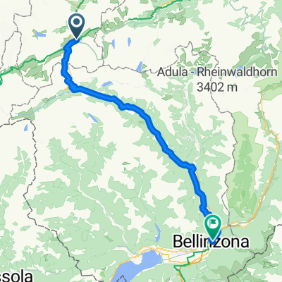
Excursion à vélo d’une journée de Andermatt à Bellinzone
Personnalise ton propre itinéraire à partir de notre modèle ou découvre comment notre communauté préfère rouler de Andermatt à Bellinzone.
Modèle d’itinéraire
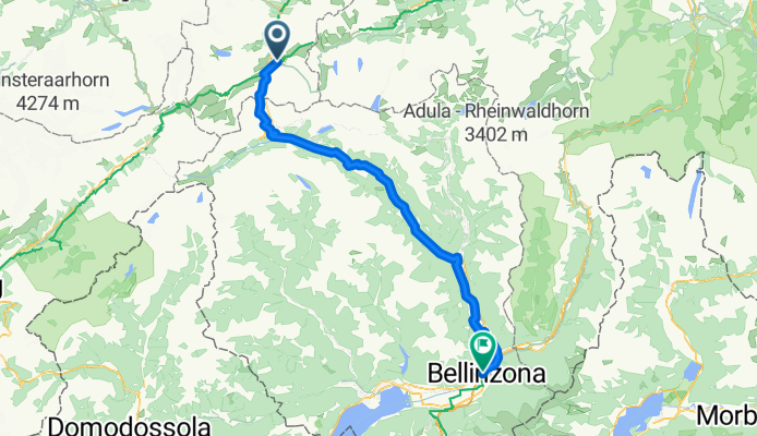
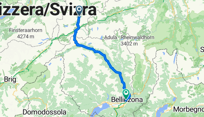
De Andermatt à Bellinzone

- 8 h 8 min
- Durée
- 99,5 km
- Distance
- 2 943 m
- Montée
- 4 157 m
- Descente
- 12,2 km/h
- Vit. moyenne
- 2 190 m
- Altitude max.
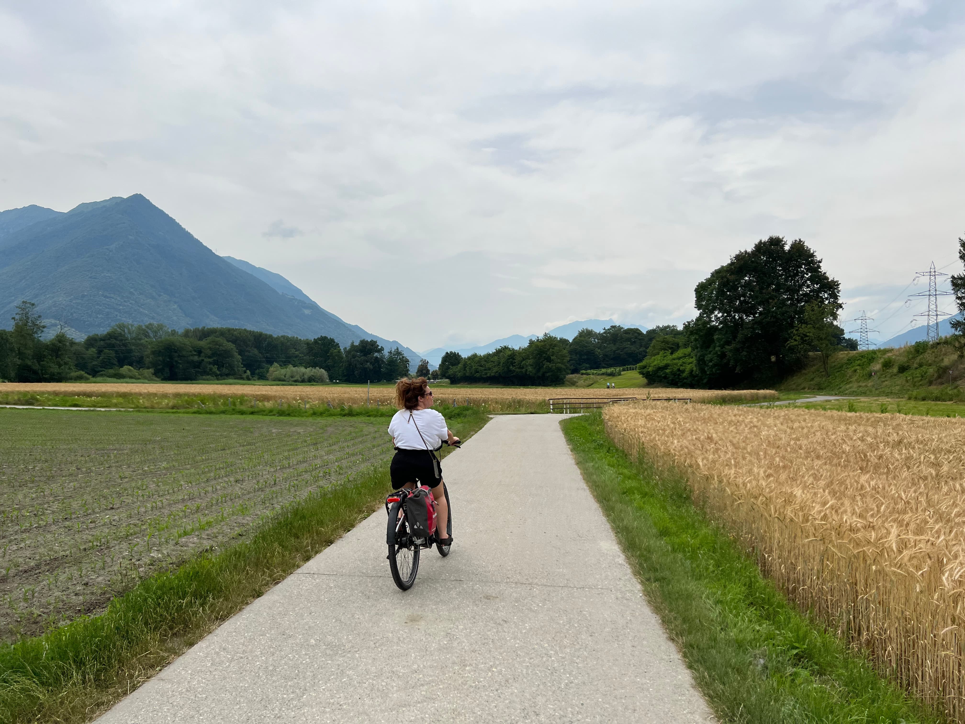
If you’re up for an epic ride crossing the heart of the Swiss Alps, this route from Andermatt to Bellinzona is a must! You’ll kick things off in Andermatt, a historic mountain town famous as a crossroads for Alpine passes (and a favorite among rail fans thanks to the scenic Glacier Express). From there, get ready to climb—big time. With nearly 3,000 meters of ascent and a maximum elevation over 2,100 meters, you’ll tackle some serious alpine roads and classic passes, all with breathtaking views.
The route is a mix of surfaces, mostly smooth pavement, though you’ll find the odd cobblestone or gravel section to keep things interesting. Expect mostly quiet roads, though the occasional busier stretch and mountain tracks add variety and challenge.
Eventually, you’ll glide (and I mean glide, thanks to over 4,000 meters of descent!) into Bellinzona. This sunny Swiss-Italian city is famous for its trio of UNESCO-listed castles and delicious Ticinese cuisine—a perfect reward after your mountain adventure. Bring an extra snack and your camera, because every kilometer here is pure cycling gold!
Communauté
Meilleurs utilisateurs dans cette région


De notre communauté
Les meilleurs itinéraires à vélo de Andermatt à Bellinzone


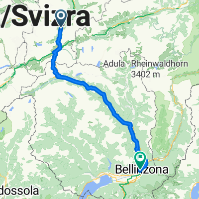
Andermatt - Bellinzona
Itinéraire à vélo à Andermatt, Canton d’Uri, Suisse
- 114,5 km
- Distance
- 2 089 m
- Montée
- 3 288 m
- Descente
Andermatt - Bellinzona
Itinéraire à vélo à Andermatt, Canton d’Uri, Suisse
- 87,5 km
- Distance
- 546 m
- Montée
- 1 749 m
- Descente

Andermatt - Bellinzona
Itinéraire à vélo à Andermatt, Canton d’Uri, Suisse
- 100,1 km
- Distance
- 1 264 m
- Montée
- 2 923 m
- Descente

bike and hik
Itinéraire à vélo à Andermatt, Canton d’Uri, Suisse
- 222 km
- Distance
- 4 132 m
- Montée
- 5 011 m
- Descente

1-2-3 Runde
Itinéraire à vélo à Andermatt, Canton d’Uri, Suisse
- 94,7 km
- Distance
- 1 183 m
- Montée
- 1 871 m
- Descente

Andermatt - Bellinzona
Itinéraire à vélo à Andermatt, Canton d’Uri, Suisse
- 87,9 km
- Distance
- 1 022 m
- Montée
- 2 219 m
- Descente

Andermatt-Oberalp-Lucomagno-Biasca-Bellinzona
Itinéraire à vélo à Andermatt, Canton d’Uri, Suisse
- 117 km
- Distance
- 1 459 m
- Montée
- 2 674 m
- Descente

Andermatt-Oberalp-Lukmanier
Itinéraire à vélo à Andermatt, Canton d’Uri, Suisse
- 115,1 km
- Distance
- 1 426 m
- Montée
- 2 631 m
- Descente

Tag 4 Andermatt - Oberalppass - Lukmanierpass - Bellinzona
Itinéraire à vélo à Andermatt, Canton d’Uri, Suisse
- 125,8 km
- Distance
- 1 905 m
- Montée
- 3 112 m
- Descente

Catani_3_Andermatt-Gotthard-Bellinzona_Bikemap
Itinéraire à vélo à Andermatt, Canton d’Uri, Suisse
- 91,5 km
- Distance
- 1 822 m
- Montée
- 3 035 m
- Descente

DAY 5 AFTER BUS
Itinéraire à vélo à Andermatt, Canton d’Uri, Suisse
- 87,7 km
- Distance
- 610 m
- Montée
- 1 859 m
- Descente
Tag 3: Andermatt - Bellinzona
Itinéraire à vélo à Andermatt, Canton d’Uri, Suisse
- 100 km
- Distance
- 2 518 m
- Montée
- 3 216 m
- Descente
Découvrez plus d'itinéraires
 1-2-3 Runde
- Distance
- 94,7 km
- Montée
- 1 183 m
- Descente
- 1 871 m
- Emplacement
- Andermatt, Canton d’Uri, Suisse
 Andermatt - Bellinzona
- Distance
- 87,9 km
- Montée
- 1 022 m
- Descente
- 2 219 m
- Emplacement
- Andermatt, Canton d’Uri, Suisse
 Andermatt-Oberalp-Lucomagno-Biasca-Bellinzona
- Distance
- 117 km
- Montée
- 1 459 m
- Descente
- 2 674 m
- Emplacement
- Andermatt, Canton d’Uri, Suisse
 Andermatt-Oberalp-Lukmanier
- Distance
- 115,1 km
- Montée
- 1 426 m
- Descente
- 2 631 m
- Emplacement
- Andermatt, Canton d’Uri, Suisse
 Tag 4 Andermatt - Oberalppass - Lukmanierpass - Bellinzona
- Distance
- 125,8 km
- Montée
- 1 905 m
- Descente
- 3 112 m
- Emplacement
- Andermatt, Canton d’Uri, Suisse
 Catani_3_Andermatt-Gotthard-Bellinzona_Bikemap
- Distance
- 91,5 km
- Montée
- 1 822 m
- Descente
- 3 035 m
- Emplacement
- Andermatt, Canton d’Uri, Suisse
 DAY 5 AFTER BUS
- Distance
- 87,7 km
- Montée
- 610 m
- Descente
- 1 859 m
- Emplacement
- Andermatt, Canton d’Uri, Suisse
 Tag 3: Andermatt - Bellinzona
- Distance
- 100 km
- Montée
- 2 518 m
- Descente
- 3 216 m
- Emplacement
- Andermatt, Canton d’Uri, Suisse
Itinéraires depuis Andermatt
Bikepacking de
Andermatt à Meiringen
Excursion à vélo d’une journée de
Andermatt à Ilanz
Excursion à vélo d’une journée de
Andermatt à Fiesch