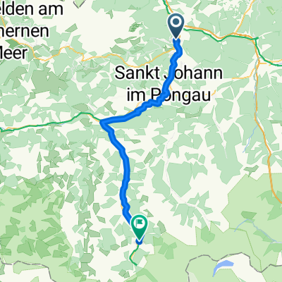
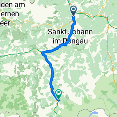
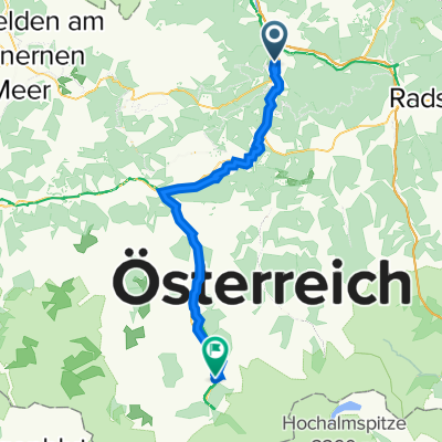
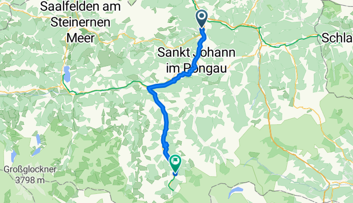
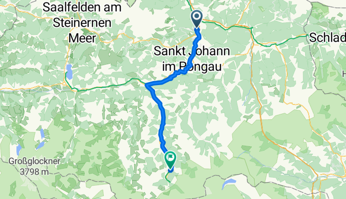
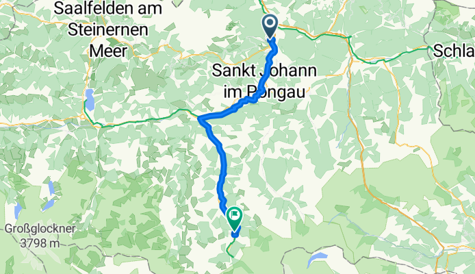
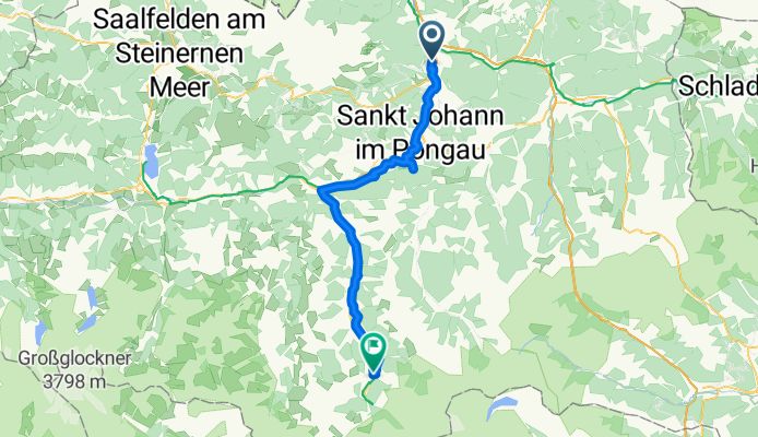
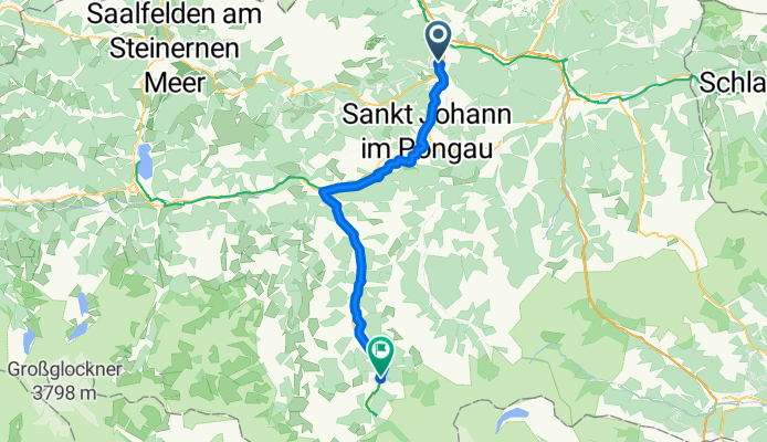
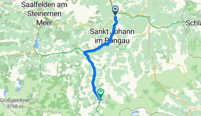
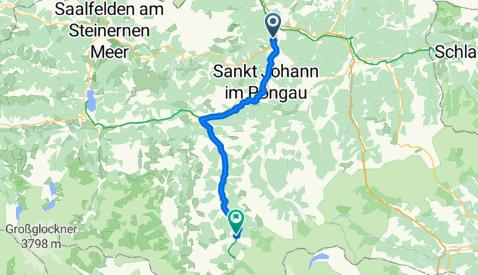
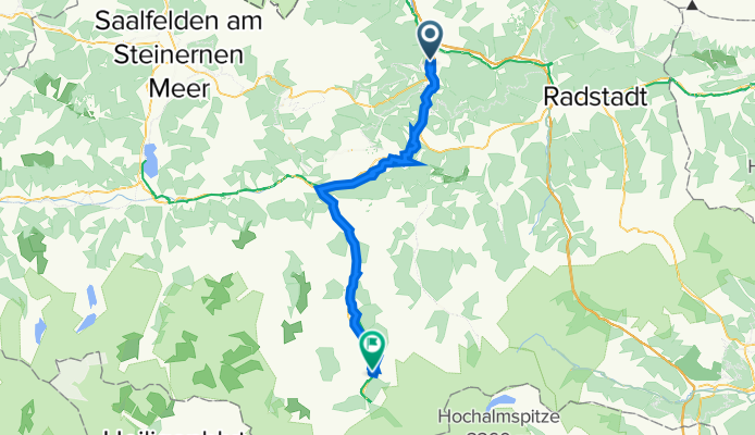
À quoi pourrait ressembler le cyclisme dans la Bischofshofen.
À quoi pourrait ressembler le cyclisme dans la Bad Gastein.

Excursion à vélo d’une journée de Bischofshofen à Bad Gastein

Personnalise ton propre itinéraire à partir de notre modèle ou découvre comment notre communauté préfère rouler de Bischofshofen à Bad Gastein.

Modèle d’itinéraire

De Bischofshofen à Bad Gastein

3 h 22 min
Durée
50,2 km
Distance
1 054 m
Montée
575 m
Descente
14,9 km/h
Vit. moyenne
1 044 m
Altitude max.

Lancez votre aventure cycliste depuis Bischofshofen, une charmante petite ville connue pour le saut à ski et entourée de superbes paysages alpins. En pédalant loin de l'agitation, préparez-vous à une sortie à la fois exigeante et gratifiante jusqu'à la paisible station thermale de Bad Gastein.

Ce trajet d'environ 50 km vous fera traverser une variété de terrains, principalement de l'asphalte (environ 74%) avec quelques parties en gravier. Vous ferez une montée notable de plus de 1000 mètres, mais les vues valent chaque coup de pédale ! Roulez principalement sur des routes calmes (environ 66%), parfaites pour profiter pleinement des magnifiques Alpes de Salzbourg.

En roulant, admirez les vallées verdoyantes et les sommets imposants. Et ne vous inquiétez pas pour la descente — elle est plus douce, vous permettant de savourer la descente jusqu'à votre destination, où les sources chaudes apaisantes de Bad Gastein vous attendent.

Que vous soyez un cycliste passionné ou simplement en balade pittoresque, pensez à y aller doucement et à apprécier la beauté de cet itinéraire. Atteindre la charmante ville de Bad Gastein, réputée pour ses cascades et ses eaux curatives, sera un triomphe bien mérité. Bon vélo !

Communauté

Meilleurs utilisateurs dans cette région

De notre communauté

Les meilleurs itinéraires à vélo de Bischofshofen à Bad Gastein

0

2. Etappe: von Bischofshofen (harrys home) nach Bad Gastein (ohne Tunnel)

Itinéraire à vélo à Bischofshofen, Salzburg, Austria

51,1 km
Distance
1 011 m
Montée
477 m
Descente
0

02 Bischofshofen - Bad Gastein

Itinéraire à vélo à Bischofshofen, Salzburg, Austria

49 km
Distance
869 m
Montée
440 m
Descente
0

Biciklitúra 2016. 2. nap. (Bischofshofen-Bad Gastein)

Itinéraire à vélo à Bischofshofen, Salzburg, Austria

Summary The second stage takes us initially alongside the reservoirs on the middle Salzach to Schwarzach, then tackles a climb before entering the Gastein Valley. A bike path leads us from the entrance to the valley to Bad Gastein, a magnificent location with Gastein Waterfall in the center of town. Our constant companions are the mountains of the Salzburg Alps. In Gastein Valley, views of the glaciated peaks of the Hohe Tauern mountains reveal themselves before our eyes. From Bischofshofen to Schwarzach, we continue to enjoy a leisurely bike ride alongside the Salzach, which, at this point, is mostly regulated by dams. Along the way, we pass the county seat of St. Johann im Pongau – a detour to the might, neo-Gothic “Pongau Cathedral”, standing in the middle of the Oberer Markt, is always rewarding. Between Schwarzach and the village of Klammstein at the entrance to Gastein Valley, we have to tackle a vertical gain of 200 meters. Since we also have to ride through a 1.5 km-long tunnel at the start of Gastein Valley, we can also take the train or a bike taxi for this section. With no climbs worthy of note, our continued bike ride through the valley is truly enjoyable, bringing us first to Dorfgastein, then on to the heart of the famous spa town, Bad Hofgastein. From here, we keep to the banks of the Gasteiner Ache to Bad Bruck. The imposing backdrop of the world-famous spa town which surrounds the Gastein Waterfall comes closer and closer into view. The last few meters in Bad Gastein are then steeply uphill. Turn-by-turn directions Second Stage: Bischofshofen – Bad Gastein km 0.0 Bischofshofen In the center of Bischofshofen, the Salzburger Strasse transitions into the Bahnhofstrasse and feeds into Franz-Mohshammer-Platz square. Here we turn left (Dr.-August-Heinrich-Strasse), then make a right at the roundabout onto the Molkereistrasse. After around 200 meters, we make a sharp left to the railway underpass. At the end of the underpass, we head uphill to the left to the bridge over the Salzach, which we cross, then ride upriver along the eastern bank heading south (if you take a right at the end of the underpass, you will stay on the west bank, where the bike path is narrow, though also an option). From this point on, we ride to Schwarzach always next to the Salzach. Soon we come to Bischofshofen’s hydroelectric weir, where we could again switch over to the west bank. We, however, remain on the east bank, now biking along a gravel path alongside the Salzach. After around 2 km, our path feeds into an access road and, 800 meters further along, at Einödbrücke bridge, into a smallish main road. We ride underneath this road, at which point we find ourselves on a paved bike path next to the river once again. After 1.7 km, we will pass the Urreiting hydroelectric weir, and after another 3.3 km, come to the first bridge over the Salzach in St. Johann. We stay on the east bank of the Salzach. After 1.1 km, we come to another bridge. Shortly before this, there is a marked turn-off (Salzachweg), which takes us to the Brückenwirt in the Untermarkt section of town, then a little further via a short, steep road to the Obermarkt. Towering above us here is the mighty neo-Gothic “Pongau Cathedral”. km 9.7 St. Johann im Pongau The bike path continues to remain next to the Salzach, leading us underneath a bridge as we come to the next weir (St. Johann im Pongau). One highlight along the Alpe-Adria Bike Tour is – especially on hot summer’s days – a visit to Liechtenstein Gorge. Here at the hydroelectric station, you can switch to the Liechtensteinstrasse, which will lead you directly to the entrance of the gorge (ca. 3 km). The bike path continues along the east bank of the Salzach, but soon changes to the west bank. Shortly before we reach the point where the Grossarler Ache flows into the Salzach, we come to a bridge for pedestrians and cyclists. If you wish to visit Liechtenstein Gorge, you again have the opportunity to do so. From this bridge, it is about 1.7 km to the gorge entrance, with this particular detour clearly marked for cyclists. We stay next to the Salzach and pass the next hydroelectric weir (St. Veit). From here it is about another 2 km to Schwarzach – always on the north bank of the Salzach. As we come to the end of the Sportplatzstrasse, we reach the Landesstrasse. Making a left, it is another 120 meters to the crossroads in the center of Schwarzach. km 16.3 Schwarzach A right takes us to Schwarzach’s market square, where we have numerous opportunities for shopping and refreshments. If we continue to the left of Hotel Gasthof Post, we come back to the Landesstrasse, which we can then follow back to the crossroads. This 600-meter loop gives us a good overview of the center of Schwarzach. The Alpe-Adria Bike Tour heads south across the Salzach bridge and then right (a left would take us to the railway station). The following stage to Dorfgastein awaits with very beautiful countryside, with two features along the way that you should be aware of in advance: On the one hand, the next 2.5 km up to the so-called “Equalization Reservoir” represent an elevation gain of 130 meters; Secondly, at the turn-off for Gastein Valley, you will have to ride through a 1.5 km-long tunnel. Though there is a separate bike lane in the tunnel, many prefer not to tackle this on their bike. So, for everyone who prefers not to bike this stage, there are two options: 1. Take the train from Schwarzach to Dorfgastein. The regional train, which runs every 2 hours, also transports bicycles. 2. Utilize shuttle service offered by local taxi companies from Schwarzach to Klammstein (= beyond the tunnel). Taxi Bamberger in Schwarzach, for example, Tel. 0664/1605590; Fare: min. EUR 28 (= 4 people with bikes) After the bridge over the Salzach, the Alpe-Adria Bike Tour takes a right, then a half-left onto the bridge over the railway tracks. Here, on the right, there begins a ca. 2.5 km-long road to the so-called “Equalization Reservoir”, which does require a substantial climb. Once at the top, however, our efforts are amply rewarded. There is also an inn (Lehengut) located here. At the end of the Equalization Reservoir, we turn right and cycle at a constant elevation past farms and alpine meadows – the surrounding countryside, as well as the views off to the north out across the Salzachtal to the so-called Salzburg Sunny Terrace, and the majestic Hochkönig Massif beyond, is incredibly picturesque. After 4 km we reach Gasthof Posauner. We need to pay closer attention at this point, since we now leave the route of the Tauernradweg, which goes around the inn, and drops underneath the expressway to the other side. The Alpe-Adria Bike Tour, on the other hand, takes us uphill to the left of the inn in a westerly direction. And so, we again ride gently uphill along a narrow road, then downhill to the expressway bridge over the Gasteiner Ache. The bike path also utilizes this bridge, making a left immediately afterwards. We then pass through a short tunnel, before the path takes us through the 1.5 km-long tunnel we mentioned before. At the end of this tunnel, we are greeted by beautiful southerly views of the Gastein Valley, as it opens up before us. After the car park for the Entrische Kirche, a natural cave well worth a visit, whose entrance is accessed on foot (45-minute walk), we again come to a tunnel, the Klammstein Tunnel. Here, a separate, 140 meters-long tunnel is being built for the exclusive use of riders (and pedestrians) on the Alpe-Adria bike tour. Scheduled completion date is spring 2011. From this point on, we enjoy a leisurely bike ride on the bike path next to the road, with the views of Gastein Valley becoming wider and wider. After 6 km, the bike path takes us briefly to the left, to the community of Mayerhofen. After another 1.2 km, we reach Dorfgastein. In a slight swing to the left and around Hotel Römerhof, we come to the main village road, which in turn leads us past the parish church. km 32.8 Dorfgastein We keep straight heading south along the “Alte Strasse”, which takess us past farmhouses and flower-covered meadows to the village of Harbach. Shortly before this road feeds into the main highway, we turn left and ride through an S-bend in a small industrial district. For 600 m, a bike path next to the road then takes us to the village of Laderding. Soon afterwards, yet another bike path next to the road begins, bringing us in 1.5 km to the roundabout “Bad Hofgastein Nord”. Following the Salzburger Strasse, we ride into the center of this famous spa community. After a small bridge, at Kaiser-Franz- Platz square, we come to the beginning of the pedestrian zone (bikes are permitted). km 413 Bad Hofgastein Passing the mighty parish church (Kirchenplatz square), we come to the start of the Pyrkerstrasse and thus the end of the pedestrian zone. We now follow the Pyrkerstrasse for the next 1.6 km. At about the half-way point (the turn-off for the Alexander-Moser-Allee), a separate bike lane begins again on the right-hand side, shortly after which we cross the Gasteiner Ache. At the end of the Pyrkerstrasse, at the south roundabout, there begins an 800-meter bike path next to the highway, which we follow as far as the Gadaunern turn-off. Before the bridge over the Gasteiner Ache, we turn right onto a gravel path alongside the river. After around 3 km, we will come to Kötschachdorf, where the bike path feeds into the Miesbichlstrasse. We will cross the Gasteiner Ache, ride past Hotel Europäischer Hof and, after a small bridge, come to the small village square in Bad Bruck, yet another section of Bad Gastein. Now beginning uphill to our left is the Badbergstrasse, which we will follow. There are a number of steep sections, and it is definitely worth considering whether or not to get off and push your bike in some spots. Whatever the case, take your time as you approach the center of Bad Gastein, since the views of this traditional spa town, built into the rocky mountainsides, become more and more magnificent. Probably the most beautiful view of all can be enjoyed directly from the Conrad-Strochner-Strasse. At this point, it is not much further to the Straubinger Platz, and to the bridge beyond over the Gastein Waterfall. Kaiser-Franz-Josef-Strasse, with its rows of shops and the casino, leads us to Mozartplatz square, also the site of the tourist information center. km 49.8 Bad Gastein From Mozartplatz square in Bad Gastein to the Tauernschleuse (motorail shuttle) is another 5.8 km see Stage 3).
51,6 km
Distance
1 081 m
Montée
541 m
Descente
0

Alpen Day 3 Bischofshofen to Bad Gastein

Itinéraire à vélo à Bischofshofen, Salzburg, Austria

46,8 km
Distance
733 m
Montée
432 m
Descente
0

Alpe Adria 2: Bischofshofen-Bad Gastein

Itinéraire à vélo à Bischofshofen, Salzburg, Austria

La seconda tappa si svolge dapprima lungo i bacini di sbarramento del medio corso del Salzach fino a Schwarzach, per superare quindi una salita oltre la quale si arriva nella valle di Gastein. Dall'inizio della valle fino a Bad Gastein, stazione termale attraversata da una famosa cascata, si percorre una pista ciclabile che attraversa un magnifico scenario alpino. Le Alpi Salisburghesi sono una presenza costante in questa tappa. Nella valle di Gastein la vista si apre infine sulle cime e sui ghiacciai degli Alti Tauri.
51,9 km
Distance
1 085 m
Montée
545 m
Descente
0

2a tappa: Bischofshofen-Bad Gastein - 2a tappa: Bischofshofen-Bad Gastein

Itinéraire à vélo à Bischofshofen, Salzburg, Austria

La seconda tappa si svolge dapprima lungo i bacini di sbarramento del medio corso del Salzach fino a Schwarzach, per superare quindi una salita oltre la quale si arriva nella valle di Gastein. Dall'inizio della valle fino a Bad Gastein, stazione termale attraversata da una famosa cascata, si percorre una pista ciclabile che attraversa un magnifico scenario alpino. Le Alpi Salisburghesi sono una presenza costante in questa tappa. Nella valle di Gastein la vista si apre infine sulle cime e sui ghiacciai degli Alti Tauri. - La seconda tappa si svolge dapprima lungo i bacini di sbarramento del medio corso del Salzach fino a Schwarzach, per superare quindi una salita oltre la quale si arriva nella valle di Gastein. Dall'inizio della valle fino a Bad Gastein, stazione termale attraversata da una famosa cascata, si percorre una pista ciclabile che attraversa un magnifico scenario alpino. Le Alpi Salisburghesi sono una presenza costante in questa tappa. Nella valle di Gastein la vista si apre infine sulle cime e sui ghiacciai degli Alti Tauri.
54,6 km
Distance
1 145 m
Montée
607 m
Descente
1

2 Bischofshofen-Bad Gastein

Itinéraire à vélo à Bischofshofen, Salzburg, Austria

La seconda tappa si svolge dapprima lungo i bacini di sbarramento del medio corso del Salzach fino a Schwarzach, per superare quindi una salita oltre la quale si arriva nella valle di Gastein. Dall'inizio della valle fino a Bad Gastein, stazione termale attraversata da una famosa cascata, si percorre una pista ciclabile che attraversa un magnifico scenario alpino. Le Alpi Salisburghesi sono una presenza costante in questa tappa. Nella valle di Gastein la vista si apre infine sulle cime e sui ghiacciai degli Alti Tauri. - La seconda tappa si svolge dapprima lungo i bacini di sbarramento del medio corso del Salzach fino a Schwarzach, per superare quindi una salita oltre la quale si arriva nella valle di Gastein. Dall'inizio della valle fino a Bad Gastein, stazione termale attraversata da una famosa cascata, si percorre una pista ciclabile che attraversa un magnifico scenario alpino. Le Alpi Salisburghesi sono una presenza costante in questa tappa. Nella valle di Gastein la vista si apre infine sulle cime e sui ghiacciai degli Alti Tauri.
60,7 km
Distance
915 m
Montée
374 m
Descente
0

2^ Tappa BISCHOFSHOFEN - BAD GASTEIN

Itinéraire à vélo à Bischofshofen, Salzburg, Austria

53,3 km
Distance
1 484 m
Montée
942 m
Descente
AAR-4 Bischofshofen - Bad Gastein
Vélo de villeRevêtu
Zeitlinger Alfred
0

AAR-4 Bischofshofen - Bad Gastein

Itinéraire à vélo à Bischofshofen, Salzburg, Austria

Etappe 2 Alpe Adria Radweg
52,5 km
Distance
1 066 m
Montée
535 m
Descente
0

AA2 Bischo-BG

Itinéraire à vélo à Bischofshofen, Salzburg, Austria

50,2 km
Distance
1 408 m
Montée
870 m
Descente
1

AA02 - BISCHOFSHOFEN - BAD GASTEIN

Itinéraire à vélo à Bischofshofen, Salzburg, Austria

51,9 km
Distance
1 171 m
Montée
630 m
Descente
Salzburger Straße 12, Bischofshofen to Hirschenweg 11, Bad Gastein
Vélo de route
Yossi Barak
0

Salzburger Straße 12, Bischofshofen to Hirschenweg 11, Bad Gastein

Itinéraire à vélo à Bischofshofen, Salzburg, Austria

47 km
Distance
1 015 m
Montée
589 m
Descente

Découvrez plus d'itinéraires