
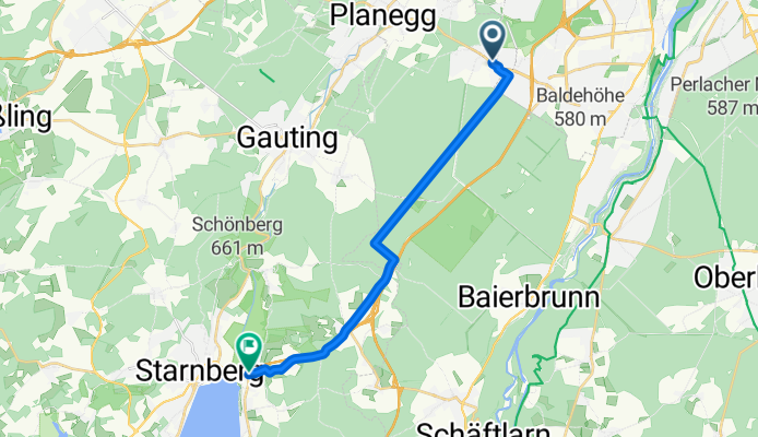
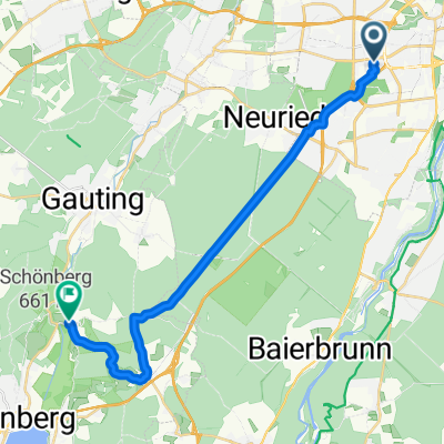
Modèle d’itinéraire
De Neuried à Starnberg

- 58 min
- Durée
- 16,9 km
- Distance
- 190 m
- Montée
- 154 m
- Descente
- 17,6 km/h
- Vit. moyenne
- 648 m
- Altitude max.
This ride takes you from the peaceful village of Neuried, just on the edge of Munich, all the way to the lakeside charm of Starnberg. It’s about 17 km—perfect for a relaxed morning or afternoon spin.
You’ll enjoy mostly paved roads (95% asphalt, so nice and smooth), cruising past fields, woodlands, and through some quiet Bavarian suburbs. About half the trip follows quiet backroads, with some scenic stretches on bike paths and tracks—so traffic is minimal and the vibe is very laid-back.
There’s a bit of climbing involved (roughly 190 meters total), but nothing too tough, and you’re rewarded with glimpses of the Alps in the distance as you near Starnberg. Once you arrive, treat yourself: Starnberg sits right on the shores of Lake Starnberg, a favorite getaway for Munich locals, great for a lakeside coffee or a refreshing dip.
Overall, it’s a gentle, picturesque ride with a fantastic destination—one of Upper Bavaria’s prettiest lakes!
Communauté
Meilleurs utilisateurs dans cette région


De notre communauté
Les meilleurs itinéraires à vélo de Neuried à Starnberg

48.106, 11.477 to 48.005, 11.347
Itinéraire à vélo à Neuried, Bavière, Allemagne
- 21,7 km
- Distance
- 390 m
- Montée
- 339 m
- Descente
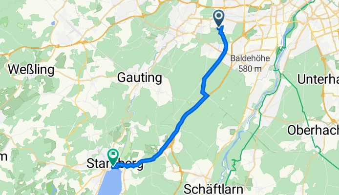
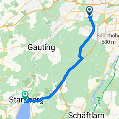
Ammerseestraße, Neuried nach Berger Straße, Starnberg
Itinéraire à vélo à Neuried, Bavière, Allemagne
- 16 km
- Distance
- 124 m
- Montée
- 95 m
- Descente
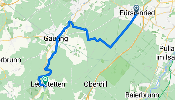
Fürstenried - ForstKasten - Gauting - Leustetten
Itinéraire à vélo à Neuried, Bavière, Allemagne
- 18,1 km
- Distance
- 80 m
- Montée
- 50 m
- Descente

Waxensteinstraße 28, München nach Altostraße 11, Starnberg
Itinéraire à vélo à Neuried, Bavière, Allemagne
- 21,5 km
- Distance
- 253 m
- Montée
- 200 m
- Descente

Zirler Straße 12, München nach Altostraße 11, Starnberg
Itinéraire à vélo à Neuried, Bavière, Allemagne
- 21,1 km
- Distance
- 242 m
- Montée
- 189 m
- Descente

Zirler Straße 11–17, München nach Altostraße 11, Starnberg
Itinéraire à vélo à Neuried, Bavière, Allemagne
- 20,4 km
- Distance
- 166 m
- Montée
- 126 m
- Descente
Waxensteinstraße 27A, München nach Altostraße 11, Starnberg
Itinéraire à vélo à Neuried, Bavière, Allemagne
- 19,8 km
- Distance
- 163 m
- Montée
- 99 m
- Descente

Waldfriedhofstraße 117, Munich to Vogelanger 2, Starnberg
Itinéraire à vélo à Neuried, Bavière, Allemagne
- 20,6 km
- Distance
- 176 m
- Montée
- 119 m
- Descente

Hadern -> Andechs -> Starnberg
Itinéraire à vélo à Neuried, Bavière, Allemagne
- 51,5 km
- Distance
- 266 m
- Montée
- 218 m
- Descente

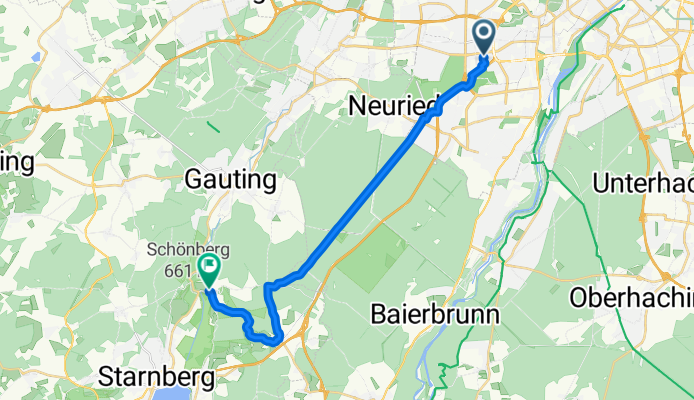
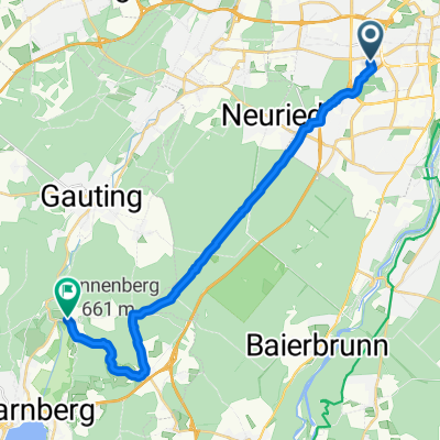
Fürstenried - Starnberger See
Itinéraire à vélo à Neuried, Bavière, Allemagne
- 17,6 km
- Distance
- 111 m
- Montée
- 82 m
- Descente
Prälat-Wellenhofer-Straße 31, München nach Nepomukweg 3, Starnberg
Itinéraire à vélo à Neuried, Bavière, Allemagne
- 18,5 km
- Distance
- 154 m
- Montée
- 112 m
- Descente

Neurieder Sträßl, München, gemeindefreies Gebiet nach Schiffbauerweg 23, Starnberg
Itinéraire à vélo à Neuried, Bavière, Allemagne
- 13,4 km
- Distance
- 135 m
- Montée
- 132 m
- Descente
Découvrez plus d'itinéraires
 Zirler Straße 12, München nach Altostraße 11, Starnberg
- Distance
- 21,1 km
- Montée
- 242 m
- Descente
- 189 m
- Emplacement
- Neuried, Bavière, Allemagne
 Zirler Straße 11–17, München nach Altostraße 11, Starnberg
- Distance
- 20,4 km
- Montée
- 166 m
- Descente
- 126 m
- Emplacement
- Neuried, Bavière, Allemagne
 Waxensteinstraße 27A, München nach Altostraße 11, Starnberg
- Distance
- 19,8 km
- Montée
- 163 m
- Descente
- 99 m
- Emplacement
- Neuried, Bavière, Allemagne
 Waldfriedhofstraße 117, Munich to Vogelanger 2, Starnberg
- Distance
- 20,6 km
- Montée
- 176 m
- Descente
- 119 m
- Emplacement
- Neuried, Bavière, Allemagne
 Hadern -> Andechs -> Starnberg
- Distance
- 51,5 km
- Montée
- 266 m
- Descente
- 218 m
- Emplacement
- Neuried, Bavière, Allemagne
 Fürstenried - Starnberger See
- Distance
- 17,6 km
- Montée
- 111 m
- Descente
- 82 m
- Emplacement
- Neuried, Bavière, Allemagne
 Prälat-Wellenhofer-Straße 31, München nach Nepomukweg 3, Starnberg
- Distance
- 18,5 km
- Montée
- 154 m
- Descente
- 112 m
- Emplacement
- Neuried, Bavière, Allemagne
 Neurieder Sträßl, München, gemeindefreies Gebiet nach Schiffbauerweg 23, Starnberg
- Distance
- 13,4 km
- Montée
- 135 m
- Descente
- 132 m
- Emplacement
- Neuried, Bavière, Allemagne
Itinéraires depuis Neuried
Excursion à vélo d’une journée de
Neuried à Unterföhring
À vélo de
Neuried à Pullach im Isartal
À vélo de
Neuried à Germering
Itinéraires vers Starnberg
Excursion à vélo d’une journée de
Pasing à Starnberg
Excursion à vélo d’une journée de
Munich à Starnberg