
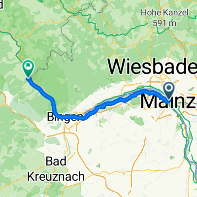
Modèle d’itinéraire
De Mayence à Bacharach
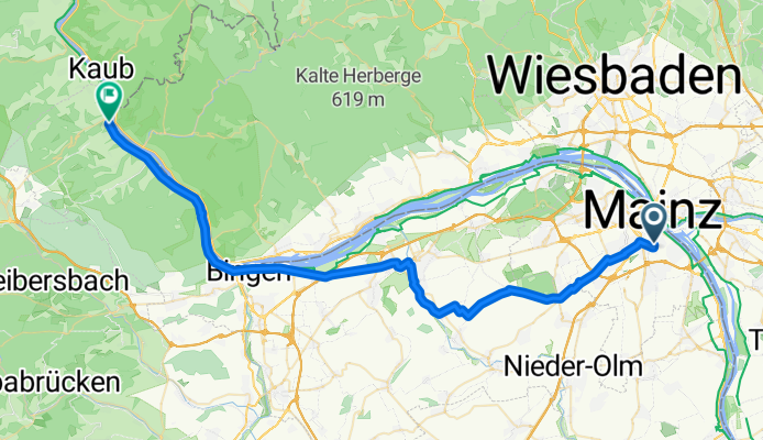
- 3 h 12 min
- Durée
- 48,9 km
- Distance
- 414 m
- Montée
- 452 m
- Descente
- 15,3 km/h
- Vit. moyenne
- 251 m
- Altitude max.
Ready for a relaxing riverside ride? This route takes you from the vibrant city of Mainz all the way to the charming town of Bacharach, hugging the scenic banks of the Rhine almost the entire way. Starting in Mainz—a city well known for its striking cathedral and rich Roman history—you’ll soon leave the urban buzz behind, cruising along quiet roads and dedicated paths.
With almost the whole route on smooth paved surfaces, it’s a comfortable adventure for most cyclists. Expect gentle climbs (about 414 m up in total), but nothing too daunting—think rolling wine hills rather than mountain passes, and you’re rewarded with long, peaceful descents.
The last stretch delivers you right to Bacharach, a storybook-perfect Middle Rhine town famed for its half-timbered houses and medieval castle watching over the river. If time allows, stop here for a cool drink or local Riesling and soak up the views.
All in all, it's a picturesque day ride—just under 49 km—blending history, river panoramas, and a taste of Rhineland wine country.
Communauté
Meilleurs utilisateurs dans cette région


De notre communauté
Les meilleurs itinéraires à vélo de Mayence à Bacharach

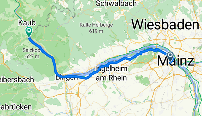
CYCLING THE RHINE: Route R07A
Itinéraire à vélo à Mayence, Rhénanie-Palatinat, Allemagne
- 48,4 km
- Distance
- 110 m
- Montée
- 101 m
- Descente

Norwegen19-6
Itinéraire à vélo à Mayence, Rhénanie-Palatinat, Allemagne
- 47,8 km
- Distance
- 24 m
- Montée
- 31 m
- Descente

ETT 5 Morgens Mainz Bacharach
Itinéraire à vélo à Mayence, Rhénanie-Palatinat, Allemagne
- 69,5 km
- Distance
- 604 m
- Montée
- 603 m
- Descente

Radtour 1. Tag
Itinéraire à vélo à Mayence, Rhénanie-Palatinat, Allemagne
- 59,1 km
- Distance
- 145 m
- Montée
- 157 m
- Descente
CYCLING THE RHINE: Route R07A
Itinéraire à vélo à Mayence, Rhénanie-Palatinat, Allemagne
- 48,5 km
- Distance
- 118 m
- Montée
- 107 m
- Descente

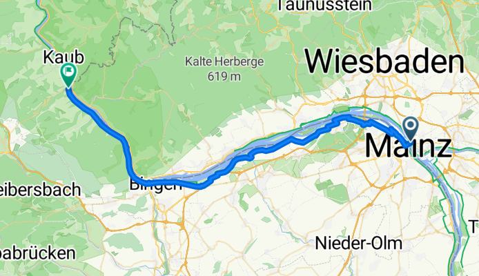
mainz kastel bis bacharach
Itinéraire à vélo à Mayence, Rhénanie-Palatinat, Allemagne
- 49,4 km
- Distance
- 307 m
- Montée
- 277 m
- Descente

RR16 - Mainz > Bacharach
Itinéraire à vélo à Mayence, Rhénanie-Palatinat, Allemagne
- 51,6 km
- Distance
- 185 m
- Montée
- 201 m
- Descente

R8. Mainz to Bacharach 50.2km S16
Itinéraire à vélo à Mayence, Rhénanie-Palatinat, Allemagne
- 50,2 km
- Distance
- 186 m
- Montée
- 188 m
- Descente

ET5 Mainz-Bacharad
Itinéraire à vélo à Mayence, Rhénanie-Palatinat, Allemagne
- 49,1 km
- Distance
- 44 m
- Montée
- 50 m
- Descente

RR16 Mainz-Bacharach.kml_RR16 Mainz-Bacharach
Itinéraire à vélo à Mayence, Rhénanie-Palatinat, Allemagne
- 49,5 km
- Distance
- 0 m
- Montée
- 0 m
- Descente

RR16 Mainz-Bacharach.kml - RR16 Mainz-Bacharach.kml_RR16 Mainz-Bacharach
Itinéraire à vélo à Mayence, Rhénanie-Palatinat, Allemagne
- 52,8 km
- Distance
- 305 m
- Montée
- 313 m
- Descente
Wiesbaden-Mainz-Kastel Bahnhof nach L224
Itinéraire à vélo à Mayence, Rhénanie-Palatinat, Allemagne
- 52,6 km
- Distance
- 209 m
- Montée
- 271 m
- Descente
Découvrez plus d'itinéraires
 CYCLING THE RHINE: Route R07A
- Distance
- 48,5 km
- Montée
- 118 m
- Descente
- 107 m
- Emplacement
- Mayence, Rhénanie-Palatinat, Allemagne
 mainz kastel bis bacharach
- Distance
- 49,4 km
- Montée
- 307 m
- Descente
- 277 m
- Emplacement
- Mayence, Rhénanie-Palatinat, Allemagne
 RR16 - Mainz > Bacharach
- Distance
- 51,6 km
- Montée
- 185 m
- Descente
- 201 m
- Emplacement
- Mayence, Rhénanie-Palatinat, Allemagne
 R8. Mainz to Bacharach 50.2km S16
- Distance
- 50,2 km
- Montée
- 186 m
- Descente
- 188 m
- Emplacement
- Mayence, Rhénanie-Palatinat, Allemagne
 ET5 Mainz-Bacharad
- Distance
- 49,1 km
- Montée
- 44 m
- Descente
- 50 m
- Emplacement
- Mayence, Rhénanie-Palatinat, Allemagne
 RR16 Mainz-Bacharach.kml_RR16 Mainz-Bacharach
- Distance
- 49,5 km
- Montée
- 0 m
- Descente
- 0 m
- Emplacement
- Mayence, Rhénanie-Palatinat, Allemagne
 RR16 Mainz-Bacharach.kml - RR16 Mainz-Bacharach.kml_RR16 Mainz-Bacharach
- Distance
- 52,8 km
- Montée
- 305 m
- Descente
- 313 m
- Emplacement
- Mayence, Rhénanie-Palatinat, Allemagne
 Wiesbaden-Mainz-Kastel Bahnhof nach L224
- Distance
- 52,6 km
- Montée
- 209 m
- Descente
- 271 m
- Emplacement
- Mayence, Rhénanie-Palatinat, Allemagne
Itinéraires depuis Mayence
Excursion à vélo d’une journée de
Mayence à Bingen-Am-Rhein
Excursion à vélo d’une journée de
Mayence à Coblence
À vélo de
Mayence à Wiesbaden
À vélo de
Mayence à Budenheim