
Sortie rapide à vélo de Langenfeld à Leichlingen
Personnalise ton propre itinéraire à partir de notre modèle ou découvre comment notre communauté préfère rouler de Langenfeld à Leichlingen.
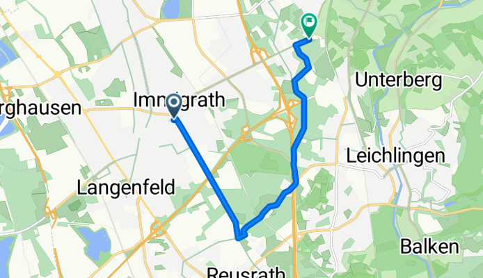
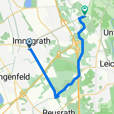
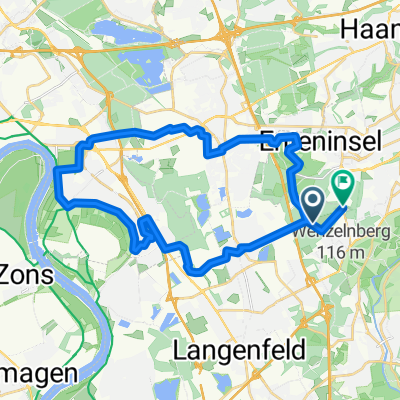
Modèle d’itinéraire
De Langenfeld à Leichlingen

- 32 min
- Durée
- 9,5 km
- Distance
- 55 m
- Montée
- 42 m
- Descente
- 17,8 km/h
- Vit. moyenne
- 95 m
- Altitude max.
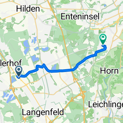
Cycling Route: Langenfeld to Leichlingen
Ready for a leisurely ride through the Rhineland? This 9.5 km route takes you from Langenfeld—a lively town known for its vibrant festivals and beautiful parks—over to the cozy town of Leichlingen, often called the “Blütenstadt” for its fruit blossoms in spring.
You’ll pedal mostly on quiet roads and dedicated cycleways, making it a comfortable trip for riders of all levels. The path is mostly paved and asphalted, so you can expect a smooth journey with just a gentle climb (about 55 meters total ascent). Expect to see plenty of green spaces and peaceful surroundings along the way.
Once you roll into Leichlingen, take some time to enjoy the charming town center or stroll by the Wupper river. Whether you’re up for a quick coffee or just want to soak in some scenery, this little cycling adventure is a great way to link two gems of North Rhine-Westphalia!
Communauté
Meilleurs utilisateurs dans cette région


De notre communauté
Les meilleurs itinéraires à vélo de Langenfeld à Leichlingen

Furter Moor
Itinéraire à vélo à Langenfeld, Rhénanie du Nord-Westphalie, Allemagne
- 4,3 km
- Distance
- 35 m
- Montée
- 0 m
- Descente

FEG zur Wasserburg
Itinéraire à vélo à Langenfeld, Rhénanie du Nord-Westphalie, Allemagne
- 8,8 km
- Distance
- 83 m
- Montée
- 53 m
- Descente

Auftanken
Itinéraire à vélo à Langenfeld, Rhénanie du Nord-Westphalie, Allemagne
- 7,8 km
- Distance
- 74 m
- Montée
- 39 m
- Descente

Segelflugplatz Wiescheid - Diepental Talsperre
Itinéraire à vélo à Langenfeld, Rhénanie du Nord-Westphalie, Allemagne
- 10,8 km
- Distance
- 119 m
- Montée
- 77 m
- Descente
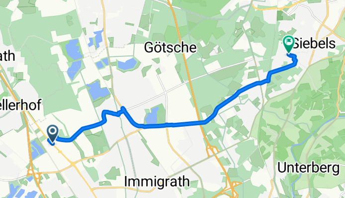
Hans-Böckler-Straße, Langenfeld (Rheinland) nach Uhlandstraße, Solingen
Itinéraire à vélo à Langenfeld, Rhénanie du Nord-Westphalie, Allemagne
- 8,7 km
- Distance
- 81 m
- Montée
- 6 m
- Descente

my first trip
Itinéraire à vélo à Langenfeld, Rhénanie du Nord-Westphalie, Allemagne
- 7,1 km
- Distance
- 69 m
- Montée
- 60 m
- Descente
landhotel
Itinéraire à vélo à Langenfeld, Rhénanie du Nord-Westphalie, Allemagne
- 7,3 km
- Distance
- 67 m
- Montée
- 33 m
- Descente

Lfeld-2010-11-21-Wietsche-Roder-Öl-SWeg-Orth-Höhe-Glüder50km-850HM
Itinéraire à vélo à Langenfeld, Rhénanie du Nord-Westphalie, Allemagne
- 16,5 km
- Distance
- 251 m
- Montée
- 217 m
- Descente

Haus Graven
Itinéraire à vélo à Langenfeld, Rhénanie du Nord-Westphalie, Allemagne
- 7,9 km
- Distance
- 42 m
- Montée
- 5 m
- Descente

10.08.2013 08:29.51 on GPSies.com
Itinéraire à vélo à Langenfeld, Rhénanie du Nord-Westphalie, Allemagne
- 30 km
- Distance
- 145 m
- Montée
- 134 m
- Descente

An der Mühle 2–12, Langenfeld (Rheinland) nach Gartenstraße 1B, Leichlingen (Rheinland)
Itinéraire à vélo à Langenfeld, Rhénanie du Nord-Westphalie, Allemagne
- 6,6 km
- Distance
- 29 m
- Montée
- 22 m
- Descente

Lfeld-2010-08-29-33km
Itinéraire à vélo à Langenfeld, Rhénanie du Nord-Westphalie, Allemagne
- 14,7 km
- Distance
- 190 m
- Montée
- 146 m
- Descente
Découvrez plus d'itinéraires
 Hans-Böckler-Straße, Langenfeld (Rheinland) nach Uhlandstraße, Solingen
- Distance
- 8,7 km
- Montée
- 81 m
- Descente
- 6 m
- Emplacement
- Langenfeld, Rhénanie du Nord-Westphalie, Allemagne
 my first trip
- Distance
- 7,1 km
- Montée
- 69 m
- Descente
- 60 m
- Emplacement
- Langenfeld, Rhénanie du Nord-Westphalie, Allemagne
 landhotel
- Distance
- 7,3 km
- Montée
- 67 m
- Descente
- 33 m
- Emplacement
- Langenfeld, Rhénanie du Nord-Westphalie, Allemagne
 Lfeld-2010-11-21-Wietsche-Roder-Öl-SWeg-Orth-Höhe-Glüder50km-850HM
- Distance
- 16,5 km
- Montée
- 251 m
- Descente
- 217 m
- Emplacement
- Langenfeld, Rhénanie du Nord-Westphalie, Allemagne
 Haus Graven
- Distance
- 7,9 km
- Montée
- 42 m
- Descente
- 5 m
- Emplacement
- Langenfeld, Rhénanie du Nord-Westphalie, Allemagne
 10.08.2013 08:29.51 on GPSies.com
- Distance
- 30 km
- Montée
- 145 m
- Descente
- 134 m
- Emplacement
- Langenfeld, Rhénanie du Nord-Westphalie, Allemagne
 An der Mühle 2–12, Langenfeld (Rheinland) nach Gartenstraße 1B, Leichlingen (Rheinland)
- Distance
- 6,6 km
- Montée
- 29 m
- Descente
- 22 m
- Emplacement
- Langenfeld, Rhénanie du Nord-Westphalie, Allemagne
 Lfeld-2010-08-29-33km
- Distance
- 14,7 km
- Montée
- 190 m
- Descente
- 146 m
- Emplacement
- Langenfeld, Rhénanie du Nord-Westphalie, Allemagne
Itinéraires depuis Langenfeld
Excursion à vélo d’une journée de
Langenfeld à Düsseldorf
Sortie rapide à vélo de
Langenfeld à Leverkusen
Sortie rapide à vélo de
Langenfeld à Monheim am Rhein
Itinéraires vers Leichlingen
Sortie rapide à vélo de
Opladen à Leichlingen