
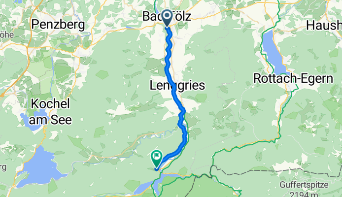
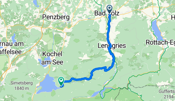
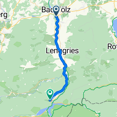
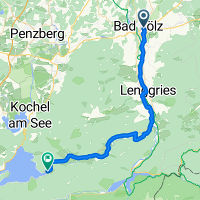
Modèle d’itinéraire
De Bad Tölz à Jachenau
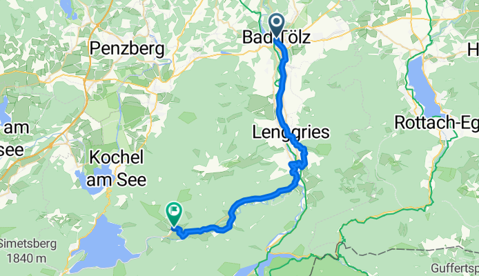
- 2 h 4 min
- Durée
- 33,1 km
- Distance
- 307 m
- Montée
- 189 m
- Descente
- 16,1 km/h
- Vit. moyenne
- 777 m
- Altitude max.
Get ready for a scenic ride from Bad Tölz to the peaceful village of Jachenau! Starting out in the historic spa town of Bad Tölz, you’ll roll through about 33 km of mostly paved roads and quiet paths, with a bit of gentle climbing (around 300 meters of ascent). The route winds south, giving you postcard-perfect views of the Bavarian Alps and plenty of fresh country air.
About three-quarters of the ride is on smooth tarmac, with the rest split between gravel and well-maintained tracks—so a sturdy road or trekking bike is ideal. You’ll spend most of your time on quiet backroads and scenic pathways, avoiding busy traffic for a relaxing pedal.
As you approach Jachenau, you’ll notice the pace of life slowing down—this little valley village is famed for its tranquility and lush green surroundings. Locals come here to escape the bustle, just like you. If you have time, grab a snack at a Gasthaus and soak in the Alpine views before heading back. It's a mellow ride with plenty of Bavarian charm!
Communauté
Meilleurs utilisateurs dans cette région


De notre communauté
Les meilleurs itinéraires à vélo de Bad Tölz à Jachenau
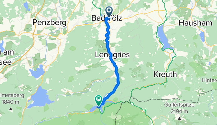
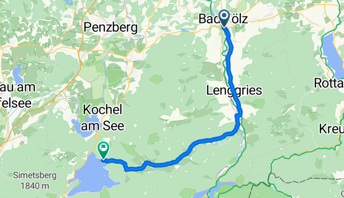
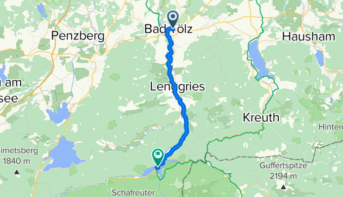
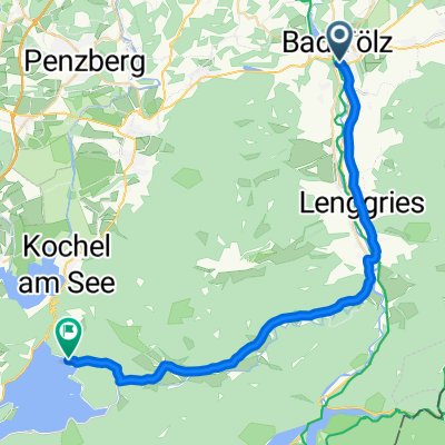
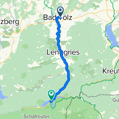
B-Tölz_Sylvensteinsee_hin&rück
Itinéraire à vélo à Bad Tölz, Bavière, Allemagne
- 27,2 km
- Distance
- 258 m
- Montée
- 163 m
- Descente
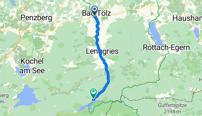
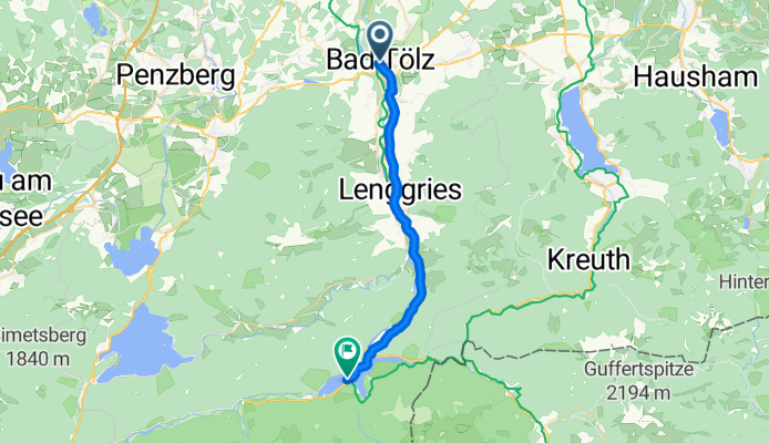
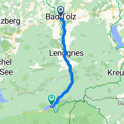
Tölz-Sylvensteinspeicher
Itinéraire à vélo à Bad Tölz, Bavière, Allemagne
- 22,8 km
- Distance
- 146 m
- Montée
- 47 m
- Descente

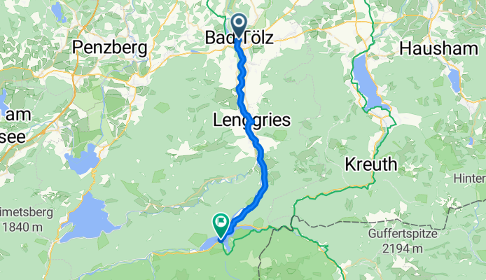
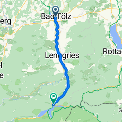
Bad Tölz nach Sylvensteinspeicher/Fall
Itinéraire à vélo à Bad Tölz, Bavière, Allemagne
- 26,2 km
- Distance
- 267 m
- Montée
- 150 m
- Descente
Von Bad Tölz zum Sylvensteinspeicher
Itinéraire à vélo à Bad Tölz, Bavière, Allemagne
- 26,5 km
- Distance
- 173 m
- Montée
- 50 m
- Descente
Bad Tölz Isarradweg ab Isardamm 15
Itinéraire à vélo à Bad Tölz, Bavière, Allemagne
- 21,8 km
- Distance
- 421 m
- Montée
- 187 m
- Descente
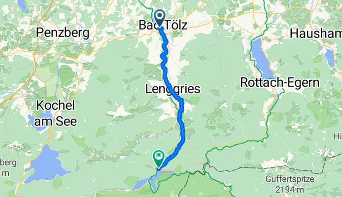
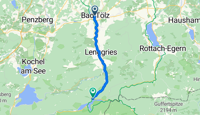
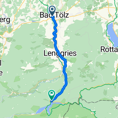
Von Bad Tölz über Jachenau zum Walchensee
Itinéraire à vélo à Bad Tölz, Bavière, Allemagne
- 32,6 km
- Distance
- 343 m
- Montée
- 197 m
- Descente
Wilhelmstraße, Bad Tölz nach B307, Lenggries
Itinéraire à vélo à Bad Tölz, Bavière, Allemagne
- 25 km
- Distance
- 291 m
- Montée
- 191 m
- Descente
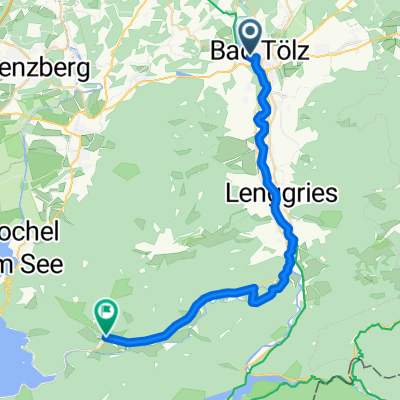
Buchener Straße, Bad Tölz nach Jachenau
Itinéraire à vélo à Bad Tölz, Bavière, Allemagne
- 31,6 km
- Distance
- 273 m
- Montée
- 143 m
- Descente
Bahnhofstraße, Bad Tölz nach Jachenau
Itinéraire à vélo à Bad Tölz, Bavière, Allemagne
- 36,3 km
- Distance
- 439 m
- Montée
- 314 m
- Descente
Bahnhofstraße 8, Bad Tölz nach B307, Lenggries
Itinéraire à vélo à Bad Tölz, Bavière, Allemagne
- 27,5 km
- Distance
- 345 m
- Montée
- 272 m
- Descente
Sylvenstein Bad Tölz
Itinéraire à vélo à Bad Tölz, Bavière, Allemagne
- 25,8 km
- Distance
- 153 m
- Montée
- 61 m
- Descente
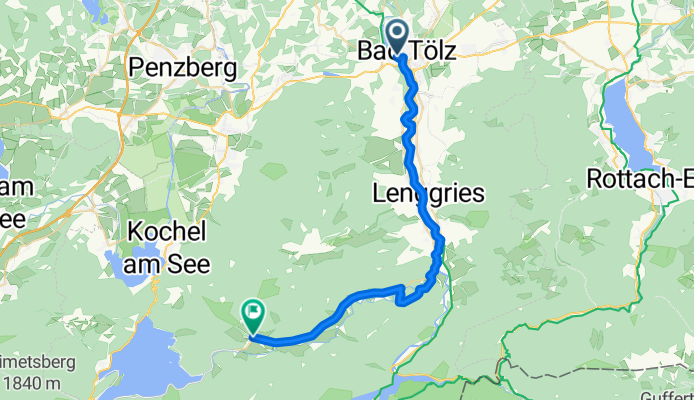
Bad Tölz - Sylvenstein CLONED FROM ROUTE 240892
Itinéraire à vélo à Bad Tölz, Bavière, Allemagne
- 22,9 km
- Distance
- 202 m
- Montée
- 78 m
- Descente
Découvrez plus d'itinéraires
 Bad Tölz Isarradweg ab Isardamm 15
- Distance
- 21,8 km
- Montée
- 421 m
- Descente
- 187 m
- Emplacement
- Bad Tölz, Bavière, Allemagne
 Von Bad Tölz über Jachenau zum Walchensee
- Distance
- 32,6 km
- Montée
- 343 m
- Descente
- 197 m
- Emplacement
- Bad Tölz, Bavière, Allemagne
 Wilhelmstraße, Bad Tölz nach B307, Lenggries
- Distance
- 25 km
- Montée
- 291 m
- Descente
- 191 m
- Emplacement
- Bad Tölz, Bavière, Allemagne
 Buchener Straße, Bad Tölz nach Jachenau
- Distance
- 31,6 km
- Montée
- 273 m
- Descente
- 143 m
- Emplacement
- Bad Tölz, Bavière, Allemagne
 Bahnhofstraße, Bad Tölz nach Jachenau
- Distance
- 36,3 km
- Montée
- 439 m
- Descente
- 314 m
- Emplacement
- Bad Tölz, Bavière, Allemagne
 Bahnhofstraße 8, Bad Tölz nach B307, Lenggries
- Distance
- 27,5 km
- Montée
- 345 m
- Descente
- 272 m
- Emplacement
- Bad Tölz, Bavière, Allemagne
 Sylvenstein Bad Tölz
- Distance
- 25,8 km
- Montée
- 153 m
- Descente
- 61 m
- Emplacement
- Bad Tölz, Bavière, Allemagne
 Bad Tölz - Sylvenstein CLONED FROM ROUTE 240892
- Distance
- 22,9 km
- Montée
- 202 m
- Descente
- 78 m
- Emplacement
- Bad Tölz, Bavière, Allemagne
Itinéraires depuis Bad Tölz
Excursion à vélo d’une journée de
Bad Tölz à Munich
Sortie rapide à vélo de
Bad Tölz à Lenggries