
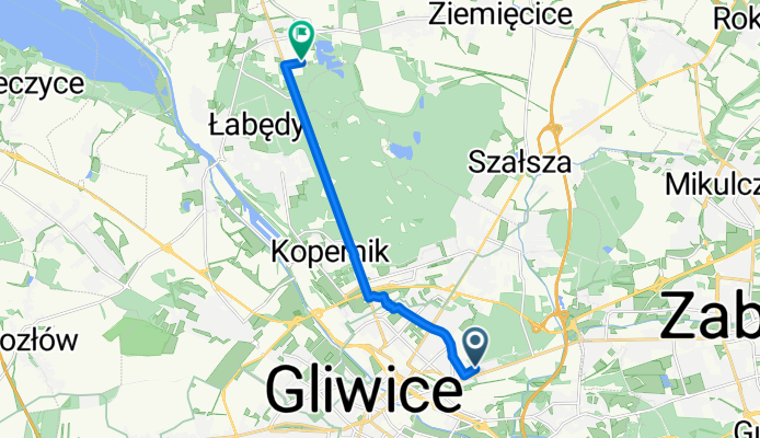
Modèle d’itinéraire
De Gliwice à Pyskowice

- 1 h 20 min
- Durée
- 19,9 km
- Distance
- 73 m
- Montée
- 59 m
- Descente
- 14,8 km/h
- Vit. moyenne
- 234 m
- Altitude max.
Starting in the vibrant city of Gliwice, known for its charming old town and impressive radio tower (one of the tallest wooden structures in the world!), this cycle route takes you north to the smaller town of Pyskowice. Covering just under 20 km, the ride is mostly gentle with a modest ascent of about 73 meters—just enough to keep things interesting without breaking a sweat.
You’ll pedal along a lovely mix of quiet roads and cycleways, making up almost 70% of the journey, which means this route is ideal if you’re looking for a peaceful ride away from heavy traffic. Expect a variety of surfaces—mainly paved and asphalt, but you’ll pass some stretches of paving stones and a little gravel too. Bring your hybrid or touring bike for the smoothest experience.
Pyskowice is a cozy town north of Gliwice, perfect for a relaxing coffee stop or some local sightseeing, especially if you enjoy the calm vibe of Upper Silesian small towns. Whether you’re a local commuter or just exploring new corners of the region, this is a fun, accessible ride that gives you a taste of both urban and rural Silesia.
Communauté
Meilleurs utilisateurs dans cette région


De notre communauté
Les meilleurs itinéraires à vélo de Gliwice à Pyskowice

WEGLOWA CZECHOWICE2
Itinéraire à vélo à Gliwice, Voïvodie de Silésie, Pologne
- 15,8 km
- Distance
- 76 m
- Montée
- 48 m
- Descente

Rowerowy Rajd Sikorki
Itinéraire à vélo à Gliwice, Voïvodie de Silésie, Pologne
- 23,3 km
- Distance
- 135 m
- Montée
- 106 m
- Descente

na dzierżno
Itinéraire à vélo à Gliwice, Voïvodie de Silésie, Pologne
- 16 km
- Distance
- 28 m
- Montée
- 49 m
- Descente

Łabędy - Rzeczyce - Dzierżno Duże
Itinéraire à vélo à Gliwice, Voïvodie de Silésie, Pologne
- 10,1 km
- Distance
- 68 m
- Montée
- 81 m
- Descente

weglowa czechowice
Itinéraire à vélo à Gliwice, Voïvodie de Silésie, Pologne
- 14,5 km
- Distance
- 117 m
- Montée
- 82 m
- Descente

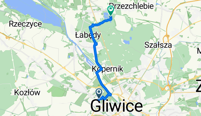
R Luksemburg 7, Gliwice do Mikulczycka 58, Przezchlebie
Itinéraire à vélo à Gliwice, Voïvodie de Silésie, Pologne
- 6,9 km
- Distance
- 118 m
- Montée
- 94 m
- Descente

Gliwice - Dzierżno 1
Itinéraire à vélo à Gliwice, Voïvodie de Silésie, Pologne
- 20 km
- Distance
- 67 m
- Montée
- 72 m
- Descente
Czechowice jezioro
Itinéraire à vélo à Gliwice, Voïvodie de Silésie, Pologne
- 9,6 km
- Distance
- 81 m
- Montée
- 57 m
- Descente
Czechowice
Itinéraire à vélo à Gliwice, Voïvodie de Silésie, Pologne
- 10,4 km
- Distance
- 94 m
- Montée
- 53 m
- Descente

Lokales 1
Itinéraire à vélo à Gliwice, Voïvodie de Silésie, Pologne
- 37,3 km
- Distance
- 163 m
- Montée
- 128 m
- Descente

Archeo Gliwice cz 1
Itinéraire à vélo à Gliwice, Voïvodie de Silésie, Pologne
- 41,1 km
- Distance
- 122 m
- Montée
- 130 m
- Descente

sosnica-przezchlebie
Itinéraire à vélo à Gliwice, Voïvodie de Silésie, Pologne
- 13,5 km
- Distance
- 39 m
- Montée
- 29 m
- Descente
Découvrez plus d'itinéraires
 weglowa czechowice
- Distance
- 14,5 km
- Montée
- 117 m
- Descente
- 82 m
- Emplacement
- Gliwice, Voïvodie de Silésie, Pologne
 R Luksemburg 7, Gliwice do Mikulczycka 58, Przezchlebie
- Distance
- 6,9 km
- Montée
- 118 m
- Descente
- 94 m
- Emplacement
- Gliwice, Voïvodie de Silésie, Pologne
 Gliwice - Dzierżno 1
- Distance
- 20 km
- Montée
- 67 m
- Descente
- 72 m
- Emplacement
- Gliwice, Voïvodie de Silésie, Pologne
 Czechowice jezioro
- Distance
- 9,6 km
- Montée
- 81 m
- Descente
- 57 m
- Emplacement
- Gliwice, Voïvodie de Silésie, Pologne
 Czechowice
- Distance
- 10,4 km
- Montée
- 94 m
- Descente
- 53 m
- Emplacement
- Gliwice, Voïvodie de Silésie, Pologne
 Lokales 1
- Distance
- 37,3 km
- Montée
- 163 m
- Descente
- 128 m
- Emplacement
- Gliwice, Voïvodie de Silésie, Pologne
 Archeo Gliwice cz 1
- Distance
- 41,1 km
- Montée
- 122 m
- Descente
- 130 m
- Emplacement
- Gliwice, Voïvodie de Silésie, Pologne
 sosnica-przezchlebie
- Distance
- 13,5 km
- Montée
- 39 m
- Descente
- 29 m
- Emplacement
- Gliwice, Voïvodie de Silésie, Pologne
Itinéraires depuis Gliwice
Sortie rapide à vélo de
Gliwice à Sośnicowice
Sortie rapide à vélo de
Gliwice à Żernica