
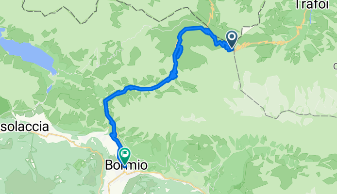
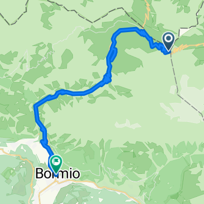
Sortie rapide à vélo de Sant'Antonio à Bormio
Personnalise ton propre itinéraire à partir de notre modèle ou découvre comment notre communauté préfère rouler de Sant'Antonio à Bormio.
Modèle d’itinéraire
De Sant'Antonio à Bormio

- 18 min
- Durée
- 4,4 km
- Distance
- 65 m
- Montée
- 195 m
- Descente
- 14,3 km/h
- Vit. moyenne
- 1 337 m
- Altitude max.
This short but sweet cycling route takes you from Sant’Antonio to the beautiful alpine town of Bormio—covering just over 4.3 km, it’s ideal for a quick ride with a scenic punch. Starting from Sant’Antonio, perched in the heart of the Valtellina valley, you’ll enjoy mostly paved surfaces, gliding along quiet roads and a few stretches of classic cobblestones thrown in for local flavor.
The route trends mostly downhill, making your descent into Bormio (famous for its thermal baths and as a gateway to the legendary Stelvio Pass) both easy on the legs and big on views. You’ll lose nearly 200 meters of elevation, so get ready for some breezy fun and alpine panoramas. Whether you’re into history, food, or just want to soak up the mountain atmosphere at the end, Bormio’s charming old town and vibrant piazza make a perfect finish line. Bring a camera and treat yourself to a gelato when you arrive!
Communauté
Meilleurs utilisateurs dans cette région


De notre communauté
Les meilleurs itinéraires à vélo de Sant'Antonio à Bormio

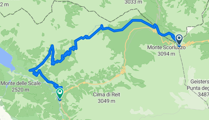
MTB Stelvio Pass - Bormio
Itinéraire à vélo à Sant'Antonio, Lombardie, Italie
- 33,7 km
- Distance
- 523 m
- Montée
- 2 042 m
- Descente

4 Star MTB Tour - terza tappa
Itinéraire à vélo à Sant'Antonio, Lombardie, Italie
- 32,8 km
- Distance
- 1 560 m
- Montée
- 2 093 m
- Descente

MTB: Dreisprachen Spitze - P. Umbrail - Bocchette di Forcola - Pedenollo - Bormio
Itinéraire à vélo à Sant'Antonio, Lombardie, Italie
- 30,1 km
- Distance
- 387 m
- Montée
- 2 010 m
- Descente
ste 3
Itinéraire à vélo à Sant'Antonio, Lombardie, Italie
- 24 km
- Distance
- 402 m
- Montée
- 1 672 m
- Descente

ste 4
Itinéraire à vélo à Sant'Antonio, Lombardie, Italie
- 48,7 km
- Distance
- 1 261 m
- Montée
- 2 533 m
- Descente

Bormio day 4 mtb schuttle
Itinéraire à vélo à Sant'Antonio, Lombardie, Italie
- 36,1 km
- Distance
- 1 294 m
- Montée
- 1 869 m
- Descente

Val di Rezzalo
Itinéraire à vélo à Sant'Antonio, Lombardie, Italie
- 39,3 km
- Distance
- 1 061 m
- Montée
- 1 605 m
- Descente

discesa Stelvio
Itinéraire à vélo à Sant'Antonio, Lombardie, Italie
- 19,8 km
- Distance
- 14 m
- Montée
- 1 464 m
- Descente

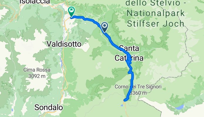
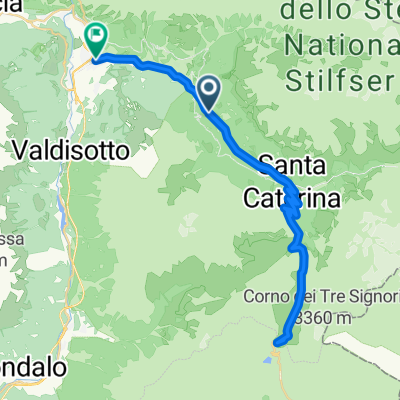
S. Catarina - Bormio
Itinéraire à vélo à Sant'Antonio, Lombardie, Italie
- 12,4 km
- Distance
- 42 m
- Montée
- 585 m
- Descente
Route von Bormio
Itinéraire à vélo à Sant'Antonio, Lombardie, Italie
- 24 km
- Distance
- 339 m
- Montée
- 1 888 m
- Descente

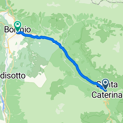
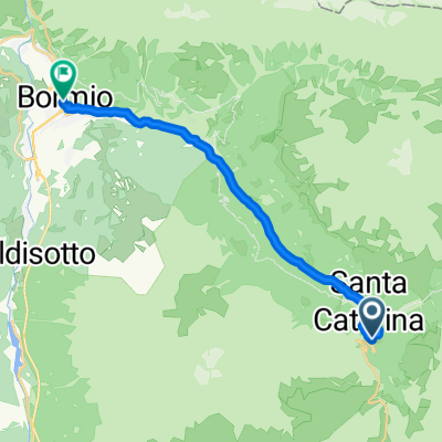
Santa Caterina - Bormio
Itinéraire à vélo à Sant'Antonio, Lombardie, Italie
- 15 km
- Distance
- 11 m
- Montée
- 785 m
- Descente
20160904_101453.gpx
Itinéraire à vélo à Sant'Antonio, Lombardie, Italie
- 44,4 km
- Distance
- 1 170 m
- Montée
- 1 425 m
- Descente
Découvrez plus d'itinéraires
 ste 4
ste 4- Distance
- 48,7 km
- Montée
- 1 261 m
- Descente
- 2 533 m
- Emplacement
- Sant'Antonio, Lombardie, Italie
 Bormio day 4 mtb schuttle
- Distance
- 36,1 km
- Montée
- 1 294 m
- Descente
- 1 869 m
- Emplacement
- Sant'Antonio, Lombardie, Italie
 Val di Rezzalo
- Distance
- 39,3 km
- Montée
- 1 061 m
- Descente
- 1 605 m
- Emplacement
- Sant'Antonio, Lombardie, Italie
 discesa Stelvio
- Distance
- 19,8 km
- Montée
- 14 m
- Descente
- 1 464 m
- Emplacement
- Sant'Antonio, Lombardie, Italie
 S. Catarina - Bormio
- Distance
- 12,4 km
- Montée
- 42 m
- Descente
- 585 m
- Emplacement
- Sant'Antonio, Lombardie, Italie
 Route von Bormio
- Distance
- 24 km
- Montée
- 339 m
- Descente
- 1 888 m
- Emplacement
- Sant'Antonio, Lombardie, Italie
 Santa Caterina - Bormio
- Distance
- 15 km
- Montée
- 11 m
- Descente
- 785 m
- Emplacement
- Sant'Antonio, Lombardie, Italie
 20160904_101453.gpx
- Distance
- 44,4 km
- Montée
- 1 170 m
- Descente
- 1 425 m
- Emplacement
- Sant'Antonio, Lombardie, Italie
Itinéraires depuis Sant'Antonio
Excursion à vélo d’une journée de
Sant'Antonio à Livigno
Itinéraires vers Bormio
Bikepacking de
Merano à Bormio
Excursion à vélo d’une journée de
Tirano à Bormio
Excursion à vélo d’une journée de
Zernez à Bormio